Stop 1/7
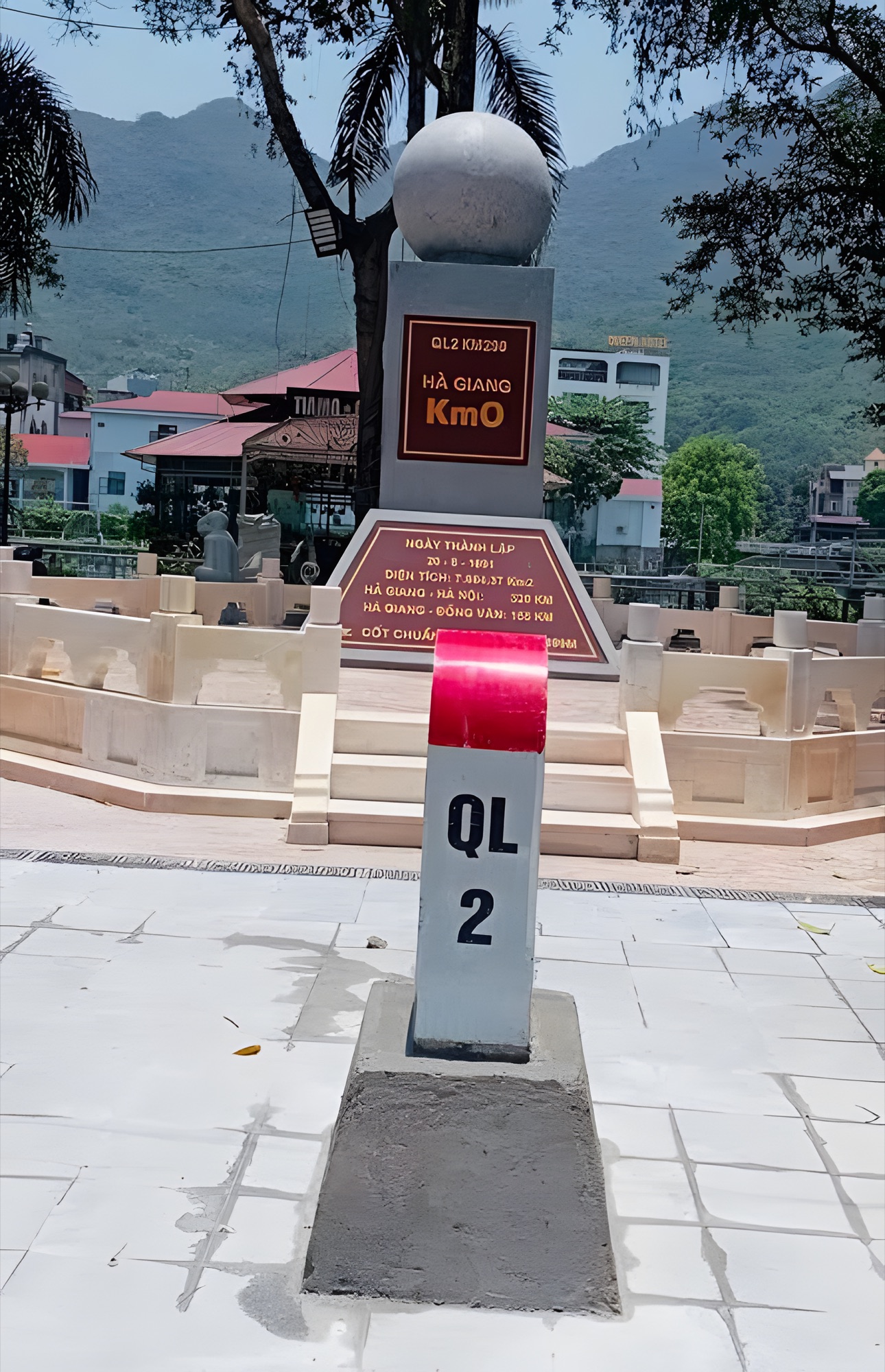
Hà Giang City is Km0 of the Loop: where you step off the sleeper bus from Hanoi, rent a motorbike or book an easy rider, stock up on cash, fuel and warm clothes, then set off on a roughly 350 km ride around the Rocky Plateau.
Hà Giang City sits snugly in a valley on both banks of the Lô River, ringed by deep-green mountains. For most travellers it isn't the final destination but Km0 of the Ha Giang Loop — the place to recover after the night bus, pick your bike and your rider, run a last check on your bags and then head up to the Rocky Plateau. Half a day or an evening in town is enough to make everything that follows run much more smoothly.
Getting from Hanoi to Hà Giang City
Hà Giang City is about 300 km from Hanoi, mostly on expressways and fairly easy national roads.
- Sleeper bus / cabin bus: the most popular option. The ride takes around 6–7 hours; late-evening departures arrive early in the morning, handy if you want to start the Loop the same day. Many companies pick up in Hanoi's Old Quarter and drop off right in the centre of Hà Giang City.
- Private car / self-drive: you set your own schedule, good for families. The last stretch before town has plenty of bends, so drive it in daylight if you're not used to mountain roads.
- Motorbike from Hanoi: only if you're used to long rides; most people take the bus and rent a bike in Hà Giang to save their energy for the Loop.
Quick tip: if you came on the night bus, catch up on a few hours of sleep before riding. The passes ahead need you fully alert.
How to ride the Loop: self-drive, easy rider or car
- Riding your own motorbike: the most freedom, but only suitable if you're comfortable with steep mountain passes and hairpin bends and hold a valid licence. Check the brakes, tyres, lights and horn before you take the bike.
- Easy rider (local driver): you ride pillion while the driver, who knows every bend, stops at the best photo spots and the best places to eat. This is the safest choice if you've never ridden high mountain passes.
- Car / 7-seater: suits families travelling with elderly relatives or young children, or the cold, rainy season.
Whichever you choose, don't rush: a relaxed Loop usually takes 3–4 days.
Things to see in Hà Giang City
- Km0 Hà Giang marker: the near-compulsory "departure" photo for everyone doing the Loop, best early in the morning while the streets are still quiet.
- Lô River banks: the river runs through the middle of town; an afternoon stroll along the embankment is lovely, with views of the surrounding mountains.
- Yên Biên Bridge: the bridge linking the two banks of the Lô, a nice angle on the city lights in the evening.
- Central square: a wide open space where local families come out to enjoy the evening air — a good place to feel the everyday rhythm of the city.
- Provincial museum: a good quick introduction to the Hmong, Dao, Tày, Lô Lô and other ethnic groups before you meet them along the road.
- Bắc Sum Slope: on the road up to Quản Bạ, its winding bends seen from above are the "appetiser" for the whole journey.
Where to eat and stay
Town has plenty of options for the first and last meals of your trip. Try bánh cuốn trứng (steamed rice rolls with egg) for breakfast, cháo ấu tẩu (a slightly bitter aconite-root porridge) in the evening — ấu tẩu must be very carefully prepared, so only eat it where they know how to make it — plus thắng cố (horse-meat stew), lạp xưởng gác bếp (smoked sausage), thịt trâu gác bếp (smoked buffalo jerky) and grilled dishes. In winter, Hà Giang's green-skinned oranges, nuts and honey are the classic things to bring home.
For accommodation, the city has hotels, guesthouses and many hostels geared to Loop riders — these often double as bike rental, easy-rider booking and storage for your big luggage while you're on the road. If you're starting the Loop early, staying near the rental area is more convenient.
Best time to go & tips
- September: rice ripening in the valleys along the road.
- October–November: buckwheat flower season, dry and clear skies, also the busiest time — book early.
- December–February: cold, with possible frost up high; mustard, plum and peach blossoms start appearing in late winter and early spring.
- Summer (June–August): lush and green but rainy, so keep an eye on the weather and keep your schedule flexible.
Prep tips before leaving town:
- Withdraw enough cash: the higher you go, the rarer ATMs become, and many eateries and homestays only take cash.
- Fill up your tank and note where the petrol stations are in the next towns.
- Carry your ID card or passport: needed to check in and when entering areas near the border such as Lũng Cú.
- Warm jacket, raincoat, gloves: temperatures on the plateau can be much lower than in town, especially early morning and at night.
- Leave some luggage behind: bring just a compact backpack for 3–4 days.
One more experience on the first leg
Just about 45 km ahead, the Quản Bạ valley is where you can see the whole road from the sky. If you like, check out the Quản Bạ flying site and add a paragliding flight to the first morning of your Loop.
Next stop: Quản Bạ · Previous stop (on the way back): Du Già