

 Paragliding · Paramotor
Stop 2/7
Quản Bạ, around Km45 of the Loop, is the gateway to the Rocky Plateau with Heaven's Gate, the Fairy Twin Mountains, the Tam Sơn valley and the villages of Nậm Đăm and Lùng Tám. It's also the team's main paragliding and paramotor site, open since 15 October 2026.
Quản Bạ, around Km45 of the Hà Giang Loop, is the first stop worth real time after leaving the city: Heaven's Gate looking down on the Fairy Twin Mountains and the Tam Sơn valley, the villages of Nậm Đăm and Lùng Tám — and our team's main paragliding and paramotor site.
After a little over an hour climbing out of the city, the road suddenly opens up at the top of the pass: below lies the Tam Sơn valley with its cornfields, rooftops and two perfectly rounded hills in the middle of the fields — the Fairy Twin Mountains. This is Quản Bạ, the southern gateway to the Đồng Văn Rocky Plateau. Many people just stop for a few photos at Heaven's Gate and carry on, but if you have time, Quản Bạ deserves a whole morning — especially if you want to see the valley from a paraglider.
Since 1 July 2025 Hà Giang province has been merged into Tuyên Quang province, so on paper Quản Bạ now belongs to Tuyên Quang. Travellers still call the area "Hà Giang", and so does this guide.
Quản Bạ at a glance
| Item | Details |
|---|---|
| Location | Around Km45 of the Hà Giang Loop, on National Road 4C |
| From Hà Giang City | About 45 km, roughly 1 h 15 min of non-stop riding |
| Must-sees | Heaven's Gate, the Fairy Twin Mountains, the Tam Sơn valley, the Miện River, Nậm Đăm village, the Lùng Tám linen-weaving village |
| Paragliding (PG) | Take-off from a ridge at about 950 m, landing on the flat field at about 450 m by the Miện River |
| Paramotor (PPG) | Take-off and landing right on the flat field by the Miện River |
| Flying site hours | 06:30–18:30 daily, season open since 15 October 2026 |
| Time to allow | 2–3 hours for the sights and a flight; one night if you want to fly early in the morning |
Getting from Hà Giang City to Quản Bạ
Quản Bạ is about 45 km from Hà Giang City along National Road 4C. Riding non-stop takes around 1 h 15 min; with photo stops, count on 1 h 30 min or more.
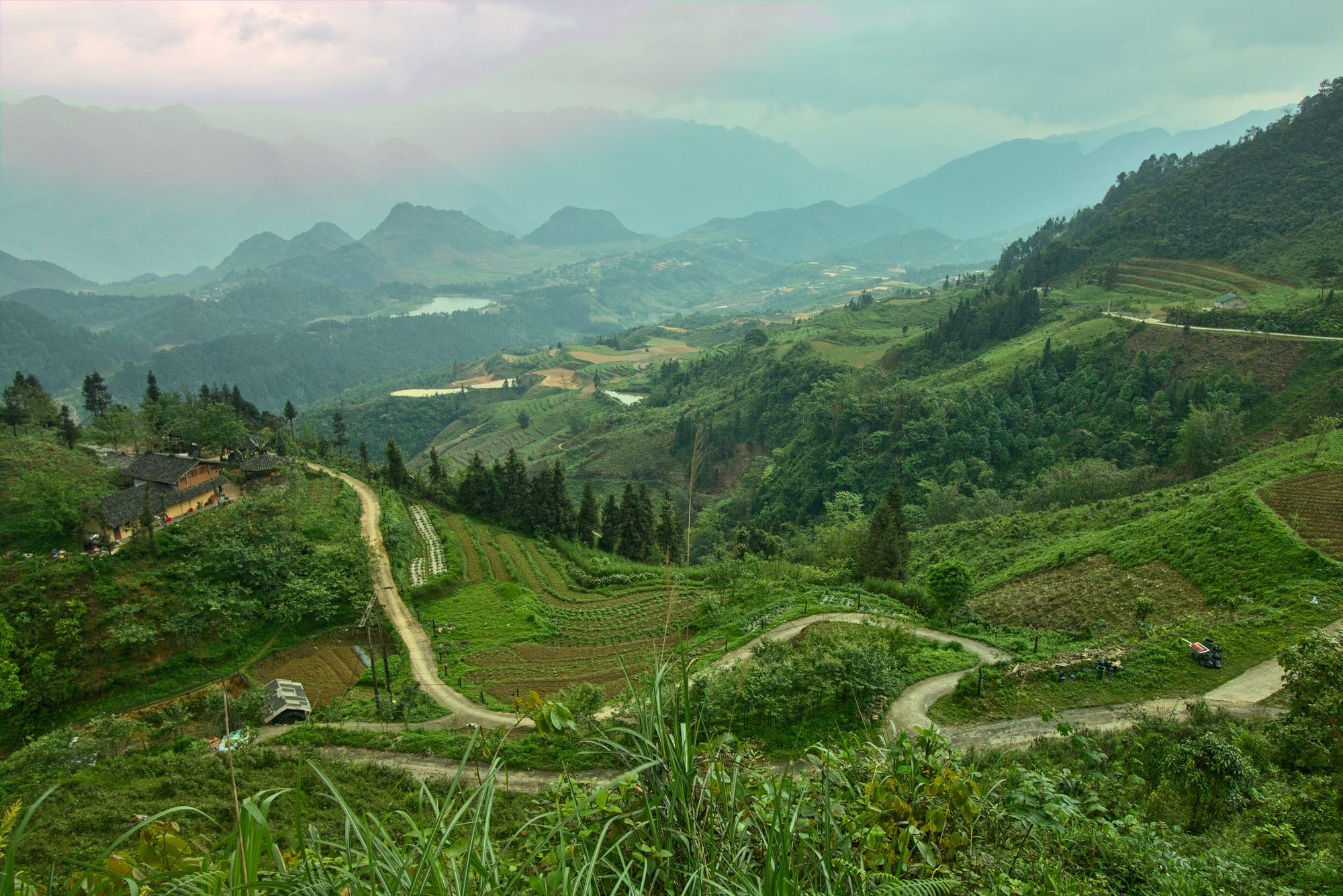
- The route: leaving the city, the road climbs Bắc Sum Slope with its many hairpin bends, then reaches Quản Bạ Heaven's Gate before dropping into the Tam Sơn valley.
- Riding yourself: the road is paved, but the climbs are long and the bends sharp. Use a low gear on descents, don't cut corners across the centre line, and watch out for trucks and buses.
- Easy rider: the safe choice if you're not used to mountain passes, especially in fog. Our article easy rider or ride yourself helps you decide.
- Car / bus: the bus routes from the city to Đồng Văn and Mèo Vạc all pass through Tam Sơn. If you only come up to fly and go back, the team runs a car from Hà Giang City for 500,000 VND (≈ US$ 20) per 4-seat car, each way.
- Fog: early in the morning and in winter, the Bắc Sum – Heaven's Gate stretch can be thick with fog. Turn on your lights, slow down and honk before blind bends.
For most tours and easy riders doing the Loop in the usual direction (Quản Bạ → Yên Minh → Đồng Văn), central Quản Bạ is the lunch stop on day one — which also makes it the easiest moment to fit a flight into your plans. All the ways up are explained in our guide to getting to the Quản Bạ flying site.
Quản Bạ Heaven's Gate
Heaven's Gate sits on National Road 4C, just before the road drops into the Tam Sơn valley. It earned its name because it is a high point on the pass where clouds often drift across, so looking down feels like standing at the gate of the sky. There is a rest stop with parking, a viewpoint and a few stalls; depending on the time there may be a small parking or service fee, so ask on the spot.
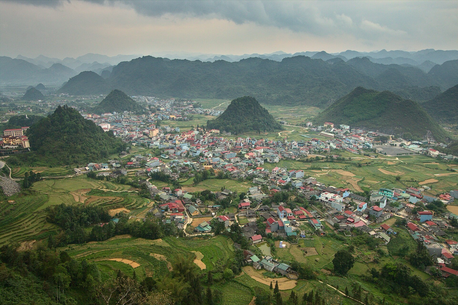
From the viewpoint you take in the whole of central Tam Sơn, the cone-shaped limestone hills and the Fairy Twin Mountains in the fields. It is the best-known photo of the Loop's first leg, so around midday the tour groups tend to arrive together. For a quieter moment, come early, or stop at one of the bends on the way down to Tam Sơn — they face the twin hills straight on and see far fewer people.
| Time | What you see | Tip |
|---|---|---|
| 6:30–8:30 | Mist and clouds lying in the valley | Seas of clouds are most likely in autumn – winter |
| 9:00–11:00 | Morning sun, clear sky | Field colours stand out, good for flying |
| 14:00–16:00 | Harsh light, possibly backlit | Shoot from the opposite direction |
| Late afternoon | Low sun, sunset | Good for a sunset flight |
In November–December the days are short and the sun sets around 17:15–17:30, so the sunset window comes earlier than in summer. Read Quản Bạ Heaven's Gate and the Fairy Twin Mountains for the best photo angles.
The Fairy Twin Mountains
The Fairy Twin Mountains (Núi đôi Cô Tiên) are two round, symmetrical hills sitting side by side in the Tam Sơn fields. According to local legend, they are the breasts of a fairy who left them on earth out of longing for a Hmong young man. Whatever you make of the story, everyone who passes recognises the shape at once.
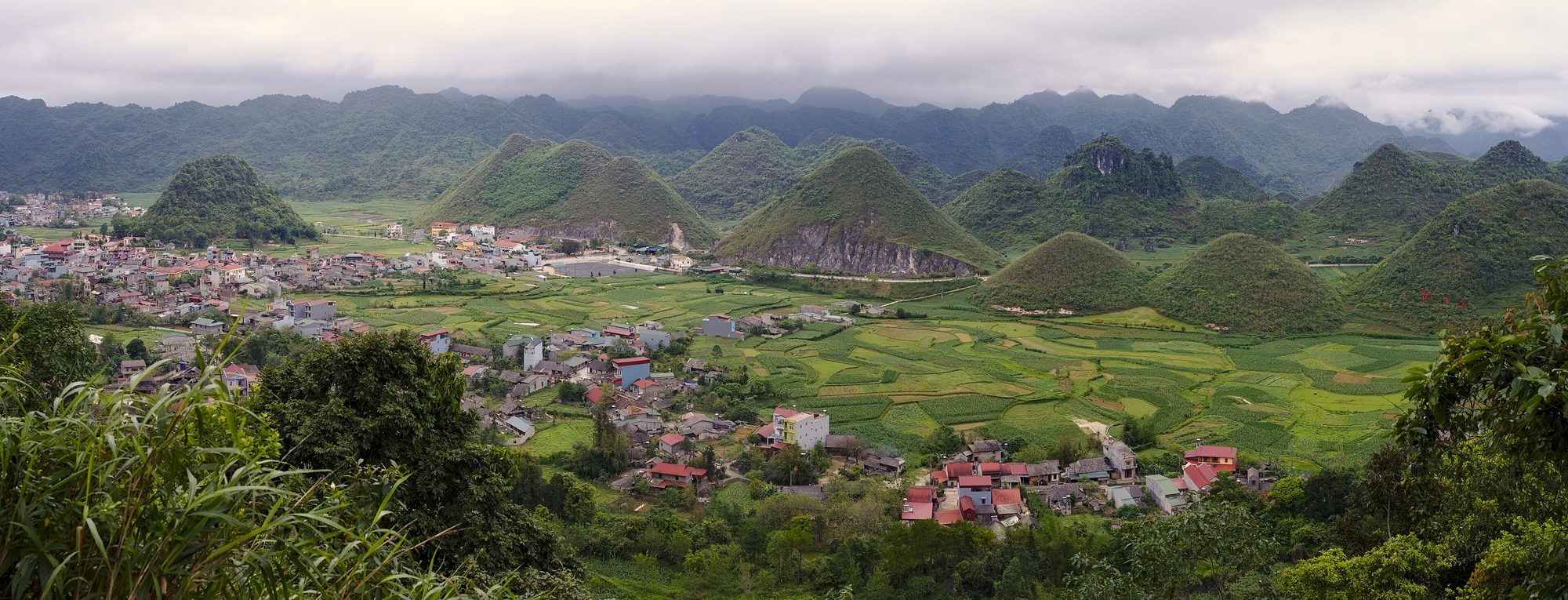
The twin hills change colour with the seasons:
- Spring – summer: the fresh green of corn and grass.
- September: golden ripe rice in the paddies around their foot.
- October–November: after the harvest, some years the foot of the hills turns pinkish-purple with buckwheat flowers.
- Winter: earthy brown, wrapped in morning mist.
There are three ways to see them: from Heaven's Gate (the panorama), from the fields at their foot (close-up, with paddies and seasonal flowers), and from a paraglider — the only angle that fits the road up to Heaven's Gate, the twin hills and the valley into one frame. When you walk into the fields for photos, stay on the paddy banks and existing paths, don't trample the crops and don't pick flowers: this is the villagers' farmland.
The Tam Sơn valley and the Miện River
Tam Sơn is the centre of Quản Bạ, right below Heaven's Gate. It has the most services on this leg: guesthouses, small hotels, homestays, eateries, a petrol station, grocery shops and usually an ATM. If you are continuing to Yên Minh, fill up here.
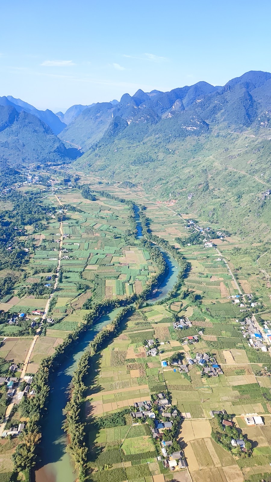
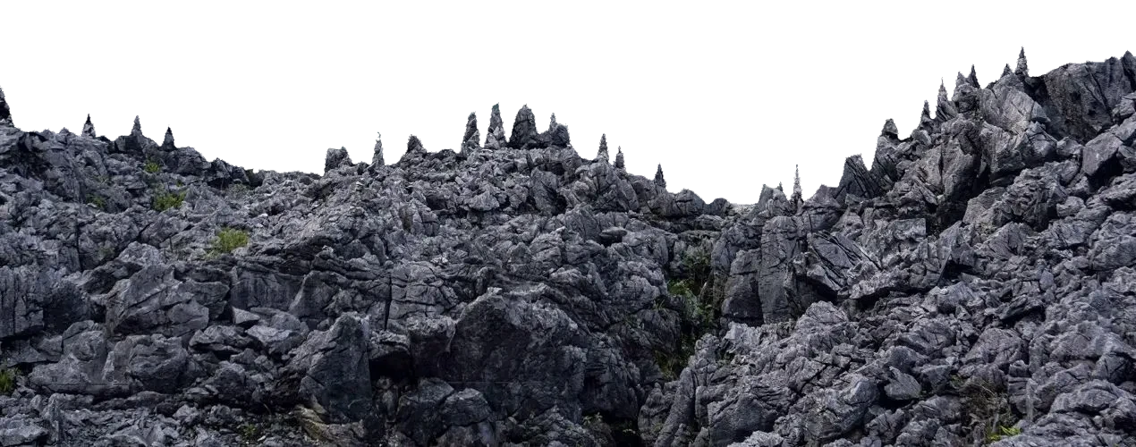
Beyond the centre the valley opens into a rare stretch of flat land among the limestone peaks, with the Miện River winding through cornfields and villages, ringed by jagged "cat's ear" karst. This width and flatness is what makes Quản Bạ so good for flying: the landing field lies in the middle of the valley, wide open, with no tall trees in the way. Even if you're not flying, on a fine morning you can drop by the riverside field to watch the wings come in to land.
Nậm Đăm cultural village
Nậm Đăm is a Dao village a short way from central Tam Sơn along a paved side road that motorbikes and cars can both use. It has many rammed-earth houses whose thick walls stay cool in summer and warm in winter, set among old trees, cornfields and small terraced paddies. The Dao here are known for their colourful hand-embroidered clothing and their herbal medicine and herbal baths.
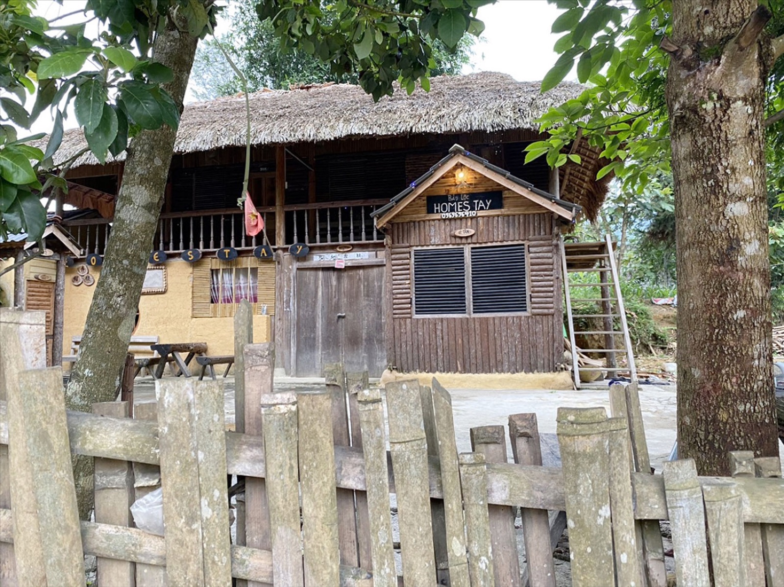
Many families have fixed up their houses to host guests while keeping the traditional form, which is why Nậm Đăm is a popular first-night stop. A few things to know when staying in the village:
- Tell your hosts your arrival time and how many people will have dinner.
- Bring a warm layer: nights in the valley are colder than you'd expect.
- Keep it quiet after about 22:00; the village goes to bed early and gets up early.
- Ask your host before entering the family altar room, and ask people before taking portraits.
- Carry small cash; there is usually no ATM in the village.
Nậm Đăm is inside the team's free pick-up zone. More in our article on Nậm Đăm cultural village.
Lùng Tám linen-weaving village
Lùng Tám lies in the Miện River valley — the very valley you see below your wing. The Lùng Tám linen cooperative was founded in 2001 and is run by local Hmong women, with its workshop in Hợp Tiến hamlet. Linen here is still made almost entirely by hand: growing the flax, stripping the fibres, joining and twisting the thread, boiling it white and soft, weaving on wooden looms, drawing patterns in beeswax, dyeing with indigo and finally boiling the wax off. A single length of cloth can take months.
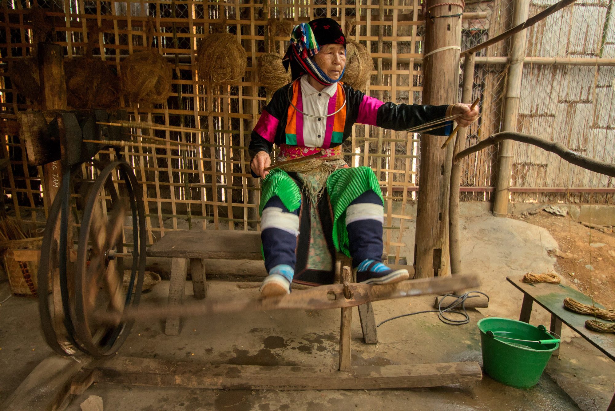
The most painstaking step is the wax drawing: the artisan uses a home-made pen with a copper tip to dot melted beeswax onto white cloth. Where there is wax the indigo can't soak in, so after dyeing and de-waxing the pattern appears white on indigo blue — triangles, spirals, crosses, bird footprints, never from a printed template.
At Lùng Tám you can watch each step, try joining thread or dotting some wax with an artisan guiding you, and buy scarves, wallets and bags straight from the workshop. Come in the morning or early afternoon on a weekday to see the most people at work, and allow at least an hour if you want to try the wax. Details in our article on the Lùng Tám linen-weaving village.
Paragliding and paramotor in Quản Bạ
The Quản Bạ valley is the main flying site of the Mebayluon flying team (Hà Giang Paragliding & Paramotor), open for the season since 15 October 2026, daily 06:30–18:30. You need no experience: the pilot flies the whole time, you just listen to a short briefing and follow the pilot's calls at take-off and landing. Full details are on the Quản Bạ flying site page.
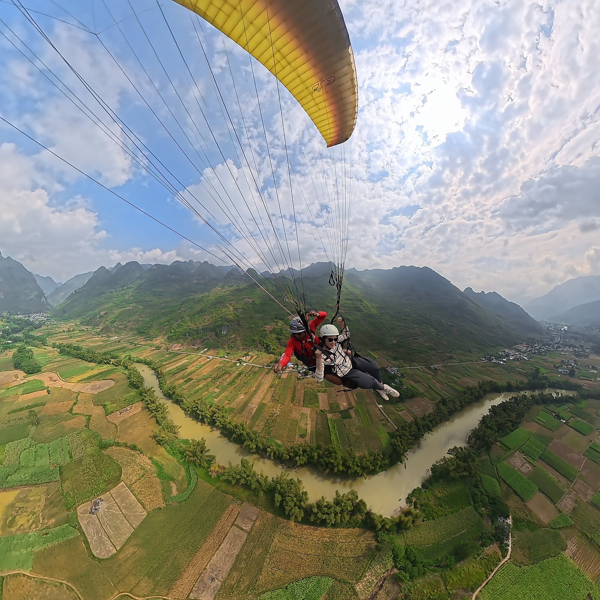
Paragliding: take-off from a ridge at 950 m
The paragliding take-off sits on a ridge at about 950 m, looking straight down into the valley. The road up takes vehicles of up to 16 seats only, because it is narrow with no space to turn around; bigger vehicles park at Long Anh restaurant at the turn-off and the team drives guests the last 1.5 km or so. After the harness and briefing, you run a few steps on the pilot's call, the wing fills and the two of you lift off the slope.
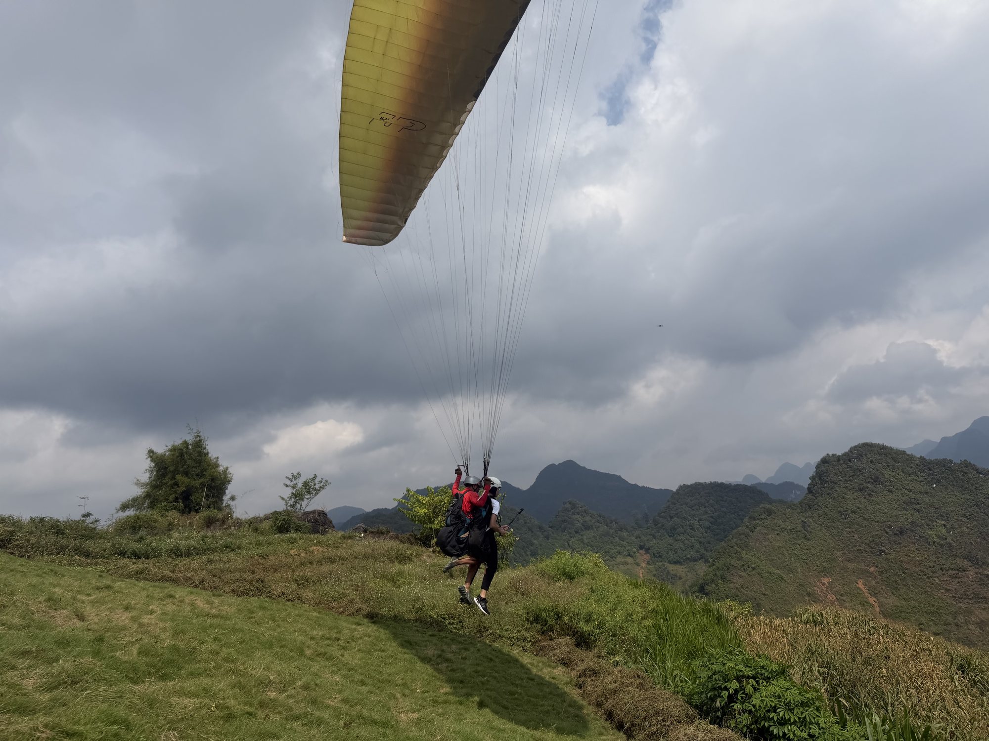
The flight lasts 9–15 minutes depending on the wind. You cross the valley with views of the Fairy Twin Mountains, the road up to Heaven's Gate, the karst peaks, the cornfields and the bends of the Miện River, then land on the flat field at about 450 m in the middle of the valley, by the river. The landing field is wide and open, with room even for 40-seat coaches to park — handy when a big group is waiting for each other. Directions to both fields are in how to get to the Quản Bạ take-off and landing and on the landing field page.
Paramotor: take-off right by the Miện River
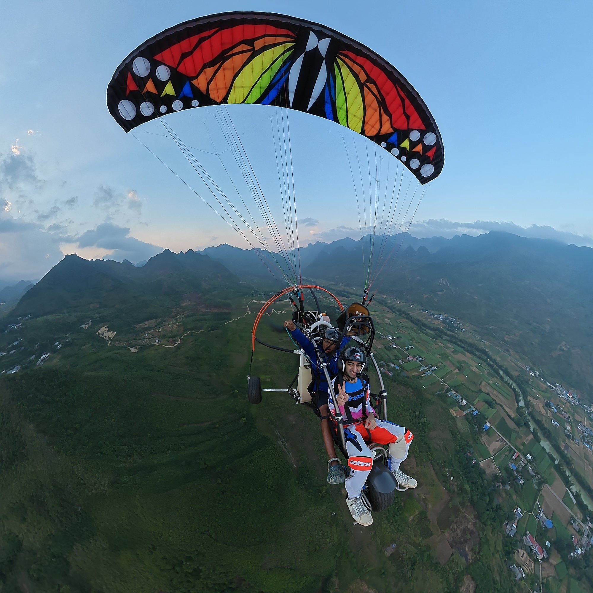
A paramotor (powered paraglider, PPG) doesn't need the mountain: the trike takes off and lands right on the flat field by the Miện River, which makes it the easiest option if you'd rather not walk or climb. With an engine the pilot controls height and direction, so flights are longer and can be timed for sunrise, sunset or cloud chasing when conditions allow. The differences between the two are explained in paragliding vs paramotor.
Packages and prices
| Package | Duration | Price per guest |
|---|---|---|
| Standard tandem paragliding (PG) | 9–15 min (wind dependent) | 2,290,000 VND (≈ US$ 91) |
| Sunset paragliding (PG) | 9–15 min (wind dependent) | 2,990,000 VND (≈ US$ 119) |
| Standard tandem paramotor (PPG) | 15 min | 2,490,000 VND (≈ US$ 99) |
| Advanced paramotor: cloud chasing, sunrise or sunset (PPG) | 22–25 min | 3,390,000 VND (≈ US$ 135) |
Paragliding has no cloud-chasing package, and sunrise flights are paramotor only. If the weather doesn't allow a special flight (cloud chasing, sunrise, sunset, long flight), it becomes a standard PG or PPG flight.
Included: free GoPro video (ask your pilot), insurance, drinking water and free pick-up and drop-off within the Quản Bạ area (Nậm Đăm, Cán Tỷ, H'Mong Village resort…). Extras: drone footage 400,000 VND per guest, 360° camera 400,000 VND per guest.
Booking and good to know
- Book online on the booking page: no deposit, nothing to pay when booking. You pay at check-in at the site, before the flight: cash, bank transfer, card (+3%) or PayPal (+3%).
- Arrive at the site about 30 minutes before your flight.
- Who can fly: children from 3 years old; guests over 90 kg please tell the team in advance; also let us know about heart conditions, pregnancy, recent surgery or epilepsy.
- Weather: we only fly when wind and visibility are safe. The team checks the forecast and confirms the flight time on the morning of the flight; bad weather means free rescheduling. You can follow the flying weather forecast a few days ahead.
- What to wear: a warm layer, long trousers and trainers with good grip. The full list is on before your flight.
Where to eat and sleep
Quản Bạ is known for Thanh Vân corn wine, mint-flower honey (the mint blooms in late autumn and early winter) and the plateau classics: thắng cố (horse-meat stew), mèn mén (steamed corn flour), smoked sausage, Hmong mustard greens and free-range chicken. The market and small eateries in Tam Sơn serve simple lunches, enough to keep you going; village homestays usually cook family dinners if you book ahead. More ideas in Hà Giang specialities to try.
| Area | Feel | Best for |
|---|---|---|
| Central Tam Sơn | Small town, handy shops; guesthouses, small hotels, homestays | Comfort seekers, bus travellers |
| Nậm Đăm | Quiet Dao village, rammed-earth homestays | Culture lovers |
| Lùng Tám | Linen-weaving village, family homestays | Craft lovers, slow travellers |
| Cán Tỷ | Open views, few visitors, on the way to Yên Minh | Riders who want to avoid crowds |
Staying the night in Quản Bạ is a good idea if you want to fly early the next morning, when the air is calm and clouds still lie at the foot of the mountains. On October–November weekends and public holidays rooms can fill up, so book a few days ahead. Each area is compared in staying overnight in Quản Bạ.
How to plan your stop
If you only have half a day (on a tour or with an easy rider): leave the city in the morning, stop at Heaven's Gate for photos, go down to Tam Sơn and fly a paraglider or paramotor, have lunch and continue to Yên Minh. Tell the team roughly when you'll arrive so they can slot your flight in.
If you stay one night:
- Day 1, afternoon: ride up from the city, see the twin hills in the afternoon light from Heaven's Gate, check in at Tam Sơn, Nậm Đăm, Lùng Tám or Cán Tỷ.
- Day 1, evening: family dinner, check the wind forecast for the next morning and confirm your slot with the team.
- Day 2, morning: pick-up at your door; a morning paragliding flight, or a sunrise or cloud-chasing paramotor flight if the sky allows.
- Day 2, midday: stop at Lùng Tám to see the weaving, then continue to Yên Minh.
Don't plan too tightly: keep half a day spare in case of thick morning fog or unsuitable wind. For the full route, see our 4-day, 3-night Hà Giang Loop itinerary.
Moving on from Quản Bạ
There are two ways from Quản Bạ to Yên Minh:
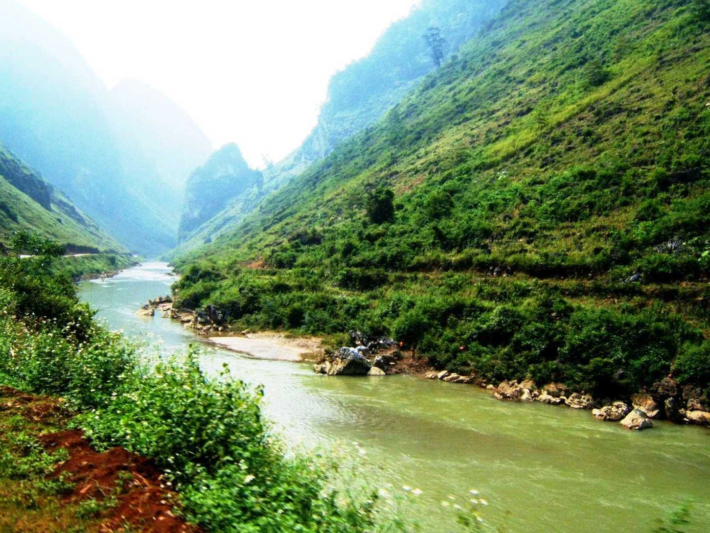
- National Road 4C: about 50 km, through Cán Tỷ and along the Miện River, a beautiful pass road with plenty of bends.
- The new inter-commune road: follow National Road 4C to the Cán Tỷ rest stop, turn onto the road through Lao Và Chải and down to Yên Minh — about 31 km in total. It is newly built, with a good surface and great views; ask your driver or homestay about current conditions before you set off.
On the way back, a road runs from Du Già through Lùng Tám to Quản Bạ (about 48 km), so if the weather kept you on the ground on the way out, you can still fly on the return. And if you'd like a second flight over the Rocky Plateau, Đồng Văn (around Km150) also offers tandem paragliding by appointment — see paragliding in Quản Bạ or Đồng Văn.
Best time to visit & tips
- September: golden rice in the valley.
- October–November: dry season, clear skies, long views; buckwheat flowers from about October, at their best from late October through November. Also the best flying season.
- December–January: cold, mornings and evenings often only 5–15 °C, frequent seas of clouds on mornings after cold, damp nights; from late December into January there can be frost on the high ground.
- February–March: plum and peach blossoms in white and pink across the villages.
Tips:
- If you plan to fly, get to Quản Bạ early or stay the night before; the morning window is usually the calmest.
- Bring a warm layer and shoes with good grip, especially for the take-off.
- Fill up in Tam Sơn before continuing to Yên Minh.
- Ask locals before taking portraits, and don't pick flowers in the buckwheat fields.
- Carry small cash for roadside stalls and small villages.
Frequently asked questions
How far is Quản Bạ from Hà Giang City?
About 45 km on National Road 4C, roughly 1 h 15 min of non-stop riding, longer if you stop for photos on Bắc Sum Slope and at Heaven's Gate.
Is Quản Bạ worth a longer stop if I'm not flying?
Yes, if you have time. Besides Heaven's Gate and the twin hills, you can walk around Nậm Đăm, watch the weaving at Lùng Tám or drop by the riverside landing field to see the wings come in. Two to three hours makes a relaxed loop.
Paragliding or paramotor?
Paragliding is a quiet, engine-free flight launched from the 950 m ridge. Paramotor takes off from the flat field, flies longer and offers sunrise, cloud-chasing and sunset packages. Both are flown by a pilot, so no experience is needed.
Should I fly in the morning or the afternoon?
Mornings are usually calmer and more likely to have clouds in the valley; late afternoon brings low golden light and the sunset. The team sets the time by the actual wind on the morning of the flight. More in morning or afternoon flights.
What if the weather is bad on the day?
We only fly when wind and visibility are safe. If you can't fly, you can reschedule for free — to another slot that day, the next day, or your return trip through Quản Bạ.
Book a flight: book online — no deposit, free cancellation
Hotline / Zalo / WhatsApp: +84 964 073 555 (Mr. Mỹ) · Ms. Judy +84 965 651 300
Read more: Quản Bạ flying site · Landing field · Flying weather forecast · The Hà Giang Loop stop by stop
Next stop: Yên Minh · Previous stop: Hà Giang City