Paragliding at Quản Bạ or Bắc Sum Pass? Comparing two flying sites near Hà Giang city
Bắc Sum Pass or Quản Bạ? A side-by-side look at the two flying sites on the QL4C near Hà Giang city: distance, landing field, valley width, paragliding and paramotor, a flying morning at Quản Bạ, getting there and fitting the flight into the Hà Giang Loop.
Captain Mỹ · · 16 min read
Bắc Sum Pass is about 9 km closer to Hà Giang city; Quản Bạ, roughly 15 minutes further along the same QL4C road, has a wide landing field in the middle of a flat valley, offers both paragliding and paramotor, and sits right next to the lunch stops of the Hà Giang Loop.
Two flying sites lie close to Hà Giang city, on the same road up to the plateau. This article compares the two places — location, terrain, landing field and what is available nearby — so you can decide which one suits your trip.
Keep reading
To be clear from the start: the Mebayluon flying team flies at Quản Bạ (and Đồng Văn), not at Bắc Sum. Everything said about Bắc Sum below describes only its location and terrain.
Where are the two sites?
Leaving Hà Giang city, the QL4C starts climbing north. Bắc Sum Pass is the stretch of road climbing towards Quản Bạ, in the Quyết Tiến area, about 36 km from the city. The take-off is right on the pass, which is handy if you are setting out from the city.
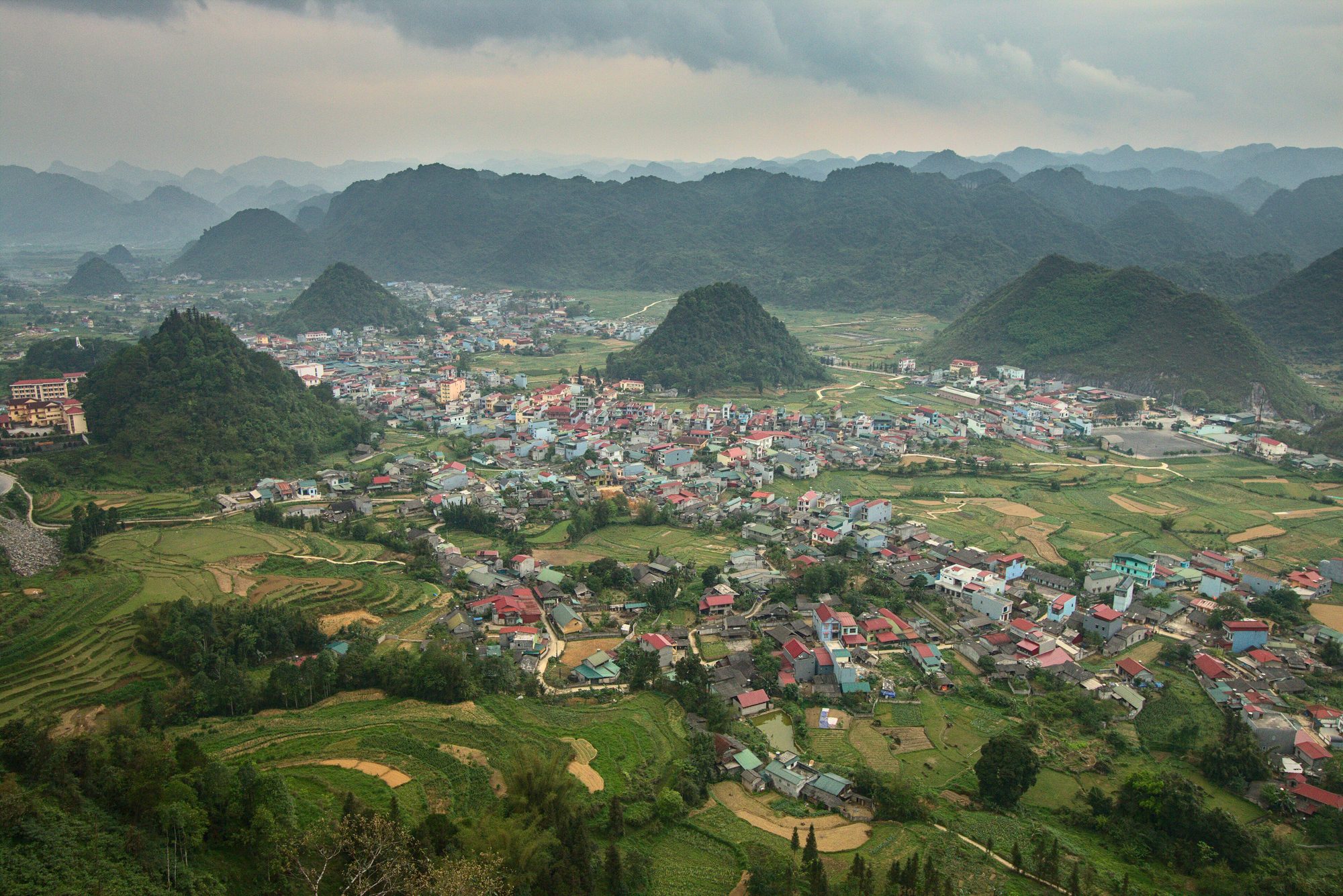
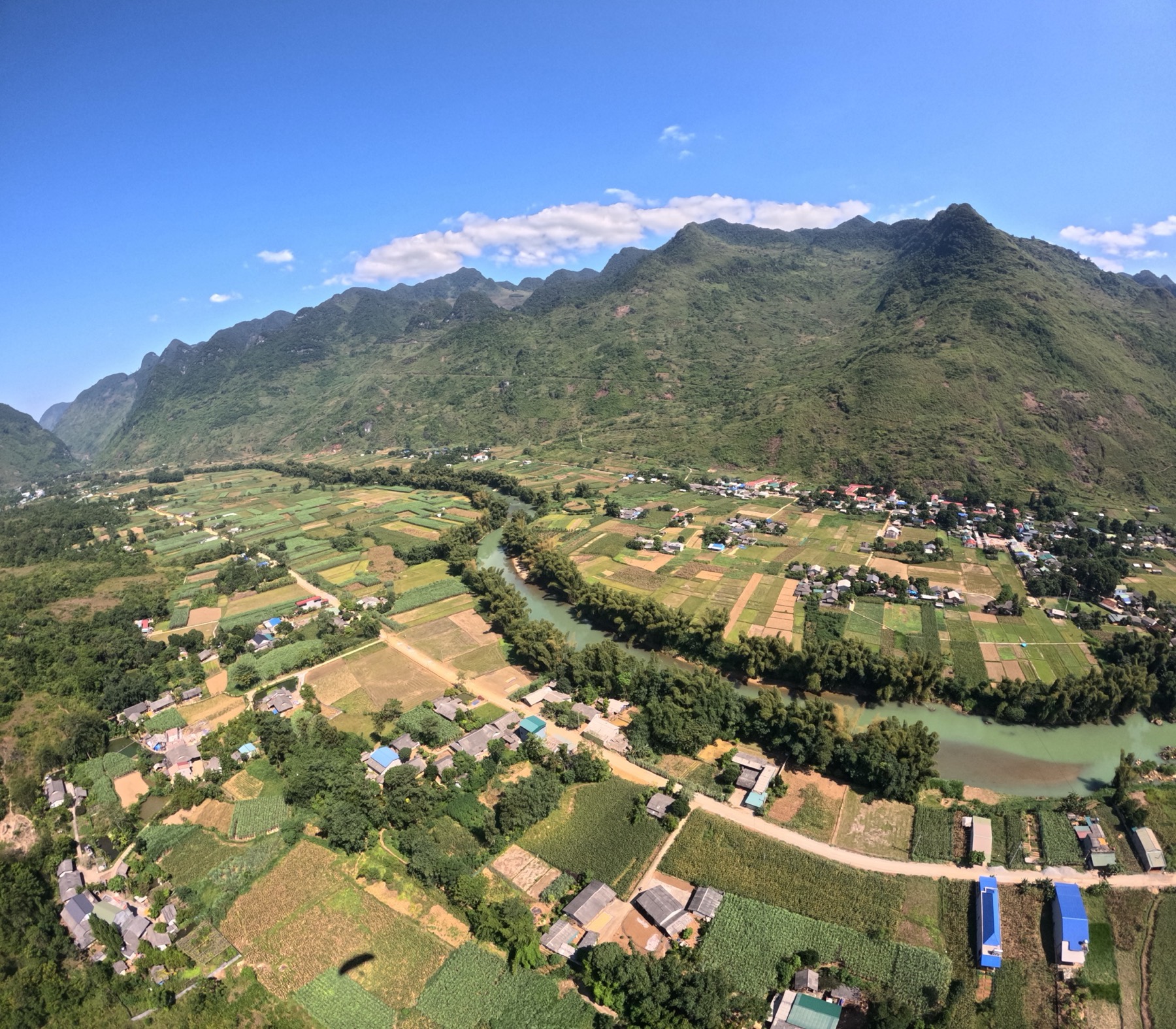
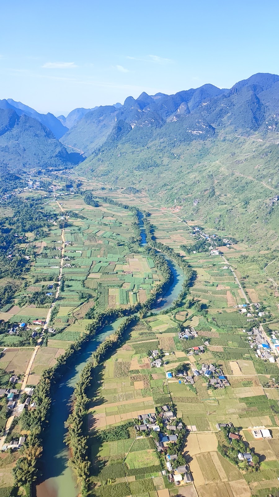
About 9 km further on (around 15 minutes by car) along the same QL4C you reach Quản Bạ, around Km45 of the Hà Giang Loop and about 45 km from the city (roughly 1 hour 15 minutes). Here the road opens onto a very wide, flat valley with the Miện river running through it.
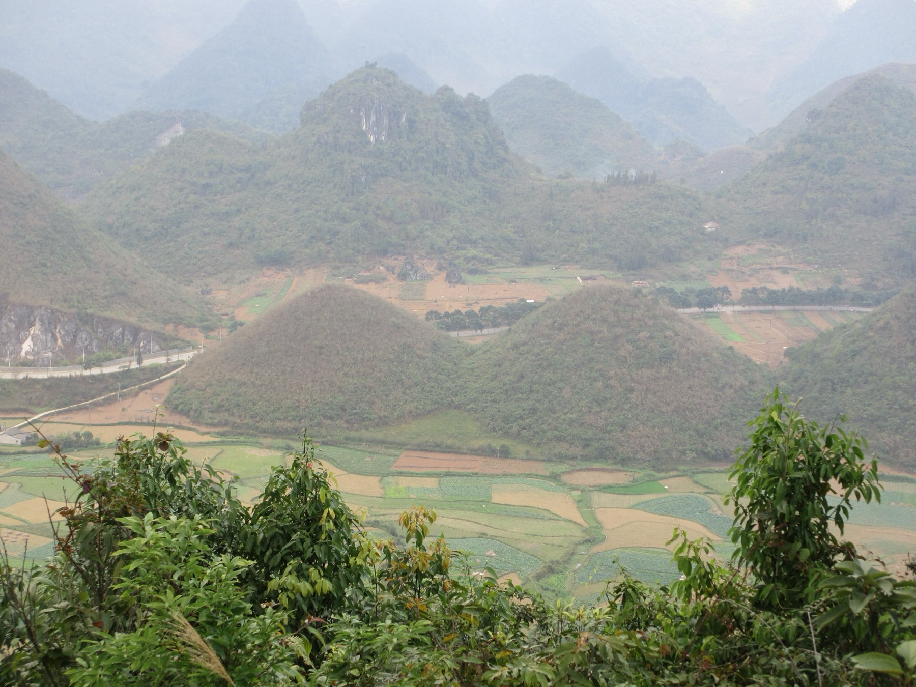
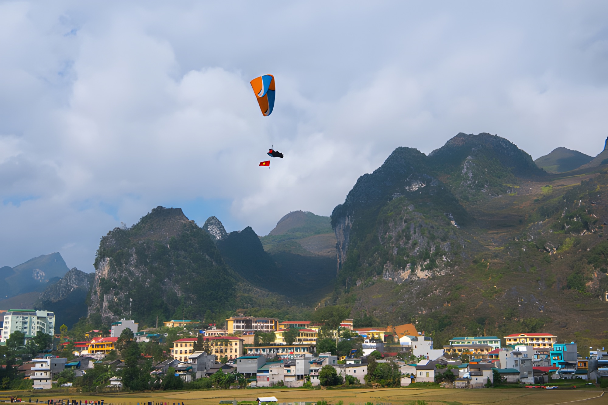
The Quản Bạ valley with its town and cone-shaped hills, seen from above — Photo: Benjamin Smith, CC BY-SA 4.0, Wikimedia Commons
Bắc Sum Pass
Quản Bạ
Distance from Hà Giang city
About 36 km
About 45 km (~9 km / ~15 min further)
Position on QL4C / the Loop
On the pass, on the climb through the Quyết Tiến area
Km45, Miện river valley, first stage of the Loop
Landing field
Many tall trees around it
Wide field in the middle of a flat valley, ~450 m altitude
Valley
Narrower
Very wide and flat
Paragliding (PG)
Yes
Yes, foot launch from a ridge at ~950 m
Paramotor (PPG)
Not flown
Yes, including sunrise, cloud-chasing and sunset flights
Nearby
Right on the pass, farther from the usual lunch stops
Tour groups' lunch stops, H'Mong Village resort, Nậm Đăm village, places to stay in Quản Bạ town
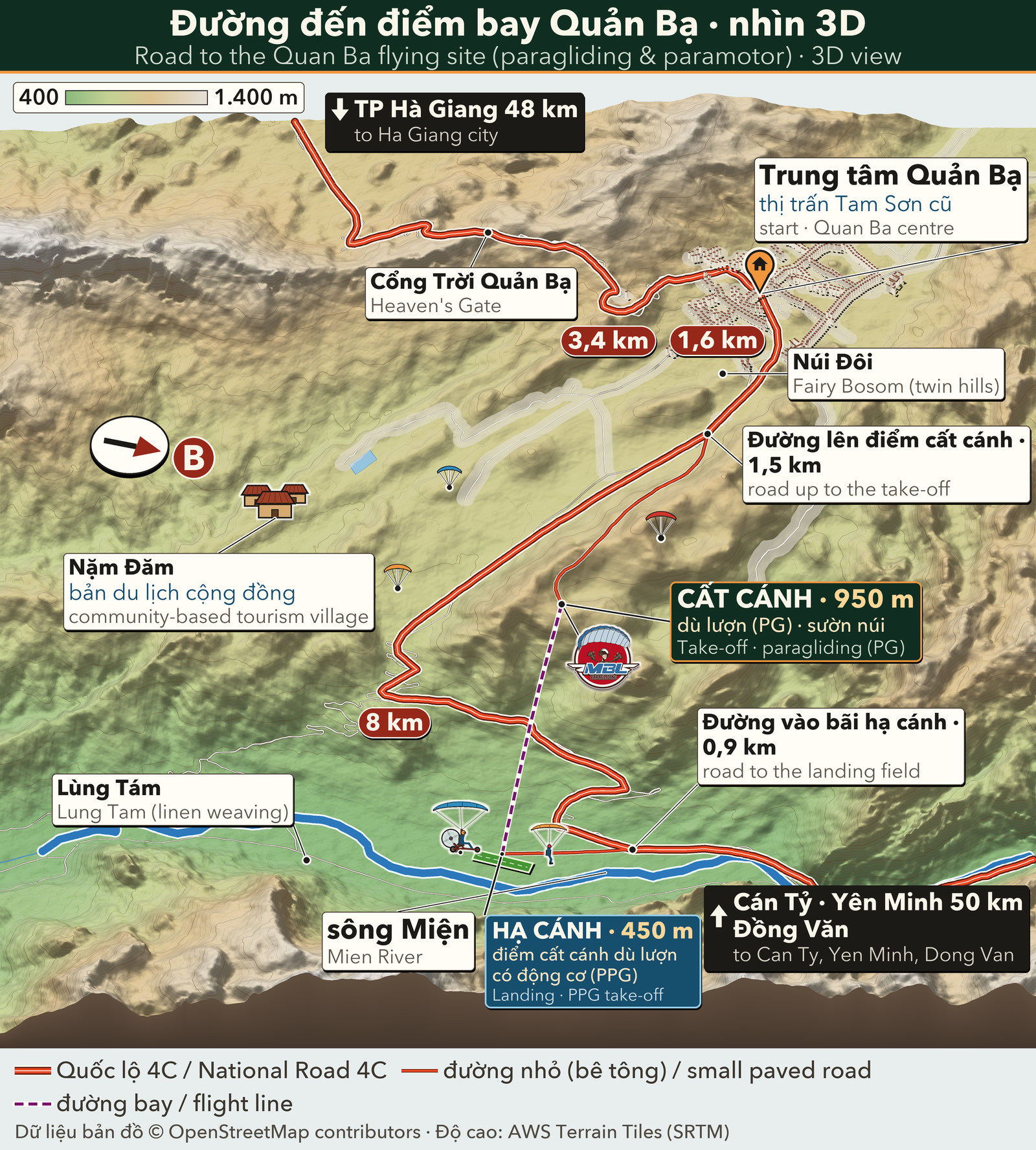
On the 3D Hà Giang Loop map you can see where the Quản Bạ take-off and landing fields are in relation to the QL4C.
The landing field: what first-time flyers should know
On a tandem flight the pilot handles the whole take-off, flight and landing. Even so, the shape of the landing field and the width of the valley decide how much room the pilot has for the final minutes.
A wide, open field in the middle of a flat valley gives the pilot space to circle down, choose the landing direction according to the wind, and keep a margin if the wind shifts.
A field ringed by tall trees, in a narrower valley, asks the pilot to plan the approach more precisely and use more piloting technique; flying conditions there are also more demanding.
These are differences in terrain; weigh them up and choose for yourself.
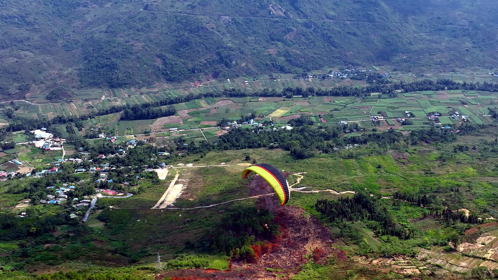
At Quản Bạ, the landing field lies in the middle of a very wide, flat valley at about 450 m, beside the Miện river. From the ridge at about 950 m, the pilot has some 500 m of height to show you the scenery and then circle down over the corn fields before setting you down on the grass. The paramotor also takes off from this same valley floor. See also the landing field page.
The grass field in the Quản Bạ valley: where paragliders land and the paramotor takes off
What does a wide landing field mean for a first-timer?
You don't steer the wing, but knowing what the landing field looks like helps you relax on your first flight:
You can see where you will come down from the start. From the take-off ridge the valley floor spreads out below you; the landing field is a flat grass field in the middle of the valley, with nothing hiding it. Many first-timers feel calmer knowing their destination is in plain sight.
A gentler last minute. Because the field is wide, the pilot can make an extra turn or two to lose height gradually, then come in facing the wind. Your only job is to follow the instructions the pilot gave you before take-off.
Friends and family wait right at the field. A road runs all the way to the landing field, and even 40-seat coaches can drive in. Anyone who isn't flying can wait here, watch the wing circle down and film you from the ground.
You can carry on straight after. Your driver or easy rider can wait for you at the landing field; the tour groups' lunch stops are not far away, and you don't have to climb back up the hill.
A wide field doesn't mean flying in any weather: at Quản Bạ the pilots only take off when wind and visibility are safe. If the weather doesn't allow it, you can reschedule for free. Read more about how the team decides on the flight safety page.
A flying morning at Quản Bạ
To give you a picture, this is how a typical morning paragliding flight at Quản Bạ goes:
The evening before or early morning: the team checks the wind and cloud forecast and confirms your flight time. You can also check the flying weather forecast yourself.
Pick-up: if you are staying in the Quản Bạ area (Nậm Đăm village, Cán Tỷ, H'Mong Village…), pick-up and drop-off are free. From Hà Giang city the team can arrange a car for 500,000 VND (≈ US$ 20) per 4-seat car, each way. Be there about 30 minutes before your flight.
Check-in: you pay before the flight, in cash, by bank transfer, by card (+3%) or by PayPal (+3%).
Up to the take-off at ~950 m: the road up only takes vehicles of up to 16 seats. Groups in bigger vehicles park at Long Anh restaurant right at the turn-off, and the team drives them the last 1.5 km or so.
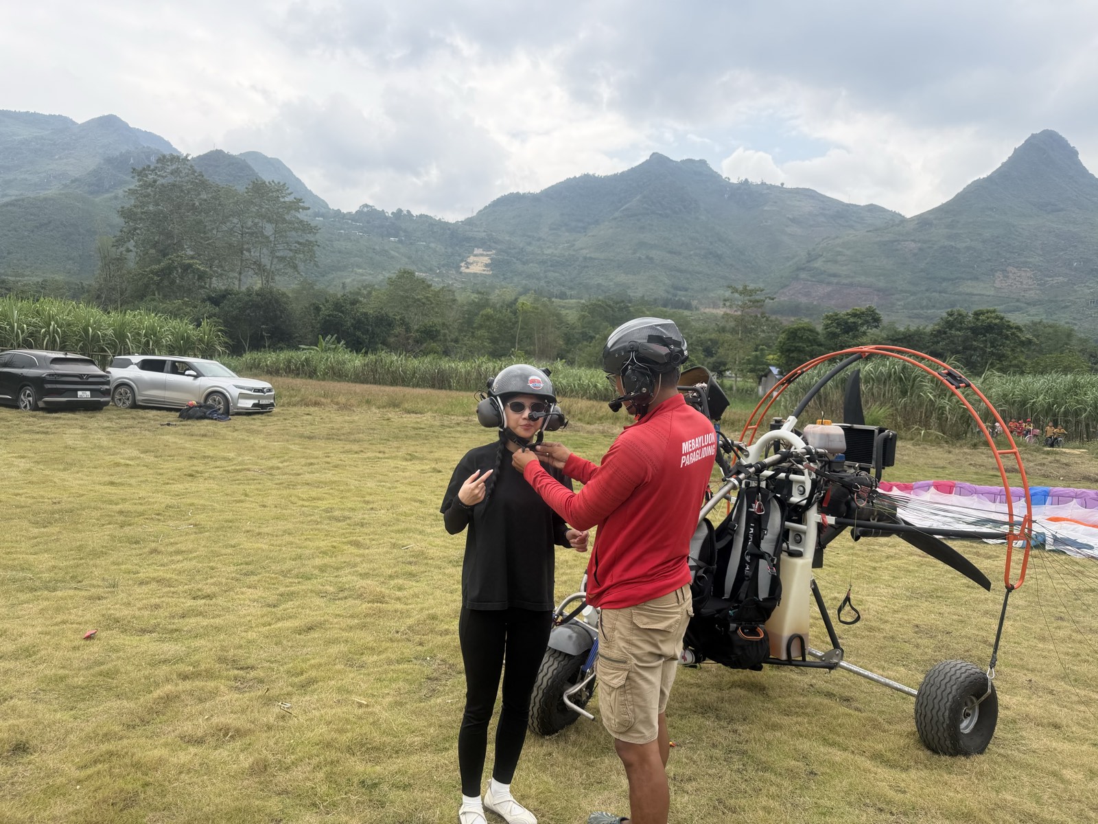
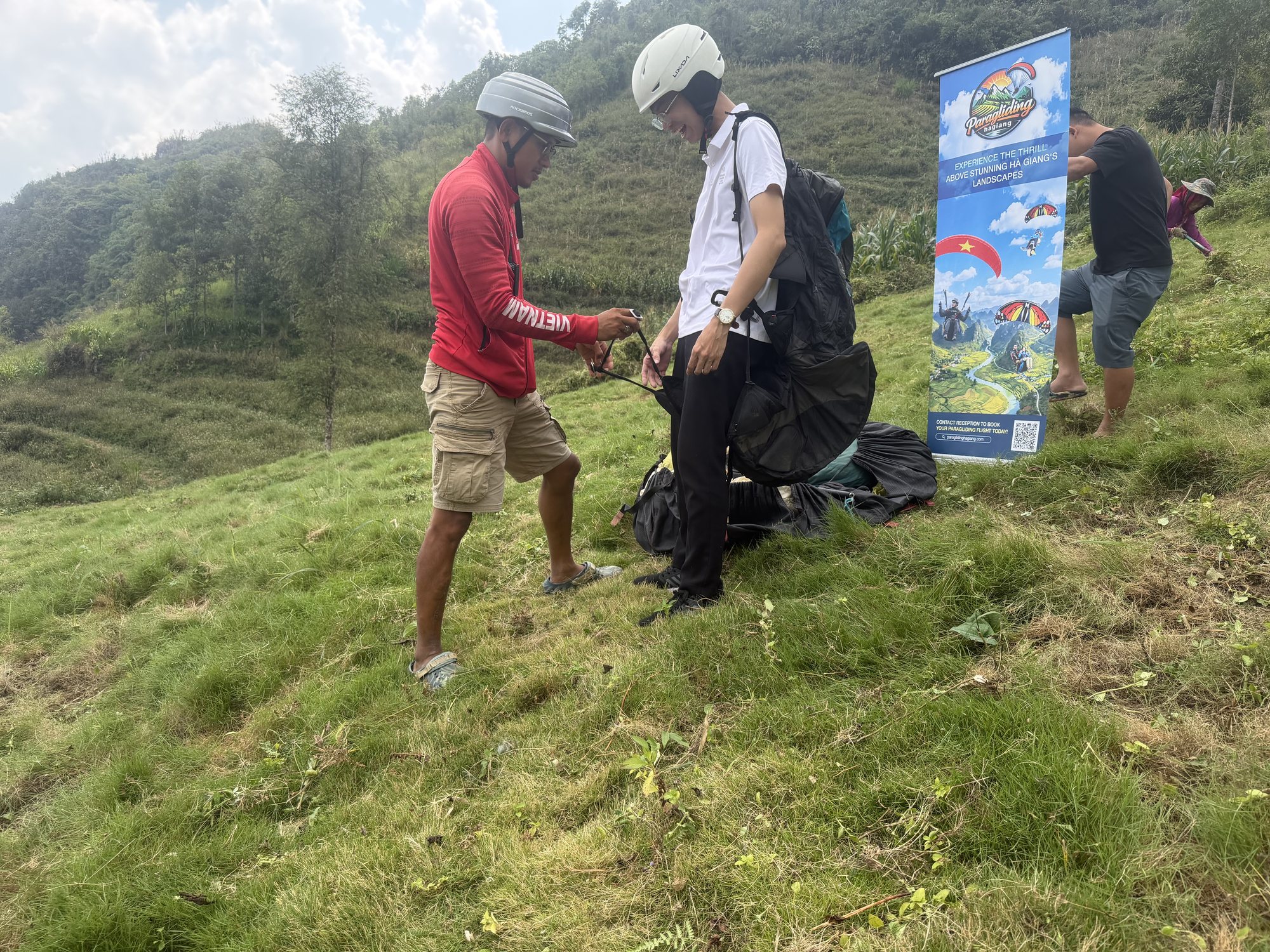
Gearing up and briefing: the pilot fits your harness and helmet, checks every buckle and explains the few running steps you'll take at launch.
The pilot checks the guest's harness before take-off at Quản Bạ
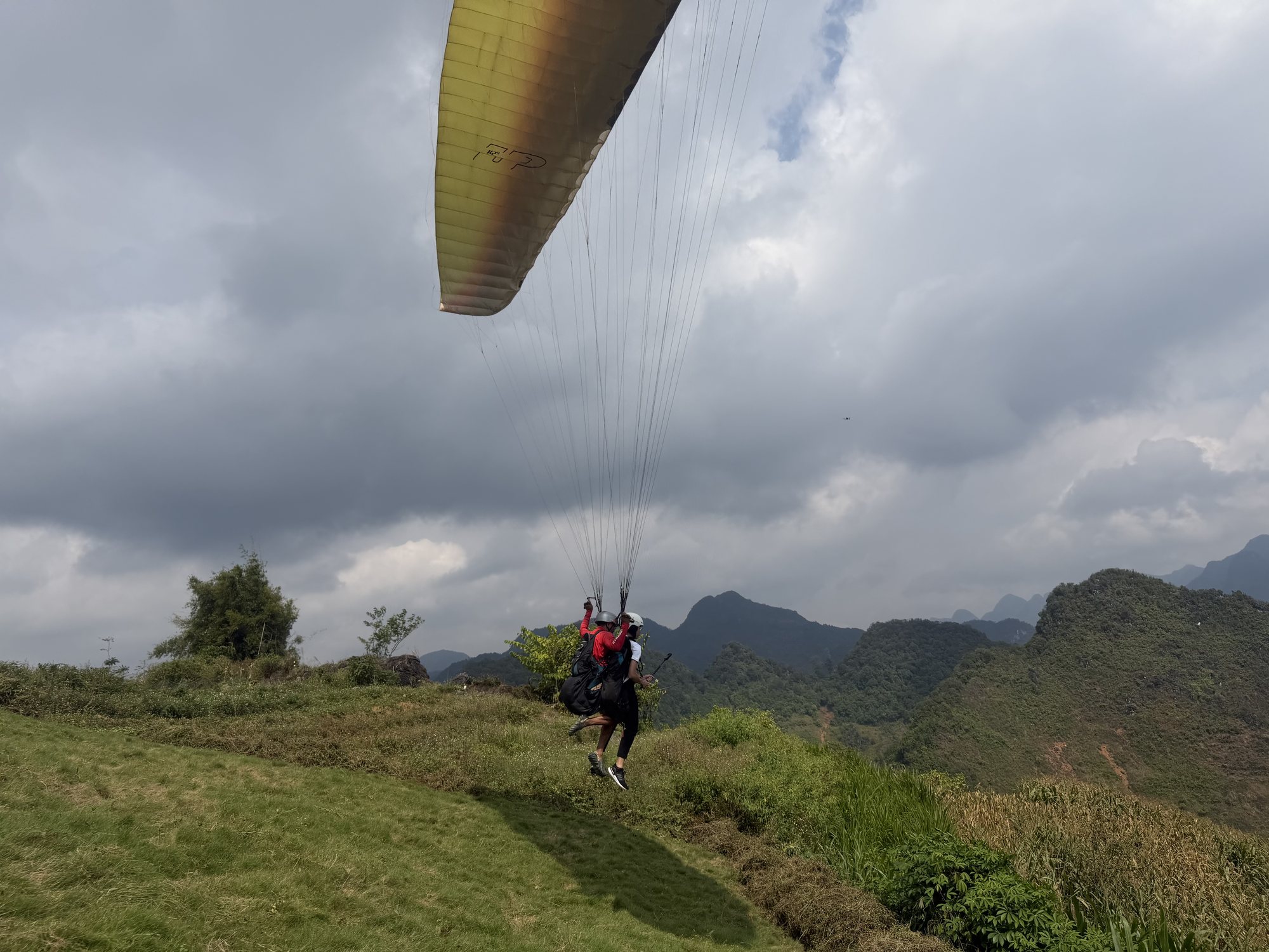
Take-off: when the wind comes in steadily, the pilot raises the wing. You run a few steps down the slope on the pilot's call until the wing lifts you both off the grass.
Flying for 9–15 minutes (depending on the wind): the pilot glides along the ridge and then out over the middle of the valley. Ask the pilot to film you on the GoPro (free), or add a drone (flycam) or 360° camera.
Landing: the wing circles down to the grass field in the valley; from there a car takes you back to where you are staying in the Quản Bạ area, or you carry on with the Loop.
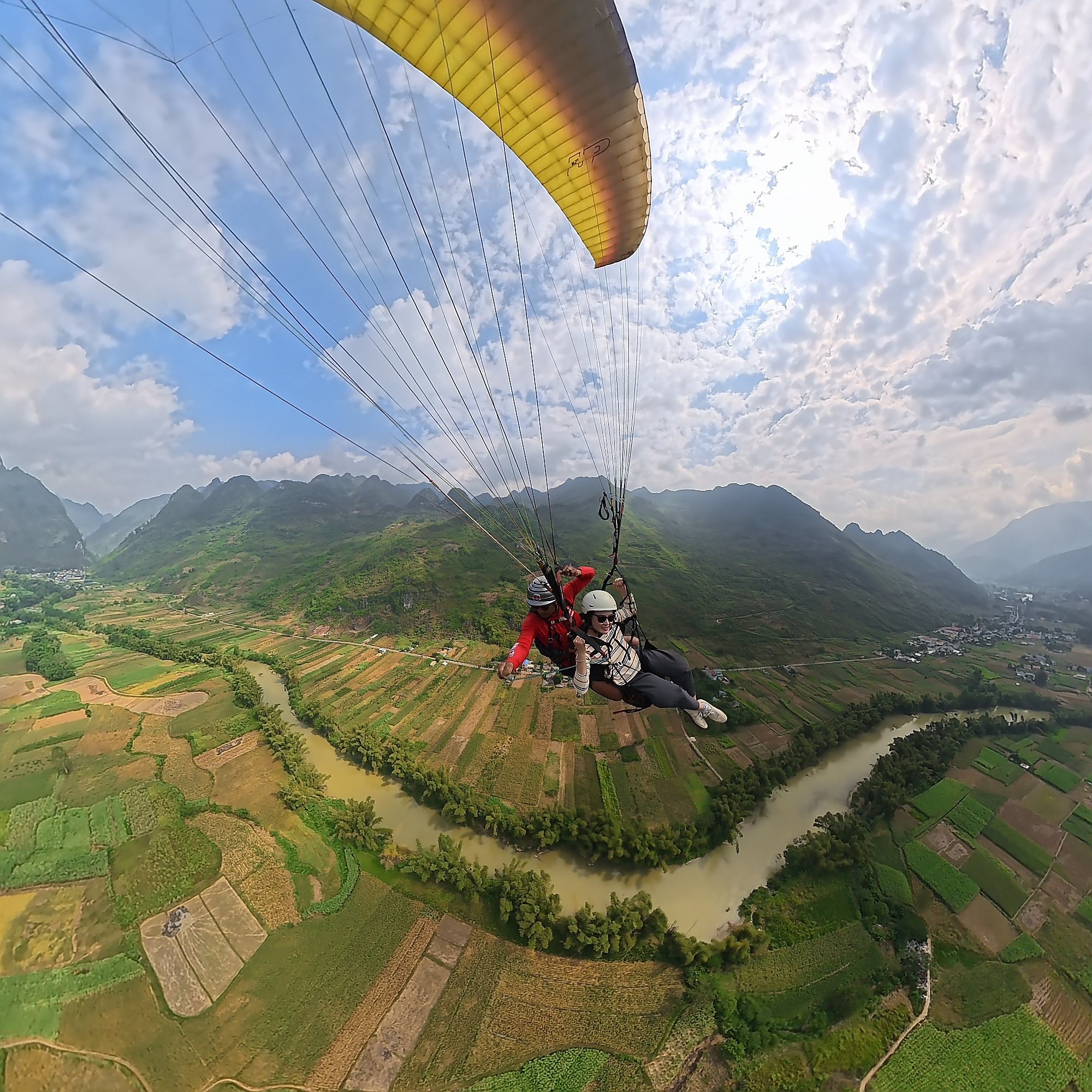
The paraglider launches from the ridge and glides out over the valley. Below you are the Fairy Twin Mountains (núi đôi Cô Tiên) — two round hills side by side among the corn fields — and further away Quản Bạ Heaven's Gate (Cổng trời Quản Bạ), ridges of sharp "cat's ear" limestone, and the Miện river winding through the valley. Read more about these landmarks in Quản Bạ Heaven's Gate and the Fairy Twin Mountains.
A tandem paraglider over a bend of the Miện river in the Quản Bạ valley
Because the valley is wide, the view opens up in several directions: on one side the ridge you have just left, on the other the fields, hamlets and the river running between two mountain ranges. In the dry season (October–December) the sky is usually clearer, so the distant ranges stand out better.
The Miện river valley, fields and villages of Quản Bạ seen from above
The Fairy Twin Mountains sit in the Quản Bạ valley and are easy to spot thanks to their two evenly rounded tops. To see them from the ground, the roadside stop on the QL4C near Heaven's Gate is where many people pull over for photos before heading down into town.
The Fairy Twin Mountains in the Quản Bạ valley — Photo: Surreal Nonsense, CC BY 4.0, Wikimedia Commons
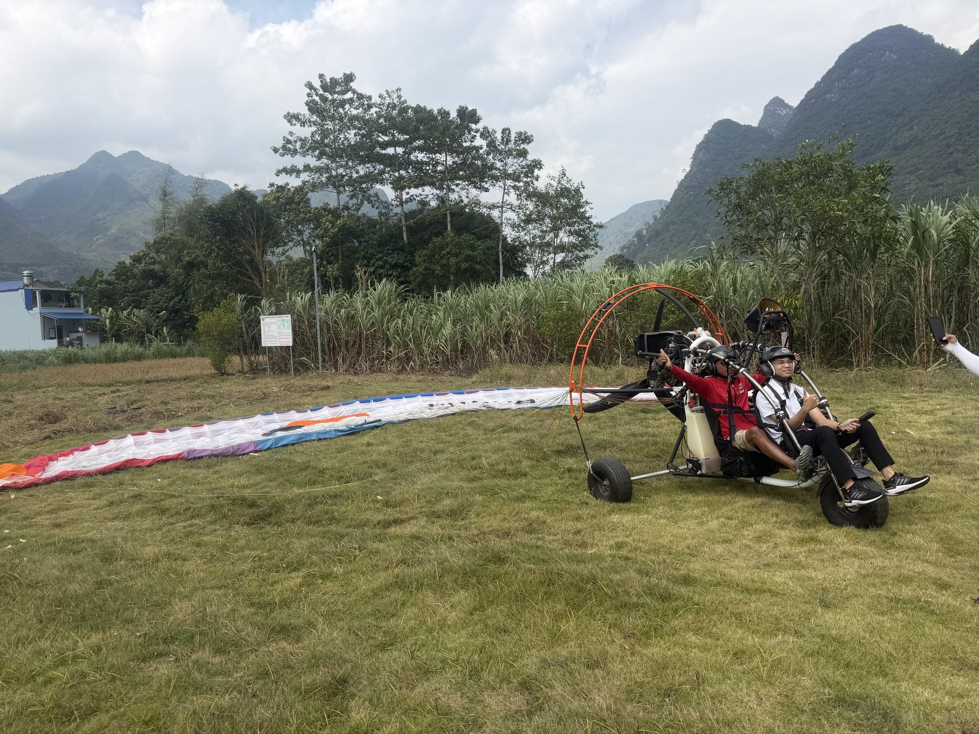
Paramotor: taking off from the flat field by the Miện river
A paramotor (PPG, powered paragliding) doesn't need a ridge: the trike carrying you and the pilot runs along the flat field beside the Miện river and takes off. With an engine, the pilot can climb on demand and fly further out over the valley. The standard flight lasts 15 minutes; the long 22–25-minute flight is scheduled early in the morning (sunrise, cloud-chasing) or late in the afternoon (sunset). Sunrise and cloud-chasing flights are paramotor only; paragliding has no cloud-chasing package. Find out more in paramotor in Hà Giang, cloud-chasing flights at Quản Bạ and paragliding in Hà Giang.
A tandem paramotor on its take-off run across the flat field by the Miện river, Quản Bạ
Paramotor flights are not flown at Bắc Sum, so if you want a powered flight, a sunrise flight or cloud-chasing near Hà Giang city, Quản Bạ is the place.
Prices at Quản Bạ
Standard paragliding, 9–15 minutes (depending on the wind): 2,290,000 VND (≈ US$ 91) per guest
Standard paramotor, 15 minutes: 2,490,000 VND (≈ US$ 99) per guest
Long paramotor flight, 22–25 minutes (cloud-chasing / sunrise / sunset): 3,390,000 VND (≈ US$ 135) per guest
Prices include GoPro video (ask your pilot), insurance, drinking water and free pick-up and drop-off within the Quản Bạ area. You can add a drone (flycam) or a 360° camera (400,000 VND ≈ US$ 16 per guest each). If conditions don't allow a special flight, it becomes a standard flight.
Quick choice
Short on time from the city and want the nearest site: Bắc Sum is about 9 km closer.
Want a paramotor flight, a sunrise flight or cloud-chasing: Quản Bạ — paramotor flights are not flown at Bắc Sum.
Want a wide landing field and an open valley: Quản Bạ.
Doing the Loop on a tour or with an easy rider and want to combine the flight with lunch: Quản Bạ, where the landing field is close to the groups' lunch stops.
Staying the night in Quản Bạ (H'Mong Village, Nậm Đăm, Quản Bạ town): Quản Bạ, with free pick-up in the area.
If you are riding or driving yourself, follow the QL4C from Hà Giang city; once past Bắc Sum Pass it is about 15 more minutes. No transport? The team can arrange a car from the city for 500,000 VND per 4-seat car each way; within the Quản Bạ area pick-up and drop-off are free.
There are two places to tell apart:
The paragliding take-off (~950 m) on the ridge. The road up is narrow and only takes vehicles of up to 16 seats; bigger vehicles park at Long Anh restaurant right at the turn-off, and the team drives guests the last 1.5 km or so.
The landing field (~450 m) on the valley floor beside the Miện river, which is also where the paramotor takes off. 40-seat coaches can drive in.
Easy riders and self-drivers can ride straight to either field.
3D map of the way to the Quản Bạ flying site: paragliding take-off at 950 m, landing field at 450 m by the Miện river (also the paramotor take-off), the twin hills, Nậm Đăm, Lùng Tám
The site is open every day from 06:30 to 18:30; flights only go ahead when wind and visibility are safe, and the team confirms the time on the morning of your flight. Book online with no deposit and pay at check-in; if the weather is bad, rescheduling is free. See also the flying site page and ideas for exploring Quản Bạ on the Hà Giang Loop.
Fitting the flight into the Hà Giang Loop
Both Bắc Sum and Quản Bạ lie on the first stage of the Loop, so a flight slots into your itinerary without a detour. A few common ways to combine them:
Fly on day one of the Loop: leave Hà Giang city in the morning, pass Bắc Sum Pass and Heaven's Gate, and reach Quản Bạ about 1 hour 15 minutes later. Fly, have lunch in town, then carry on to Yên Minh. Tell your easy rider or tour in advance so they can plan the timing.
Spend a night in Quản Bạ: you'll need to for sunrise, cloud-chasing (paramotor) or sunset flights. In November–December the sun sets around 17:15–17:30, so sunset flights are scheduled earlier than in summer. For places to stay, see staying overnight in Quản Bạ and Nậm Đăm cultural village.
From Quản Bạ to Yên Minh: besides the QL4C (about 50 km) there is a new inter-commune road via Cán Tỷ – Lao Và Chải, about 31 km, with a good surface and plenty of views. Ask the team or your guide before you set off.
One more flight over the Rocky Plateau: at Đồng Văn (around Km150) the team runs tandem paragliding by prior appointment, depending on the wind.
The Miện River at Cán Tỷ commune, Quản Bạ, with Highway 4C along the bank — Photo: BacLuong at Vietnamese Wikipedia, public domain, Wikimedia Commons
No. Paramotor flights are not flown at Bắc Sum. Paramotor flights take place at Quản Bạ: the standard 15-minute flight costs 2,490,000 VND per guest, the long 22–25-minute flight (cloud-chasing, sunrise, sunset) 3,390,000 VND per guest.
How much further is Quản Bạ than Bắc Sum?
About 9 km along the same QL4C, or roughly 15 minutes by car. Bắc Sum is about 36 km from Hà Giang city, Quản Bạ about 45 km (roughly 1 hour 15 minutes).
Does the Mebayluon team fly at Bắc Sum?
No. We fly at Quản Bạ (paragliding and paramotor, every day) and Đồng Văn (paragliding, scheduled according to the wind).
After flying at Quản Bạ, can I still continue the Loop the same day?
Yes. Many guests fly in the morning, have lunch near the landing field and then ride on to Yên Minh. For a sunrise, cloud-chasing or sunset flight it's best to stay the night in Quản Bạ.
Can a group in a coach get to the Quản Bạ flying site?
Yes. 40-seat coaches can drive right into the landing field. The road up to the paragliding take-off only takes vehicles of up to 16 seats; bigger vehicles park at Long Anh restaurant at the turn-off and the team takes guests up. Large groups should let the team know in advance so flights can be scheduled.
What if the weather is bad?
The team only flies when wind and visibility are safe, and confirms your flight time on the morning of the flight. If the weather doesn't allow flying, you can reschedule for free. Booking needs no deposit; you pay at check-in.
Can I fly if I've never flown before?
Yes, no experience is needed; children from 3 years old can fly with a pilot. Guests over 90 kg, or with a heart condition, pregnancy, recent surgery or epilepsy, please tell the team in advance. See also how heavy can you be to paraglide.
Book a flight:book online — no deposit, free cancellation
Quản Bạ or Đồng Văn? An honest comparison of our two flying sites on the Hà Giang Loop: location, getting there, scenery, paragliding vs paramotor, what a flying session looks like, wind and schedule, price, and how to fly both…
The Chín Khoanh slope is a stack of hairpin bends on QL4C between Phố Cáo and Sủng Là, about 18 km past Yên Minh and 27 km before Đồng Văn: why it's called "nine coils", the best viewpoint, how to stop safely, how it differs from Thẩm Mã and what to see nearby…
A practical guide to the Mã Pí Lèng Sky Path, the cliff-edge walking trail above the Nho Quế River: the trailhead at the Youth Volunteers monument, the route section by section, the death rock closure (October 2026), what to wear, when to go and how to pair it with a Tu Sản canyon boat trip…
A guide to Lô Lô Chải, the Lô Lô village at the foot of the Lũng Cú flag tower: rammed-earth houses, costume and bronze drums, Café Cực Bắc, homestays, the road from Đồng Văn, 2026–2027 traffic rules and village etiquette…
The Yên Minh pine forest lines Highway 4C about 7–8 km before Yên Minh town on the Quản Bạ side: exact location, commune after the 2025 merger, best light, how to stop safely, what's nearby and how to fit it into a 3- or 4-day Loop…
A guide to Pao's House in Lũng Cẩm cultural village, in the Sủng Là valley about 24 km from Đồng Văn: the Mua family's 1947 rammed-earth Hmong home, the film The Story of Pao, tickets, access from Road 4C, flower seasons and how to pair it with the Chín Khoanh bends and the Hmong King Palace…