Can you paraglide in Đồng Văn? Yes: tandem paragliding over the Old Quarter and the Rocky Plateau, scheduled in advance around the wind for each group. Paramotor and daily flights are in Quản Bạ — many guests fly at both.
Captain Mỹ · · 15 min read
Yes, you can go paragliding in Đồng Văn: tandem flights over the Old Quarter and the heart of the Rocky Plateau, landing right in town, scheduled in advance for each group around the wind — get in touch to book.
Đồng Văn sits at around Km150 of the Hà Giang Loop (Hà Giang now belongs to Tuyên Quang province and the old town is now Đồng Văn commune, but travellers still call the area Hà Giang). Here the Mebayluon flying team runs tandem paragliding over Đồng Văn Old Quarter and the Đồng Văn Karst Plateau, a UNESCO Global Geopark. Đồng Văn offers paragliding only, no paramotor, and there are no fixed daily time slots: the team schedules each group in advance based on the wind forecast. If you want a guaranteed daily flight, or want to try paramotor, the main flying site is Quản Bạ at around Km45 — and many guests choose to fly at both on the same Loop trip.
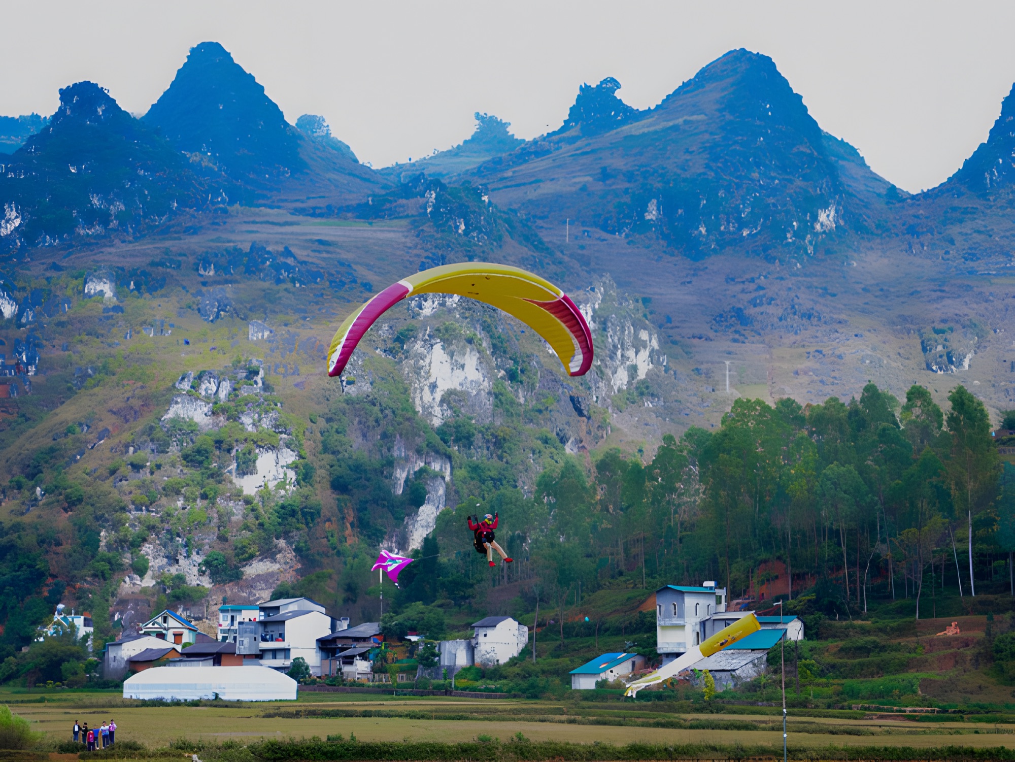
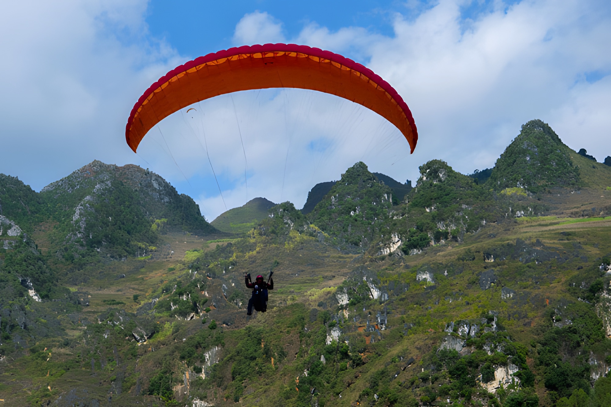
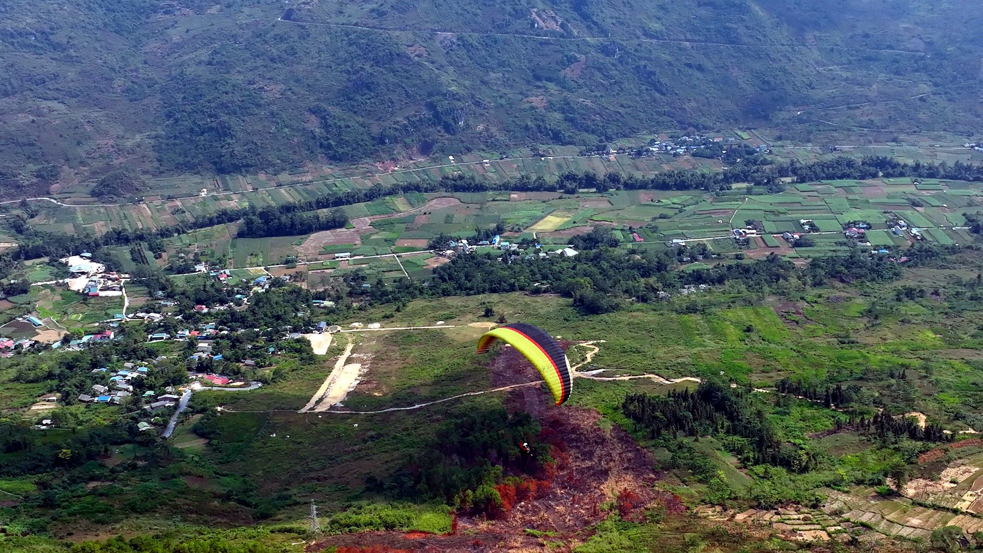
A paraglider over Đồng Văn town among the cat-ear limestone peaks, during a flying day in 2017 — Photo: Nguyễn Thị Phương (Camera Thành Phụng), Báo Hà Giang, 2017
Paragliding in Đồng Văn: what will you see?
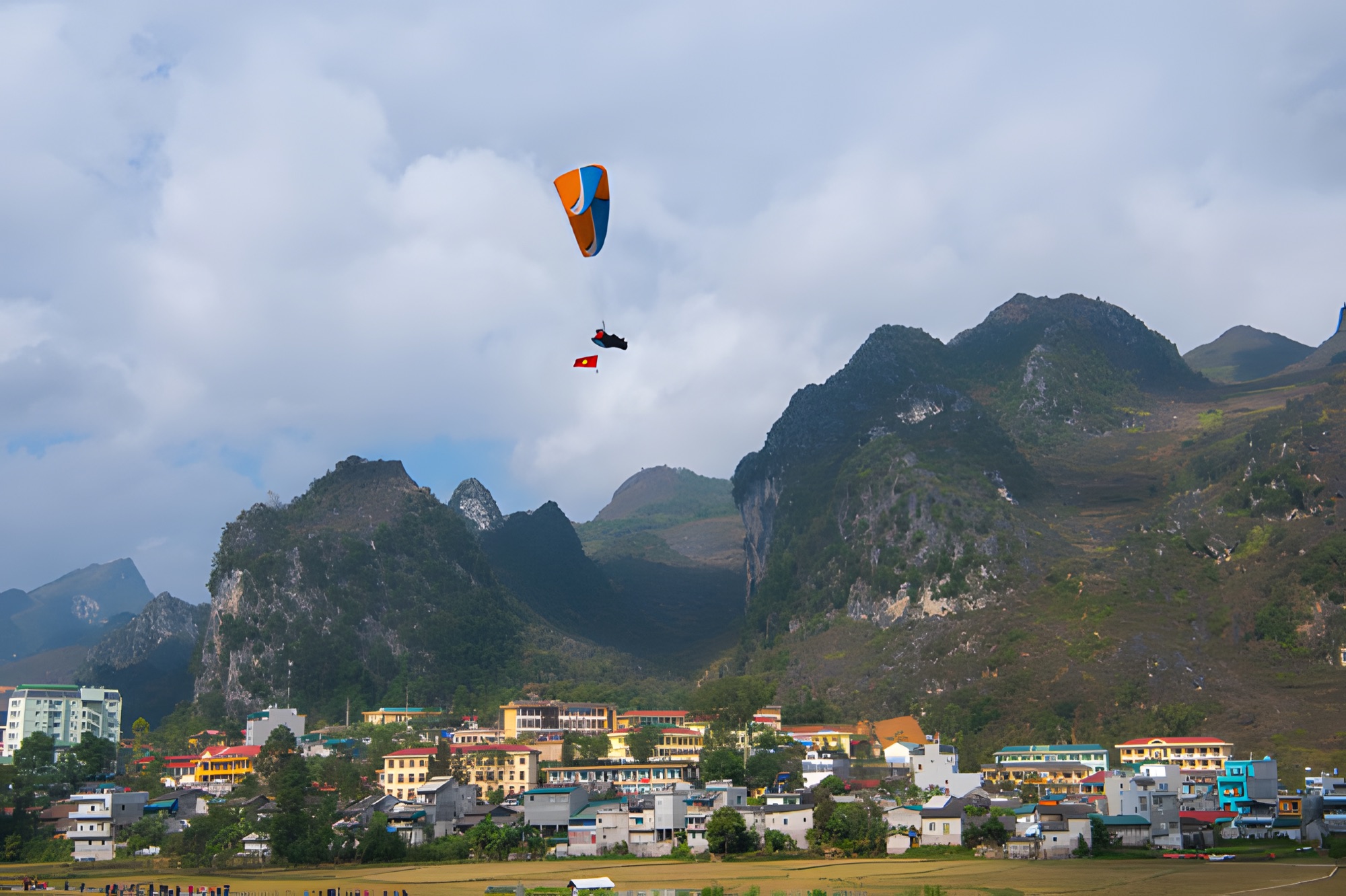
If Quản Bạ is the southern gateway, with the wide green valley of the Miện River, Đồng Văn lies in the very heart of the Rocky Plateau. From under the wing the scenery is harsher and grander: grey limestone peaks crowded together, narrow valleys, small hamlets clinging to the rock, and the town tucked neatly into a bowl between the mountains.
Đồng Văn town and Old Quarter from above
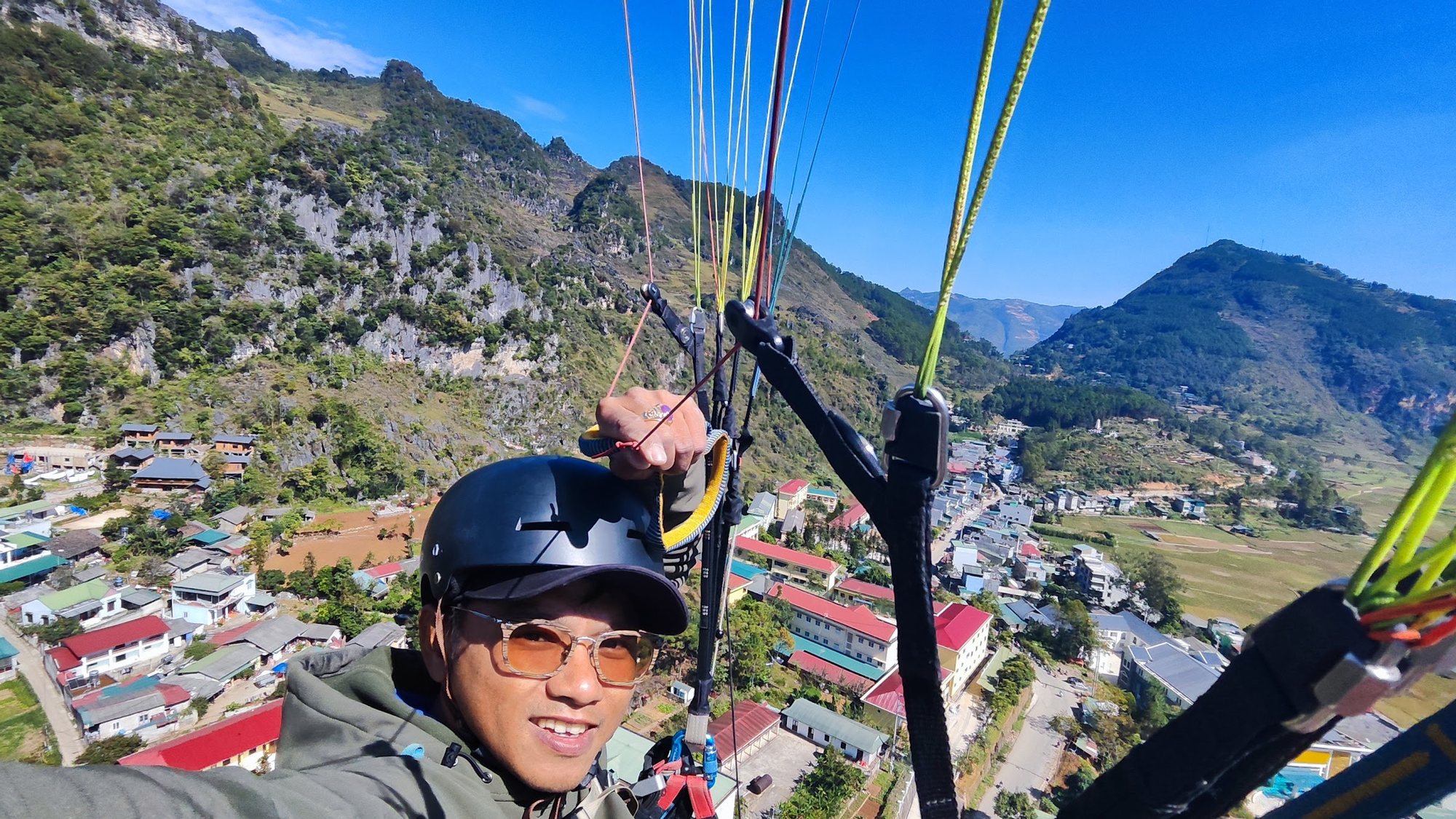
Rows of rammed-earth houses with yin-yang tiled roofs nestle at the foot of the mountains, while the old market and the town's little sloping lanes look like a miniature model. From the height of the wing you can clearly see the road running through town, the cornfields on the rim of the bowl and the limestone slopes rising right behind the streets. Landing in Đồng Văn town means that a few minutes after touching down, you can walk into the Old Quarter for a coffee.
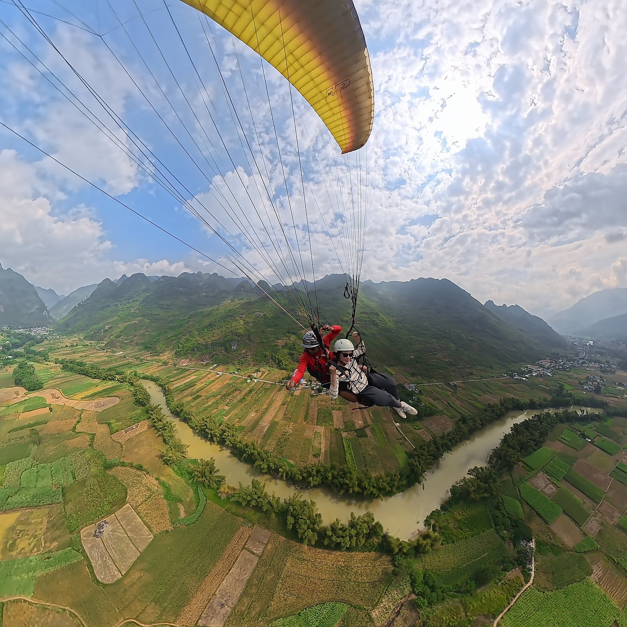
A paragliding pilot's selfie above Đồng Văn town: streets, cornfields and limestone cliffs laid out beneath the wing
The Rocky Plateau and cat-ear limestone
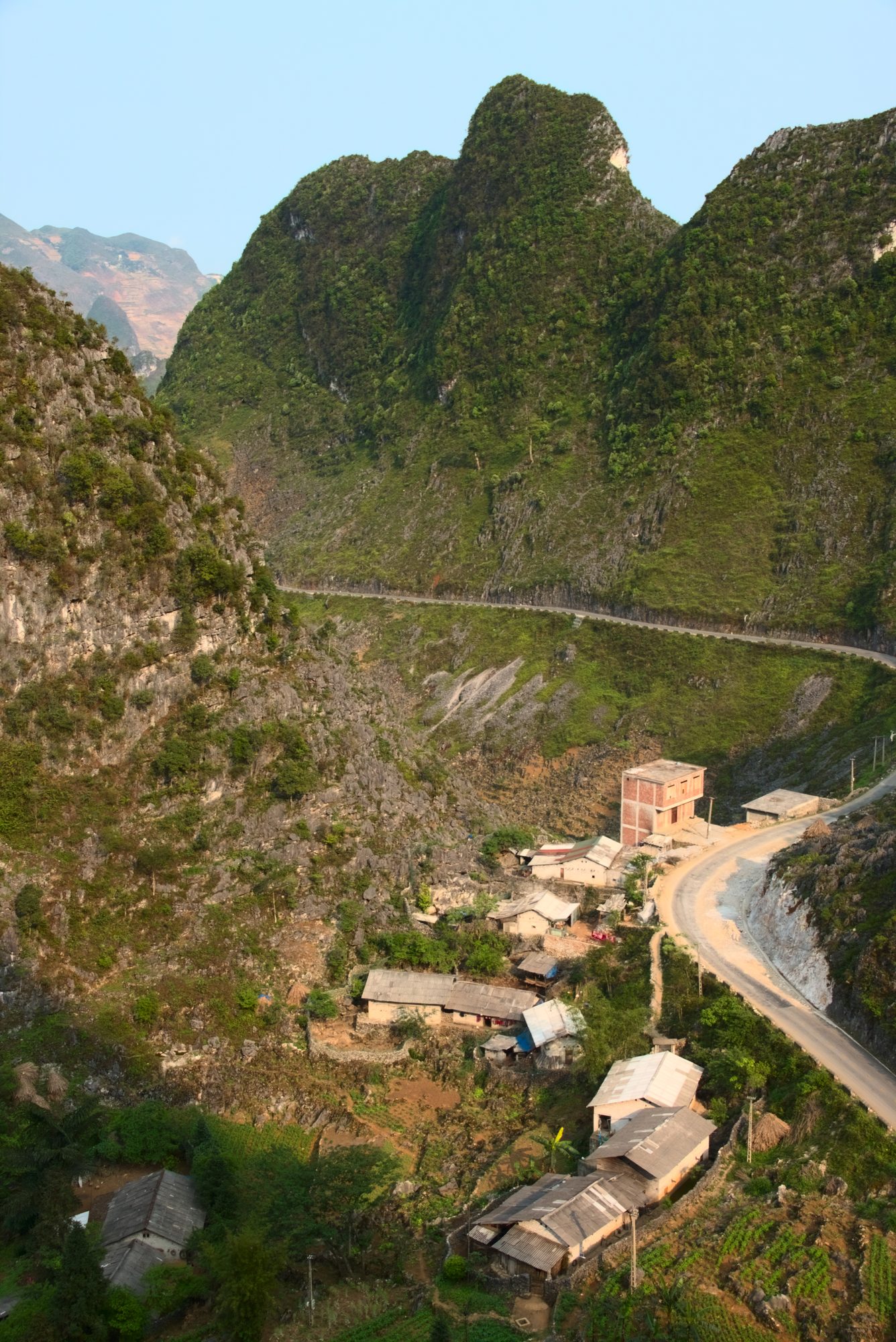
Đồng Văn lies within the Đồng Văn Karst Plateau, a UNESCO Global Geopark. Looking down, you can clearly see the sharp-edged tai mèo (cat-ear) limestone covering the slopes, with tiny patches of corn and buckwheat that locals plant in every rocky hollow, and hand-stacked stone walls around the houses. Note: there are no rice terraces on the Rocky Plateau around Đồng Văn — the scenery here is stone, corn, buckwheat and clouds.
A small hamlet among steep limestone peaks in the Đồng Văn area — a familiar sight from under the wing — Photo: Benjamin Smith, CC BY-SA 4.0, Wikimedia Commons
Towards Mã Pí Lèng and the Nho Quế River
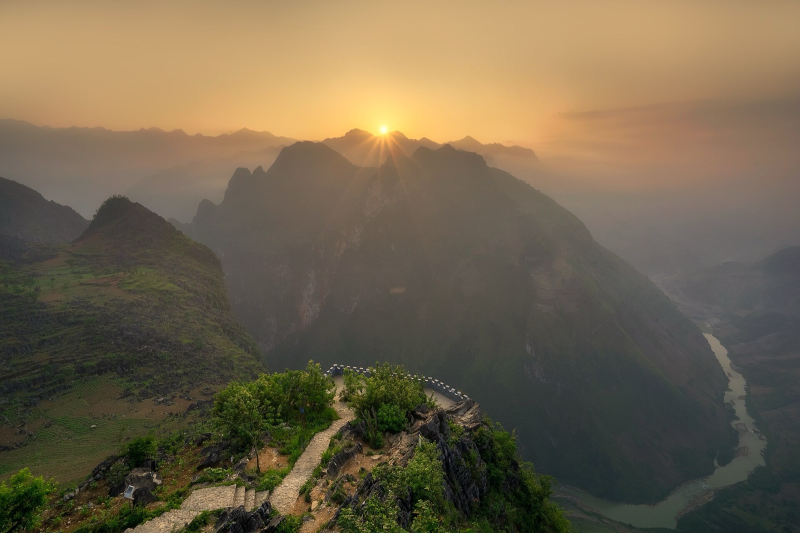
Đồng Văn is the gateway to Mã Pí Lèng Pass and the Nho Quế River canyon — the most spectacular stretch of the Hà Giang Loop. Fly in Đồng Văn and then ride on through this section, and you will see the Rocky Plateau from both angles: from the sky and from the edge of the abyss. Mã Pí Lèng Pass is about 20 km long, around 1,200 m high, and begins just past town.
Paragliding only, scheduled around the wind
Flying over limestone mountains needs the right wind in both direction and strength, so Đồng Văn offers tandem paragliding only, no paramotor. Flights don't run on a fixed daily schedule as in Quản Bạ; instead they are arranged in advance for each group, based on the forecast for the exact day you will be in Đồng Văn.
Flying site
Paragliding (PG)
Paramotor (PPG)
Flight schedule
Quản Bạ (Km45)
Yes
Yes
Daily 06:30–18:30, season open from 15/10/2026
Đồng Văn (Km150)
Yes
No
Scheduled in advance around the wind for each group, contact us to book
Why are there no fixed time slots? Đồng Văn doesn't have flights running all day like Quản Bạ, so the flying team needs to know your group size and the day you will be there in advance in order to fit you into a suitable wind window. When the wind isn't safe, the team doesn't take off — that is a general rule of paragliding, not something special to Đồng Văn. You can read more about why wind, rain and clouds can postpone a flight.
A red wing soaring in front of the limestone cliffs of Đồng Văn — Photo: Nguyễn Thị Phương (Camera Thành Phụng), Báo Hà Giang, 2017
Tell the flying team the date you expect to be in Đồng Văn, how many people are in your group, and weights if anyone is over 90 kg.
The team checks the forecast and gets back to you with a suitable time slot and the price for your group's flight; the exact time is confirmed on the morning of the flight after checking the wind.
Booking requires no deposit and no prepayment; you pay on the day, before take-off. If the wind isn't right, your flight is rescheduled free of charge; you can also switch to flying in Quản Bạ, which has daily flights. Get in touch as early as you can, especially for large groups or for weekends in flower season.
What happens on the day?
On the morning of the flight, the team checks the wind again and messages you the exact time. Be at the meeting point about 30 minutes before your slot. Your pilot gives a short briefing: how to put on the harness and helmet, how to run a few steps at take-off and how to sit for landing. You don't need to steer anything — your tandem pilot handles the whole flight. If you'd like a video of your flight, remind the pilot to film it on GoPro. After landing in town, you can walk straight into the Old Quarter.
When is the best time to fly in Đồng Văn?
October – December is the dry season, with clearer skies and a better chance of good flying days. It is also buckwheat flower season: the flowers bloom from around October to early December, at their best from late October through November. This year the 12th Buckwheat Flower Festival opened on the evening of 25 October 2026 at Youth Square (Quảng trường Thanh niên) in Đồng Văn commune, with events running until the end of December 2026 — see more on Hà Giang's buckwheat flower season.
Cold weather: mornings and evenings on the plateau are often only 5–15 °C in November and December, and Đồng Văn is colder still. Up in the air the wind makes it feel even colder, so bring a warm jacket and thin gloves.
Short days: in November and December the sun sets at around 17:15–17:30, so afternoon flights are scheduled earlier than in summer.
Late December – January can bring frost in the highlands and slippery roads early in the morning; allow extra travel time.
Before your trip you can follow the flying weather forecast to pick days with better chances of flying, then let the team know so they can hold a slot for you.
After landing: strolling Đồng Văn Old Quarter
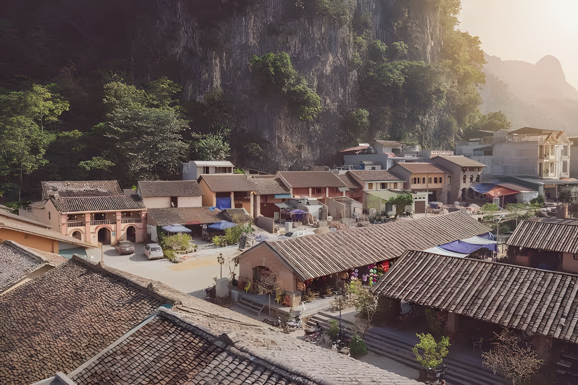
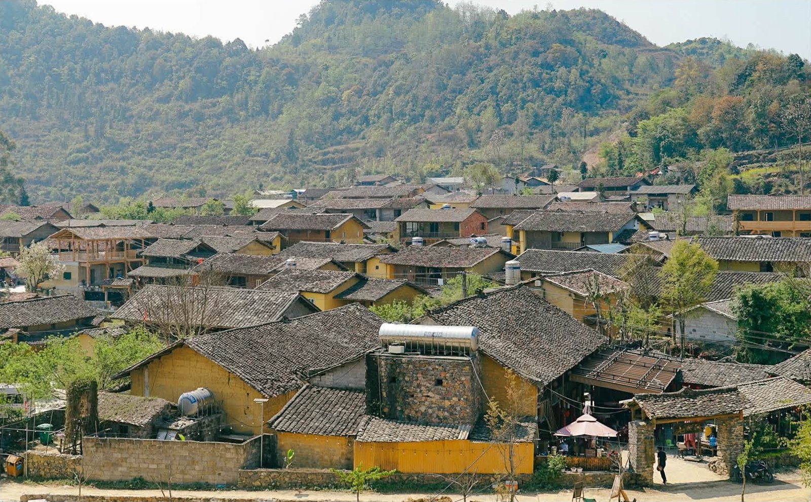
Đồng Văn Old Quarter stretches for about 1 km, with some 40 old rammed-earth houses featuring yin-yang tiled roofs, wooden verandas and red lanterns, most built between the late 19th century and the first half of the 20th century. At its centre stands the U-shaped old market, built of large stone blocks by the French in the 1920s together with craftsmen from Sichuan.
Đồng Văn Old Quarter, its yin-yang tiled roofs at the foot of the limestone mountains
If you fly at the weekend, stay on until Sunday morning for the Đồng Văn market: vendors arrive from around 5:30 and it is busiest from about 7:00 to 10:00, with brocade, livestock, thắng cố (horse-meat stew), mèn mén (steamed cornmeal), five-colour sticky rice and black bánh chưng. Bring cash. In the evening the Old Quarter has cafés, lantern-hung houses and food stalls around the market selling cháo ấu tẩu (ấu tẩu root porridge), thắng cố and grilled skewers; on full-moon nights or during festivals there is sometimes an extra "Old Quarter night" programme, but not every month — ask your homestay. Details in our article on Đồng Văn Old Quarter, the night market and the Sunday market.
Quản Bạ: the main flying site, with both paragliding and paramotor
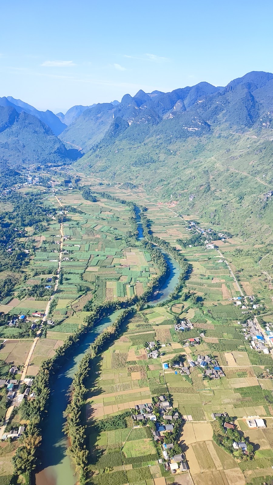
Quản Bạ is about 45 km from Hà Giang city (roughly 1 hour 15 minutes along National Road 4C) and is open daily from 06:30 to 18:30. Paragliders take off on foot from a mountainside at about 950 m and land in the Lùng Tám valley at about 450 m; paramotors take off right from the valley floor beside the Miện River. From above you'll see the Fairy Twin Mountains (Cô Tiên), Quản Bạ Heaven Gate, cat-ear limestone scattered among cornfields and the Miện River winding through the valley. See the details on the flying sites page.
A tandem paraglider gliding over a bend of the Miện River in the Quản Bạ valley
Prices include a GoPro video, insurance, drinking water and free pick-up and drop-off within the Quản Bạ area. You can add drone footage or a 360° camera (400,000 VND, about US$16, per guest for each). Cloud-chasing and sunrise flights are paramotor only; if conditions don't allow them, a special flight becomes a standard flight. Read more about paramotor in Hà Giang.
Flying at both Quản Bạ and Đồng Văn on one Loop trip
Many guests choose to fly at both: paramotor in Quản Bạ to see the Miện River valley, and paragliding in Đồng Văn to see the heart of the Rocky Plateau. The safest approach is to fly Quản Bạ on day one — the daily schedule makes it easy to get a slot — and treat the Đồng Văn flight as a bonus if the wind cooperates. If the wind in Đồng Văn doesn't work out, you already have one flight in the bag. For a detailed comparison of the two sites, see our article Quản Bạ or Đồng Văn: where should you fly?
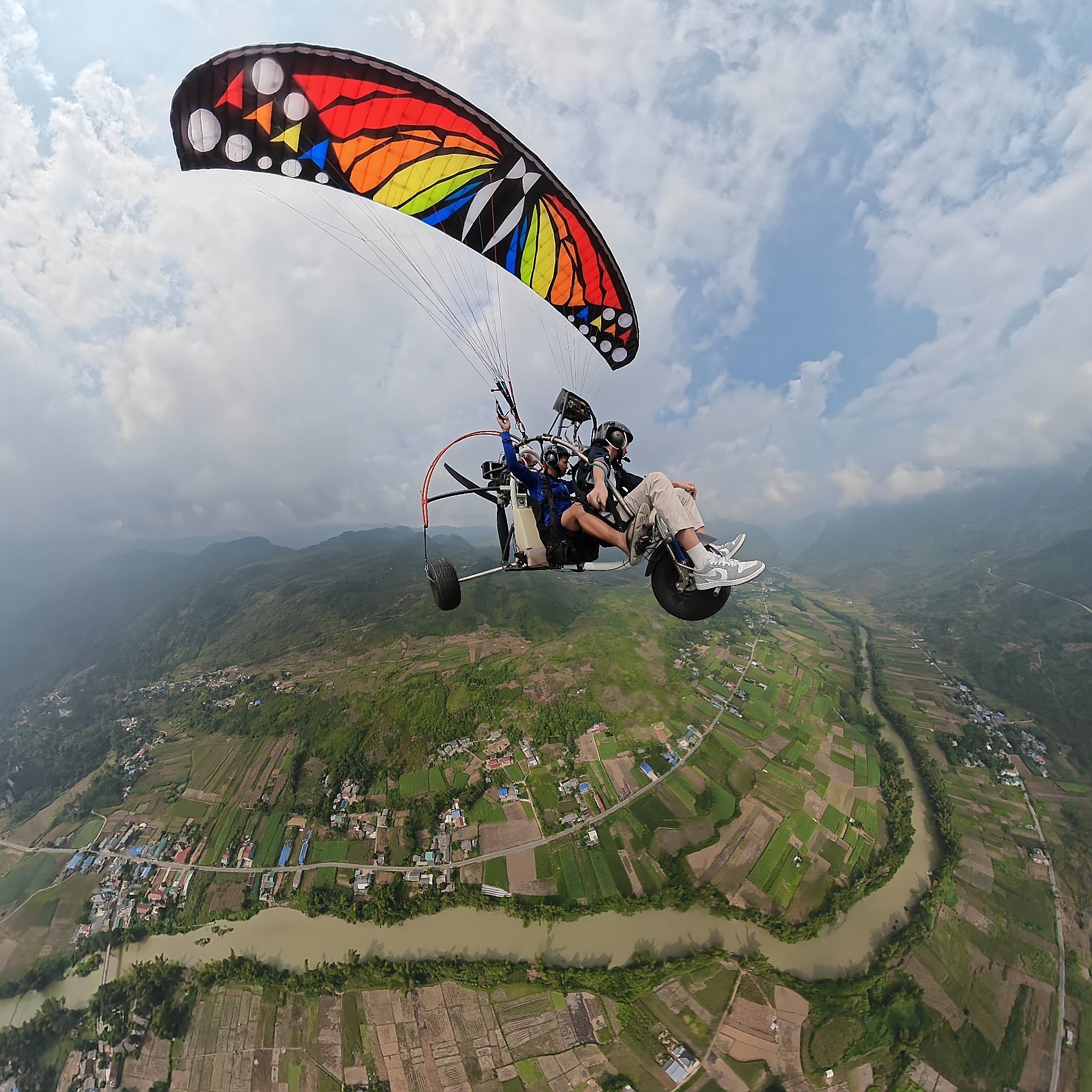
Paramotor over the Miện River and the villages and fields of Quản Bạ — a flight available only in Quản Bạ
Combining your flight with the Hà Giang Loop
Quản Bạ is at around Km45 and Đồng Văn around Km150 of the Loop, so both flying sites sit neatly on the popular route. Here's a suggested 3-day itinerary:
Day 1: Ride from Hà Giang city up to Quản Bạ and go paragliding or paramotoring. In the afternoon, continue on to Yên Minh.
Day 2: Yên Minh – Đồng Văn, with a detour up to Lũng Cú to visit the flag tower at Vietnam's northern frontier (the road usually passes through Sà Phìn, home of the Vương family mansion); spend the night in Đồng Văn Old Quarter. If you've booked a slot and the wind is right, go paragliding in Đồng Văn (that afternoon or the next morning).
Day 3: Cross Mã Pí Lèng Pass, admire the Nho Quế River, descend to Mèo Vạc, then return to Hà Giang city or go back via Du Già.
Because Đồng Văn flights depend on the wind, keep half a day flexible around Đồng Văn — for example, spend two nights in Đồng Văn, or leave the morning of day 3 free before crossing the pass. See the stage guide Đồng Văn on the Hà Giang Loop and our article Hà Giang Loop itinerary with paragliding.
Lũng Cú: the flag tower at the frontier
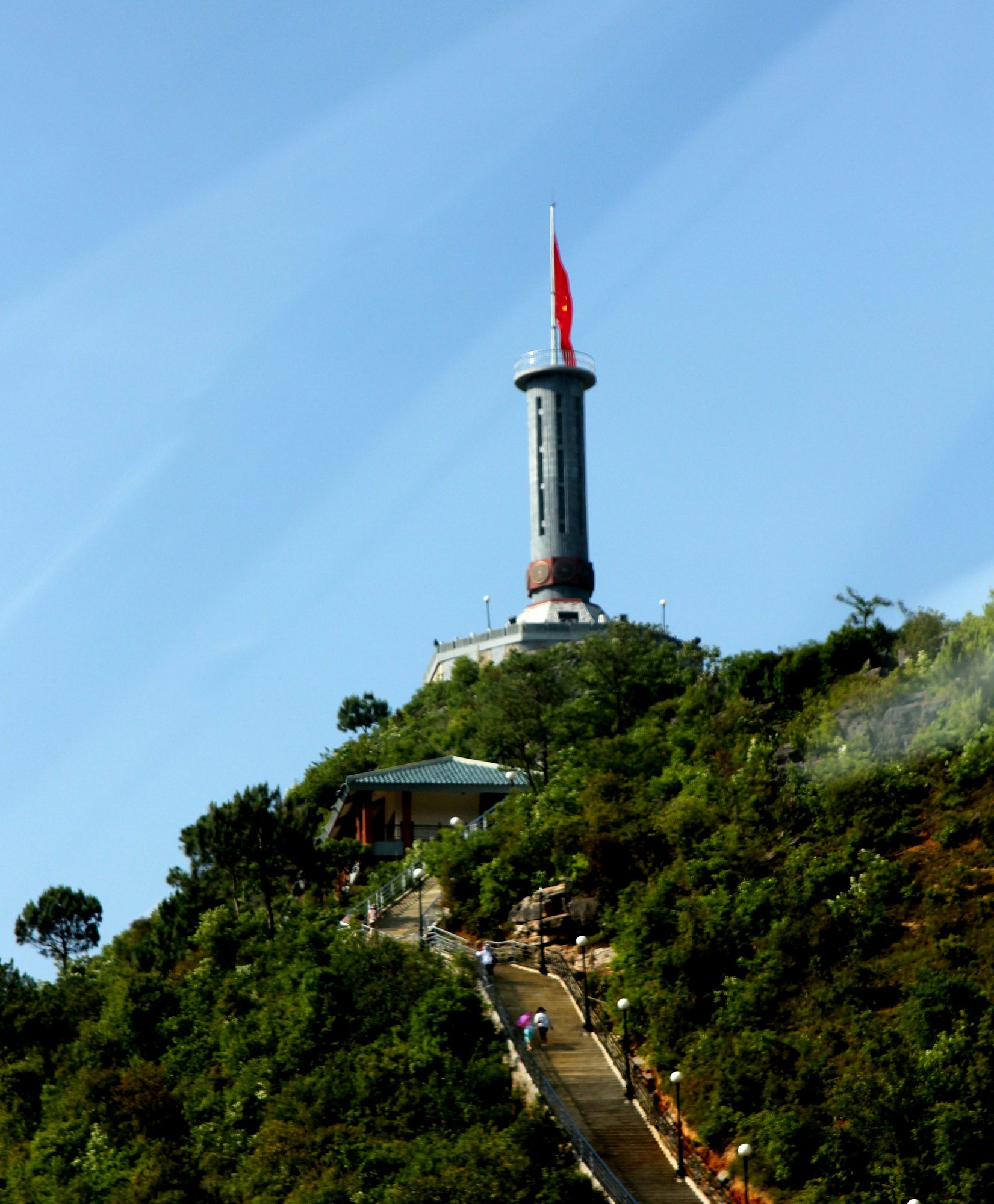
The turn-off for Lũng Cú is about 2 km from Đồng Văn town, and the flag tower is about 24 km from Đồng Văn. From the car park, climb the steps to the hilltop where the flag tower stands and look out over the hills and villages below. Go in the morning if you want to fly in Đồng Văn in the afternoon. See more in the Lũng Cú stage guide.
Lũng Cú flag tower and the stairway to the top — Photo: Leminhel at Vietnamese Wikipedia, public domain, Wikimedia Commons
The Vương family mansion (King of the Hmong Palace) in Sà Phìn
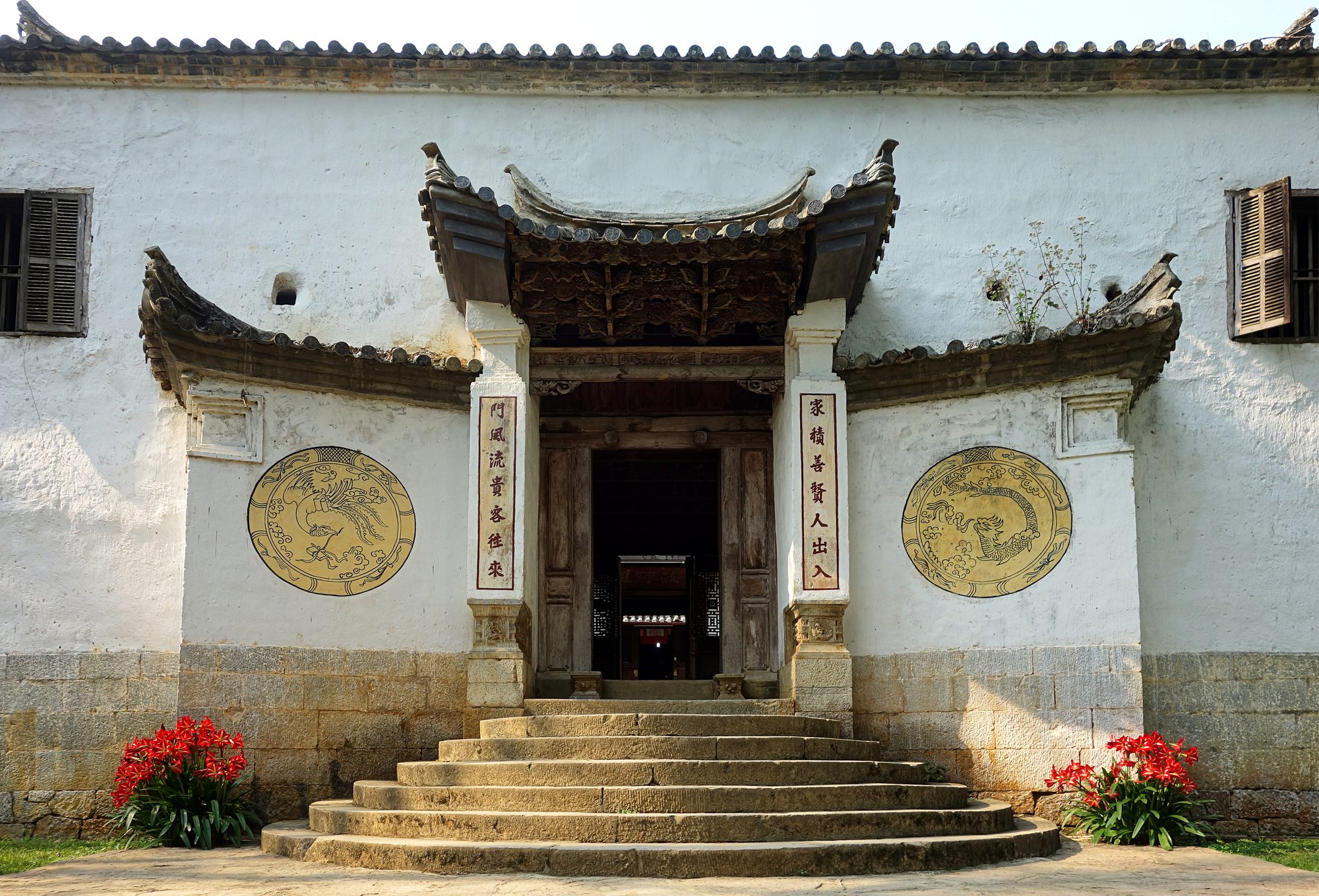
The Vương family mansion is about 13–15 km from central Đồng Văn, on the Đồng Văn – Lũng Cú side, reached by a short branch road off National Road 4C. Built around 1898–1907 on a turtle-shell-shaped mound, it blends Yunnanese and French architecture with Hmong stonework, and is a national architectural and artistic heritage site. Tickets cost about 20,000–25,000 VND (about US$1, subject to change), and it is usually open from morning until about 17:00. Read more about the King of the Hmong Palace in Sà Phìn.
The main gate of the Vương family mansion in Sà Phìn — Photo: Velvet, CC BY-SA 4.0, Wikimedia Commons
Mã Pí Lèng and a boat on the Nho Quế River
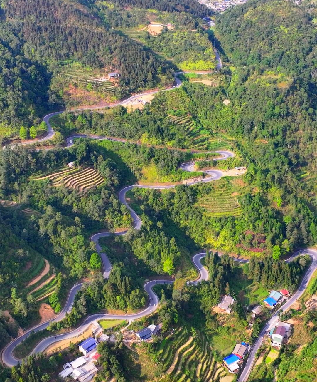
On the morning of day 3, heading from Đồng Văn towards Mèo Vạc takes you onto Mã Pí Lèng Pass. To get down to the river, turn off at the Tà Làng junction for the boat dock below the Tu Sản canyon. Aim to arrive before about 16:00; life jackets are compulsory on the boat. Details in our article on taking a boat on the Nho Quế River through the Tu Sản canyon.
Before you fly in Đồng Văn
No experience needed; children from 3 years old can fly tandem with a pilot.
Guests over 90 kg, please let us know in advance; tell the flying team if you have a heart condition, are pregnant, have had recent surgery or have a history of epilepsy.
Wear long sleeves and lace-up trainers; bring a warm jacket, as the Rocky Plateau is often colder than you'd expect early in the morning and late in the afternoon.
Wear sunglasses on a strap or keep them in a closed pocket; put a lanyard on your phone if you want to take your own photos.
Stay reachable on Zalo or WhatsApp on the day, as the flight time is confirmed in the morning.
No. Đồng Văn offers tandem paragliding only. Paramotor flights are only available in Quản Bạ.
Can I book a Đồng Văn flight at a fixed time?
There are no fixed time slots. The flying team schedules each group in advance around the wind and confirms the exact time on the morning of the flight.
How much does paragliding in Đồng Văn cost?
The price of a Đồng Văn flight is quoted when the flying team schedules your group, so please contact our hotline/Zalo/WhatsApp on +84 964 073 555. Prices for Quản Bạ are listed in the table above.
Where do we land?
Flights in Đồng Văn land in Đồng Văn town, close to the Old Quarter.
What if the wind isn't right?
Your flight is rescheduled free of charge, and you lose nothing since no deposit is required. You can also switch to flying in Quản Bạ, which has daily flights.
Want to see the Old Quarter and the Rocky Plateau from under a wing? Book your flight and add the note "Đồng Văn flight", or call +84 964 073 555.
Book a flight:book online — no deposit, free cancellation
Bắc Sum Pass or Quản Bạ? A side-by-side look at the two flying sites on the QL4C near Hà Giang city: distance, landing field, valley width, paragliding and paramotor, a flying morning at Quản Bạ, getting there and fitting the flight into the Hà Giang Loop…
Quản Bạ or Đồng Văn? An honest comparison of our two flying sites on the Hà Giang Loop: location, getting there, scenery, paragliding vs paramotor, what a flying session looks like, wind and schedule, price, and how to fly both…
The Chín Khoanh slope is a stack of hairpin bends on QL4C between Phố Cáo and Sủng Là, about 18 km past Yên Minh and 27 km before Đồng Văn: why it's called "nine coils", the best viewpoint, how to stop safely, how it differs from Thẩm Mã and what to see nearby…
A practical guide to the Mã Pí Lèng Sky Path, the cliff-edge walking trail above the Nho Quế River: the trailhead at the Youth Volunteers monument, the route section by section, the death rock closure (October 2026), what to wear, when to go and how to pair it with a Tu Sản canyon boat trip…
A guide to Lô Lô Chải, the Lô Lô village at the foot of the Lũng Cú flag tower: rammed-earth houses, costume and bronze drums, Café Cực Bắc, homestays, the road from Đồng Văn, 2026–2027 traffic rules and village etiquette…
The Yên Minh pine forest lines Highway 4C about 7–8 km before Yên Minh town on the Quản Bạ side: exact location, commune after the 2025 merger, best light, how to stop safely, what's nearby and how to fit it into a 3- or 4-day Loop…