The Quản Bạ Paramotor Flight Route: What You Fly Over in 15 Minutes
A stop-by-stop guide to the paramotor loop over the Miện valley in Quản Bạ, Hà Giang: where you take off, what you see, how high you fly, and why the long flight is the one that shows the Twin Mountains. With original route maps.
Đội trưởng Mỹ · · 11 min read
The Quản Bạ paramotor flight is a closed loop. You take off from a flat field beside the Miện River, on the valley floor at about 450 m, fly one circuit of the valley and land back where you started. The standard 15-minute flight covers roughly 7–8 km. The long flight of 22–25 minutes covers 12–13 km and climbs about twice as high. This article follows both loops stop by stop, with maps we drew from open elevation data, and explains why the line is shaped the way it is.
One thing first: the route is not a fixed track. The lines on the maps are the typical shape of the flight. The pilot adjusts direction, height and length to the wind on the day, and that decision always comes before the plan.
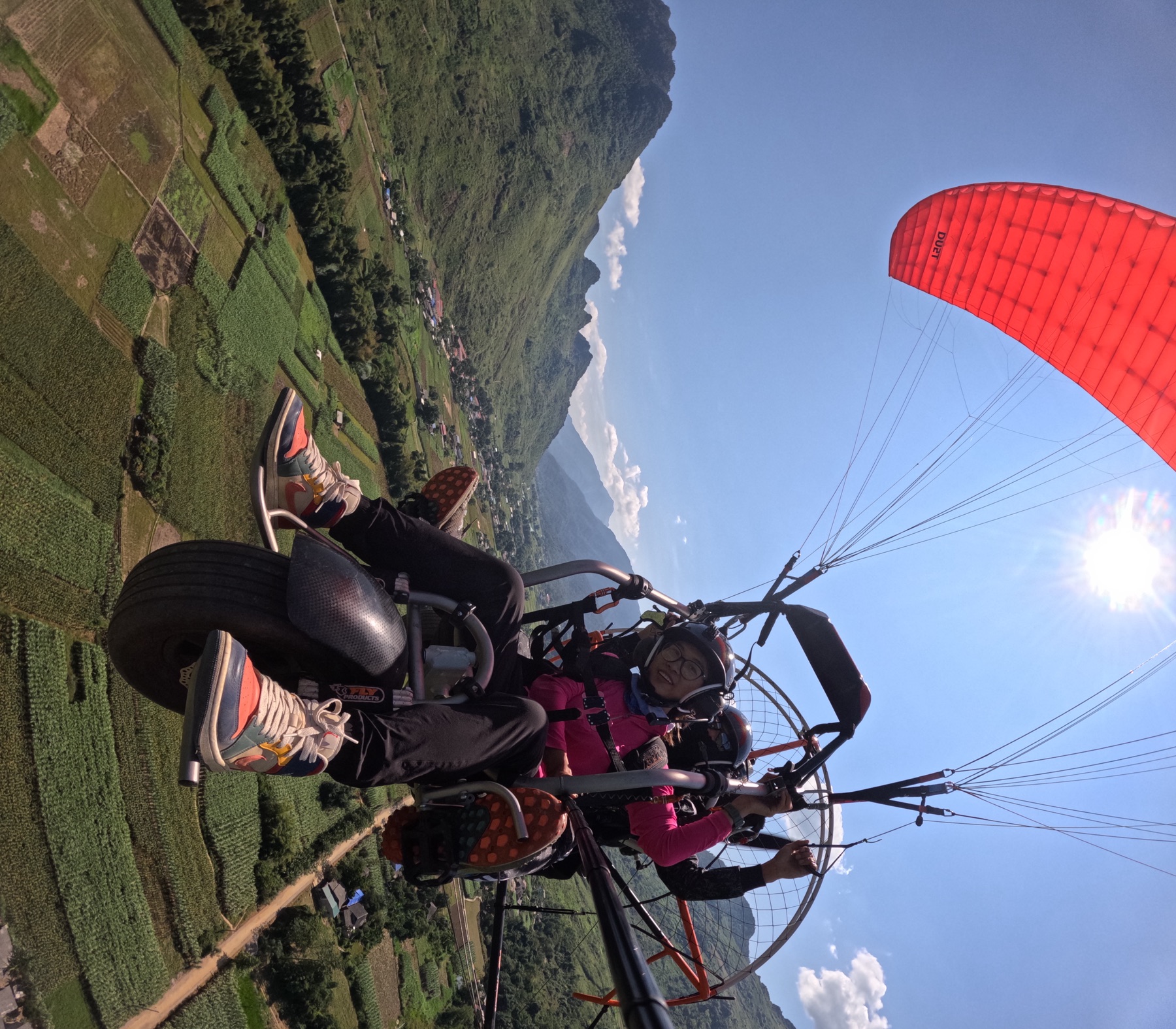
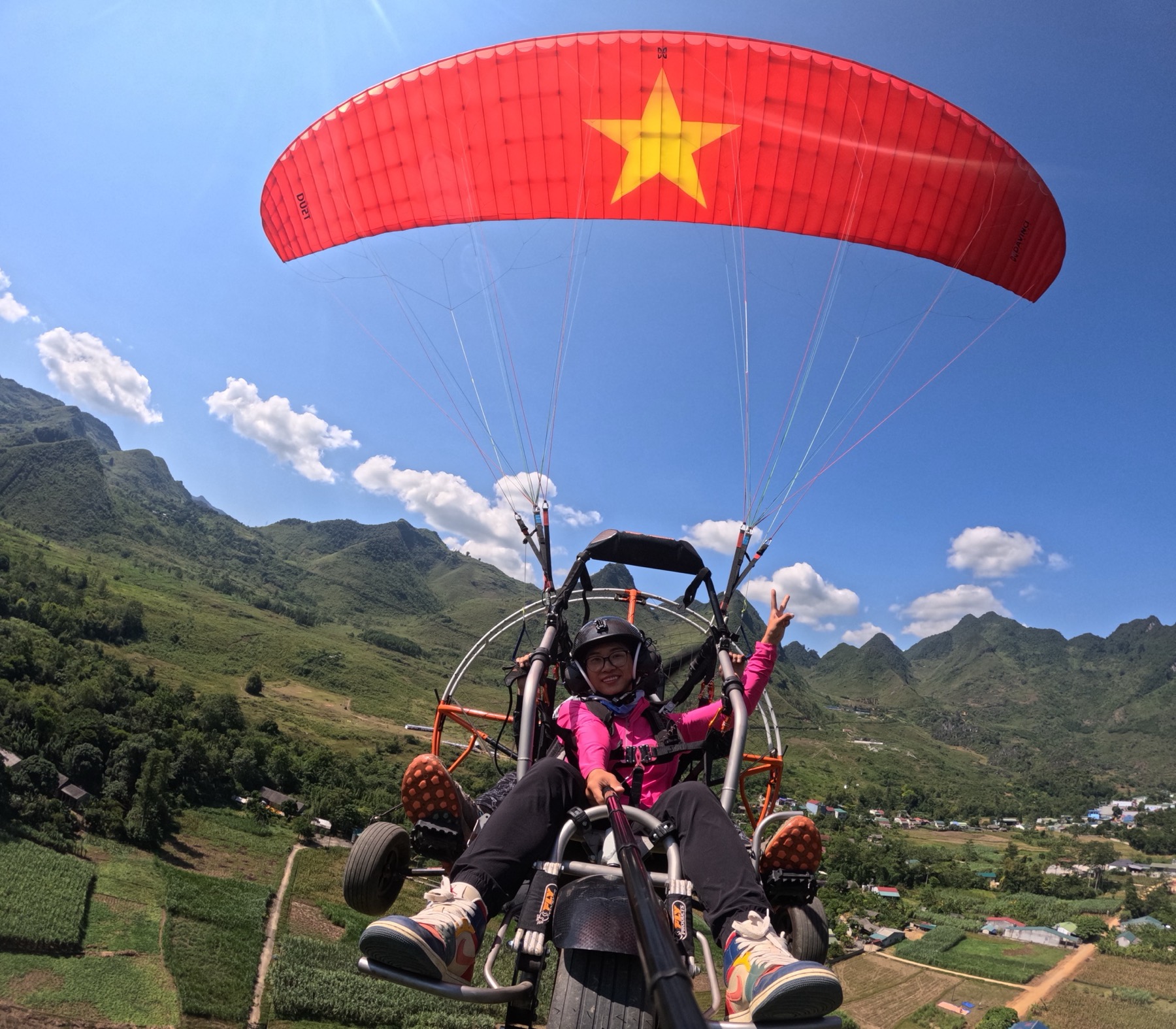
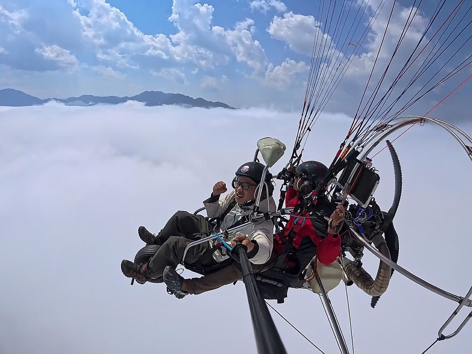
In the turn above the Miện valley: fields below, the eastern wall behind.
Where the flight happens: a valley below the valley
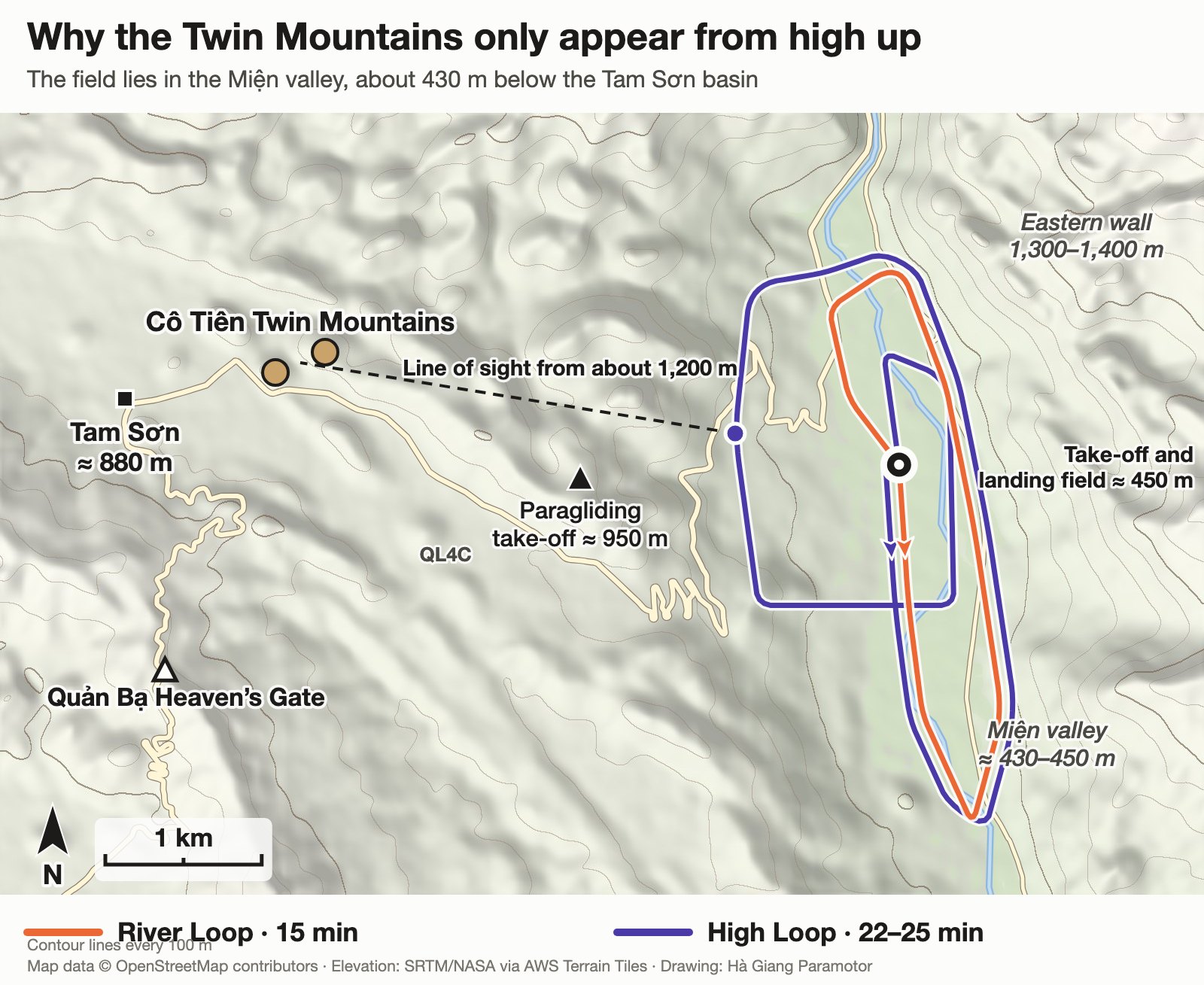
Most visitors know Quản Bạ from the Heaven's Gate viewpoint, looking down on Tam Sơn town and the Cô Tiên Twin Mountains. The paramotor field is not in that basin. It lies about 4 km further east and roughly 430 m lower, in the valley of the Miện River, where road QL4C comes down a stack of hairpins on its way to Yên Minh.
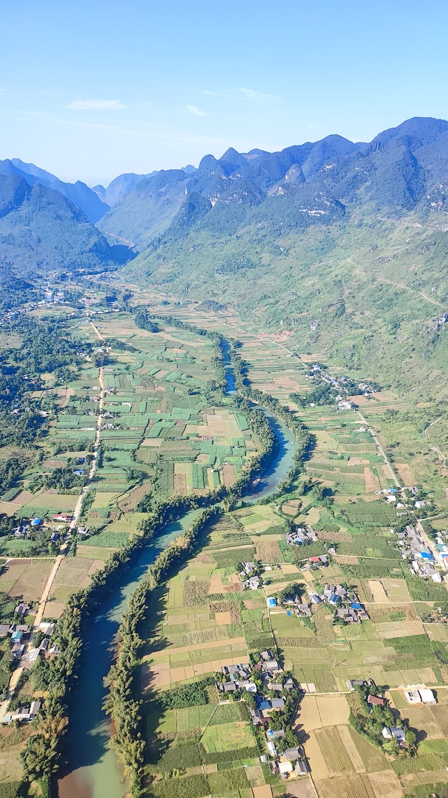
From the elevation data, the valley looks like this:
A flat floor about 1 km wide at the field and around 7 km long, at 430–450 m, covered in maize and rice fields with the river winding through it.
A western rim at 850–980 m. The paragliding take-off sits on it at about 950 m, and Tam Sơn lies behind it.
An eastern wall that rises to 1,300–1,400 m within about 2.5 km of the river.
A gorge to the north, about 2 km from the field, where the floor shrinks to a couple of hundred metres across.
So the paramotor flies in a long, straight corridor with a mountain wall on each side. That shape decides almost everything about the route.
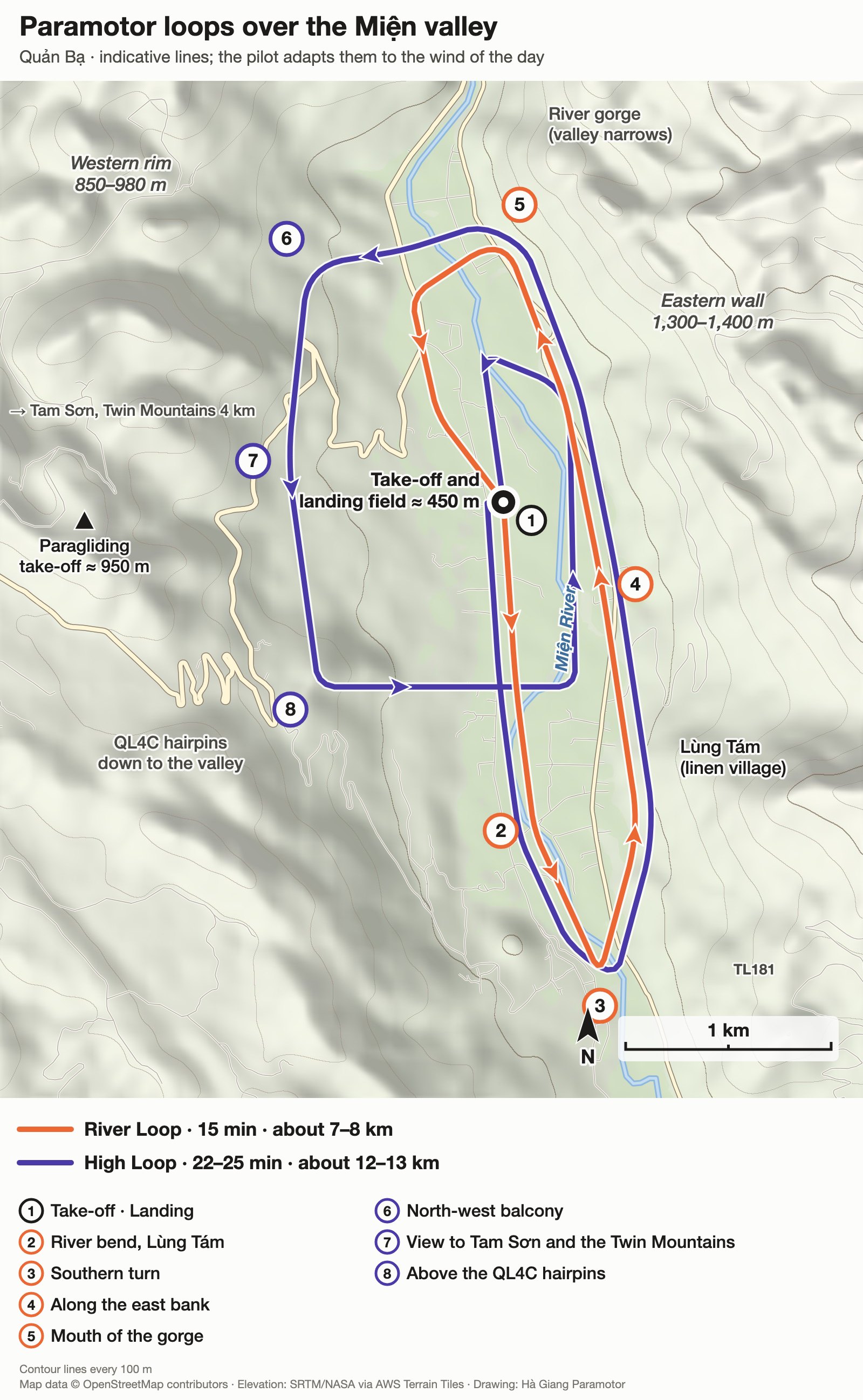
The River Loop (orange) and the High Loop (violet). Numbers match the stops described below.
The 15-minute River Loop, stop by stop
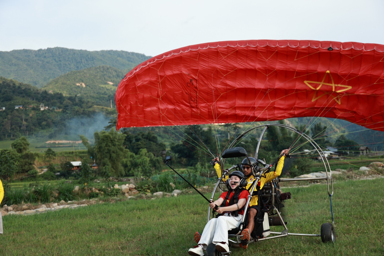
1. Take-off. The wing is laid out on the field, the engine comes up to full power and the paramotor lifts off into the wind. On most flying days that means heading south. The first minute is a straight climb over the strip of fields between the village road and the river.
2. The river bend and Lùng Tám. About a kilometre and a half out, the Miện swings across the valley floor in a wide green curve. On the far bank are the houses of Lùng Tám, the commune known for its hand-woven hemp and beeswax batik. If you plan to visit after the flight, read our guide to the Lùng Tám linen weaving village. By now you are 150–200 m above the fields and still climbing.
3. The southern turn. A little over 2 km south of the field the valley tightens and bends south-east. The pilot turns here, in a wide arc over the river. This is where passengers usually get their first long look back up the whole valley.
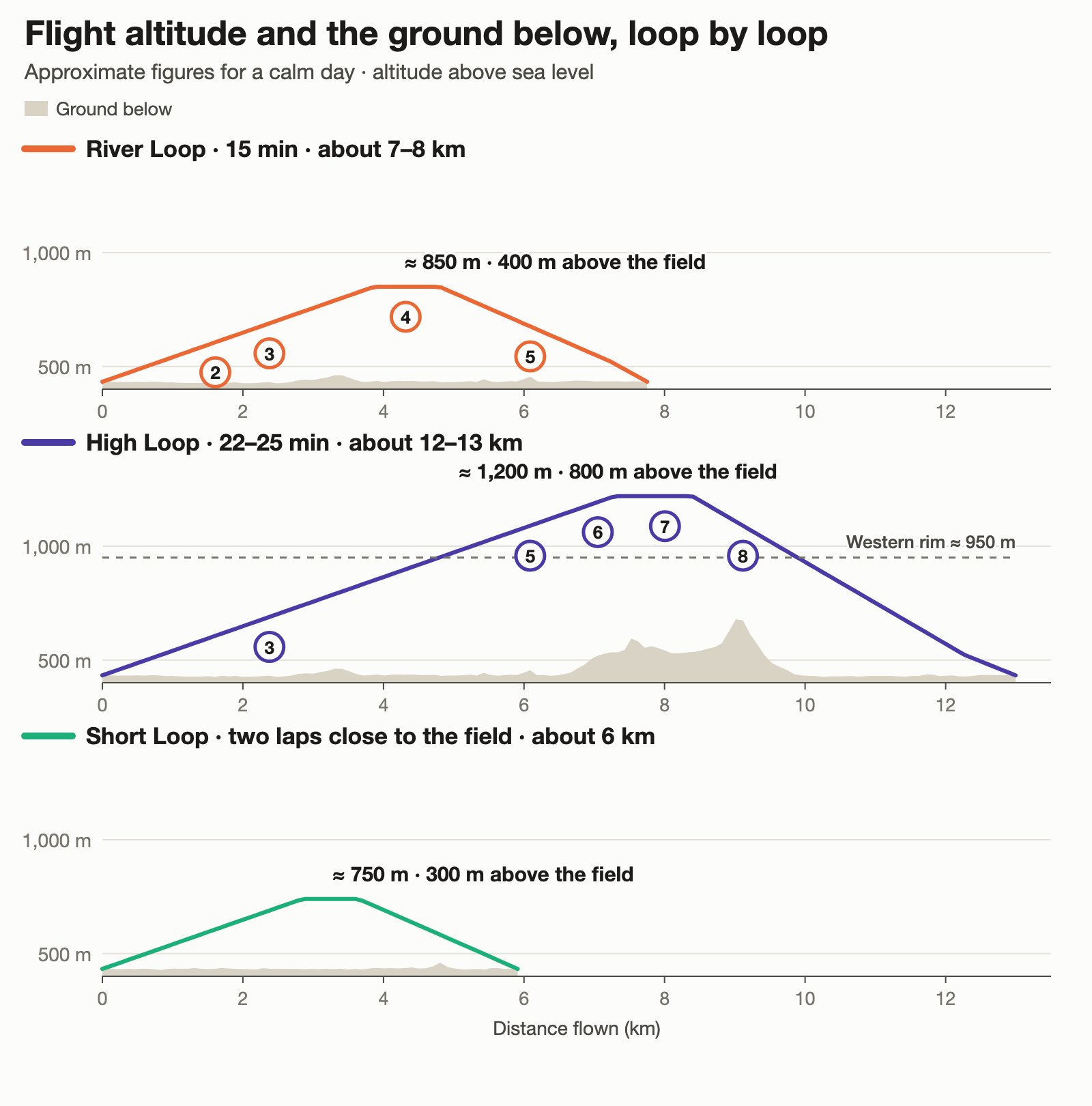
4. Along the east bank. The return leg runs north over the river and the eastern fields, and it is the highest part of the loop: around 350–400 m above the valley floor, close to 850 m above sea level. On your right the eastern wall climbs another 500 m above you. On your left you can pick out the field you left a few minutes ago and, above it, the hairpins of QL4C on the western slope.
5. The mouth of the gorge. Past the field the valley narrows towards the gorge, where river and road squeeze through side by side. The loop turns back before the narrow part. From here the pilot eases the power, descends along the western side of the floor and lines up to land into the wind, on the same field.
Flown at a tandem paramotor's cruising speed of roughly 40 km/h, the loop takes 11–13 minutes in the air. Take-off, the landing circuit and the wind of the day make up the rest of the 15 minutes.
How high each loop goes, and the ground beneath it. Approximate figures for a calm day.
Why the loop has this shape
The valley wind. In a valley like this the air usually moves along the valley, not across it. Once the sun warms the slopes, a breeze tends to blow up the valley from the south. Early in the morning the air is calm or drifts gently down from the north. A paramotor is slowest and lowest just after take-off, so the pilot flies the upwind end of the loop first and comes home with the wind behind. On a day when the breeze comes from the north, the same loop is flown the other way round.
A place to land, all the way round. The whole loop stays over the flat valley floor. If the engine stopped, the wing would simply glide like a paraglider, and there would be level fields within reach at every point of the circuit. This is also why the route does not wander over the steep, wooded slopes on either side.
Distance from the walls. A mountain wall disturbs the wind on its sheltered side. With a 900 m wall to the east and a 500 m rim to the west, the smooth air is in the middle of the valley, and that is where the line runs.
Height over houses. A paramotor has an engine, and people live in this valley. The route crosses villages only once it has gained height, and the climb-out follows the fields rather than the road.
Shared sky. Paragliders launch from the western rim and glide down to land on the same field. A powered aircraft gives way to an unpowered one, so the paramotor keeps clear of their path and the pilots stay in radio contact.
What the short loop does not show you
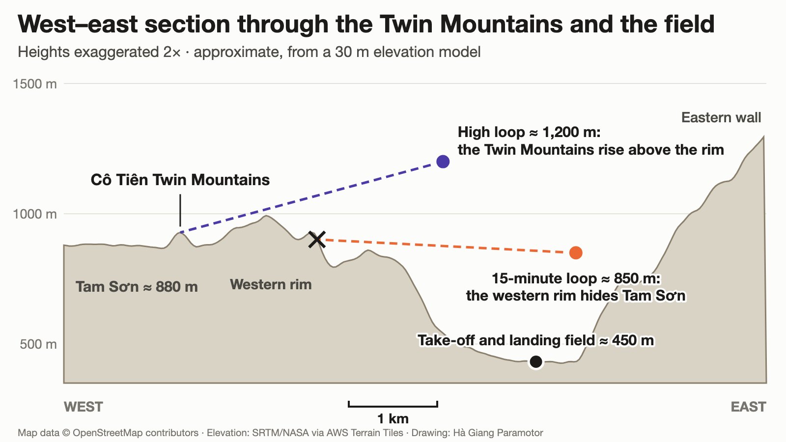
Here we should be honest. On the 15-minute loop you fly below the top of the western rim, and the Twin Mountains stand behind that rim, in the Tam Sơn basin. From this height the rim hides them. What you get instead is the river, the patchwork of fields, the hairpin road, the gorge and a wall of limestone that fills half the sky.
A slice through the landscape: the field lies in a deeper valley than Tam Sơn, so the Twin Mountains only show from higher up.
If you want to stand next to the Twin Mountains, the place is the ground: see our guide to Heaven's Gate and the Cô Tiên Twin Mountains. If you want to see them from the air, that is what the long flight is for.
The High Loop: 22–25 minutes
The long flight starts on the same line as the River Loop, but the pilot keeps climbing instead of levelling off. By the time the paramotor passes the field again it is level with the western rim. It then crosses to the western side of the valley and flies south along a kind of balcony at around 1,200 m, some 750 m above the field.
6. The north-west balcony. The first view over the rim opens here, along a side valley that runs up towards Tam Sơn.
7. Tam Sơn and the Twin Mountains. About 3 km to the west, the town appears in its basin and the two round hills rise above the line of the rim. How much of them you see depends on how high the pilot can take you that day.
8. Above the hairpins. The road you probably drove down is now several hundred metres below, folded into tight bends. From here the paramotor descends in a long curve across the river and joins the landing circuit.
The same area seen wider: the dashed line is the view from the High Loop towards the Twin Mountains.
The long flight is also the one we use for sunrise, sunset and the sea of clouds, and the terrain explains why. The eastern wall keeps the valley floor in shade for roughly an hour and a half after sunrise. At 1,200 m, by our calculation, you are in sunlight about half an hour after the sun comes up. In the evening the field loses the sun around an hour before sunset, while up at rim height the light lasts almost to the end. On mornings when fog fills the valley floor, the extra height is what lifts you above it. More on that in our guide to cloud chasing by paramotor in Quản Bạ.
When the wind changes the plan
On days when the valley wind is strong, the pilot may fly a shorter pattern: two tight laps close to the field, never far from the landing area, instead of one long loop. On other days the loop is flown in the opposite direction, or stops short of the southern turn. And sometimes the right decision is to wait an hour or move the flight, which costs you nothing. You can check the day's outlook on the flying weather page.
Best time of day for each loop
Time
What the valley looks like
Suits
06:30–08:00
Floor in shade, possible fog or low cloud, calm air
High Loop: sunrise, sea of clouds
08:00–10:30
Sun reaches the fields, clear colours, light breeze
River Loop, first-time flyers
15:00–16:30
Warm side light on the eastern wall
River Loop
16:30–18:00
Valley floor in shadow, golden light higher up
High Loop: sunset
The site is open from 06:30 to 18:30. Exact times are confirmed after the pilot has checked the wind.
Frequently asked questions
Can I choose the route?
You choose the flight: 15 minutes or 22–25 minutes. The pilot chooses the line, the direction and the height according to the wind. You are welcome to say what you would most like to see, and the pilot will include it when conditions allow.
Will I fly over the Twin Mountains?
No. The Twin Mountains are in the Tam Sơn basin, about 4 km west of the field and behind a ridge. On the long flight you can see them from a distance once the paramotor is above the rim. On the 15-minute flight the rim hides them.
How high does the paramotor go?
On the 15-minute loop, typically 350–400 m above the valley floor. On the long flight, around 750 m above the field, which is about 1,200 m above sea level. The pilot may fly lower or higher depending on wind and cloud.
Is the route the same every day?
The shape is similar, the details are not. Direction, turning points and height all follow the wind of the day.
What happens if the engine stops?
The wing keeps flying. A paramotor without power is a paraglider, and it glides down to land. The route is planned over flat ground so that there is a field within reach.
A breakdown of the strengths and weaknesses of paragliding and paramotor flights in Quan Ba: which time of day suits which, and which type of traveller fits PG and which fits PPG, and why…
Everything you need to know about paragliding in Hà Giang: the Quản Bạ and Đồng Văn sites, paragliding and paramotor prices, flying hours, who can fly, and booking with no deposit…
What is a paramotor, where can you fly one in Hà Giang, how much does it cost and how does it differ from regular paragliding? A PG vs PPG comparison to help you choose the right flight…
Tandem paragliding has a clear division of roles: the pilot handles the wind, equipment, take-off and landing; you just run a few steps and enjoy. The process from booking to touchdown…
Chasing clouds by paramotor in Quản Bạ, Hà Giang: which season and time of day give the best chance of a sea of clouds, how the 22–25 minute long flight differs from the standard package, and how to book to boost your chances…
Your weight affects the wing, take-off speed and landing speed. Guests over 90 kg can still fly — just let us know in advance so the team can arrange a suitable pilot and equipment…