Quản Bạ Heaven's Gate and the Cô Tiên twin mountains
Quản Bạ Heaven's Gate and the Cô Tiên twin mountains: road up, best viewpoints and times, the legend, Tam Sơn, Nậm Đăm, Lùng Tám and paragliding over the same valley.
Ms. Judy · · 15 min read
Quản Bạ Heaven's Gate sits at about Km45 of National Road 4C, roughly 1 hour 15 minutes from Hà Giang city; it is at its best on early mornings from October to December, when mist still lies in the Tam Sơn valley and the Cô Tiên twin mountains rise out of the fields.
Quản Bạ Heaven's Gate (Cổng trời Quản Bạ) is the first stop — and for many people the first big impression — of the Hà Giang Loop. From here you look down over the Tam Sơn valley, with the Cô Tiên twin mountains sitting among the fields. And right down in that valley is the Quản Bạ paragliding site — where you can fly over the very scenery you have just photographed.
This guide gathers everything you need for the stop: the road up, the viewpoints, the best times of day and year, the legend of the twin mountains, the villages around the valley, and how to see it all again from a wing. Since 1 July 2025 Hà Giang province has been merged into Tuyên Quang province, so on paper Quản Bạ now belongs to Tuyên Quang; travellers still simply call it "Hà Giang".
Where is Quản Bạ Heaven's Gate and how do you get there?
Heaven's Gate lies on National Road 4C, around Km45 from Hà Giang city, just before the road drops into the valley and the town centre of Tam Sơn. From the city it is about 45 km, roughly of non-stop driving, up the Bắc Sum slope with its many hairpin bends. If you stop for photos along the way, allow 1 hour 30 minutes or more.
Keep reading
1 hour 15 minutes
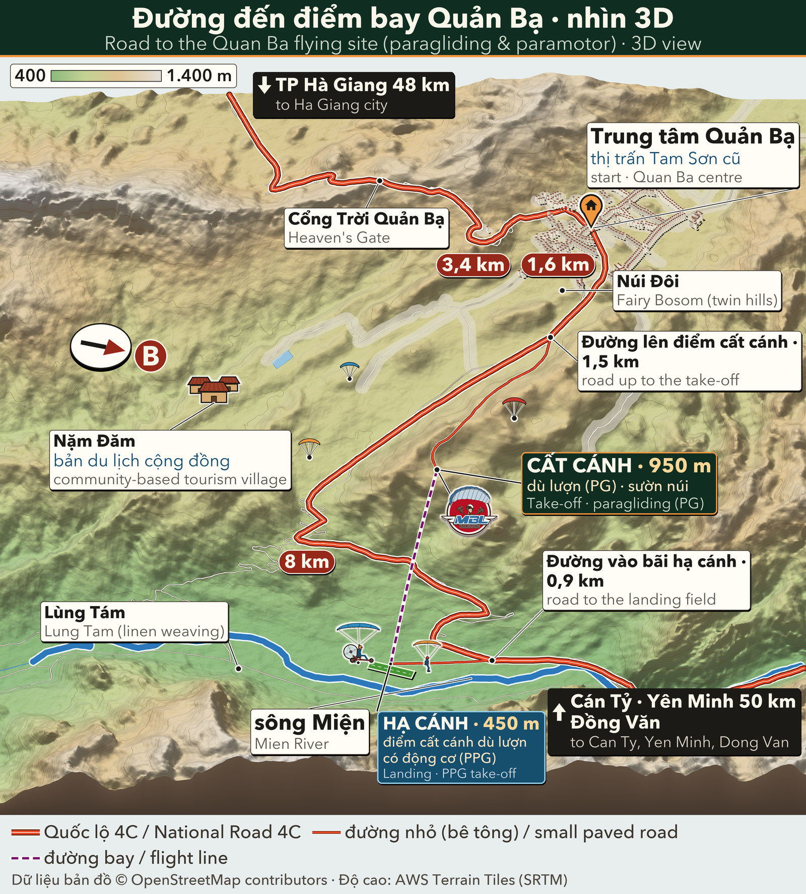
3D map: National Road 4C over Quản Bạ Heaven's Gate down to the Quản Bạ centre, the twin mountains, Nậm Đăm and Lùng Tám villages, the 950 m paragliding take-off and the 450 m landing field by the Miện river
There are several ways up:
Riding a motorbike yourself: the road is paved but the climbs are long and the bends tight. Use a low gear downhill, don't cut corners towards the centre line, and watch out for trucks and buses.
Easy rider: the safer choice if you are not used to mountain passes, especially on misty mornings.
Car or bus: buses from the city to Yên Minh and Đồng Văn all pass Heaven's Gate and Tam Sơn. If you only come up to fly and go back, the team can arrange a car from Hà Giang city for 500,000 VND (≈ US$ 20) per 4-seat car, each way.
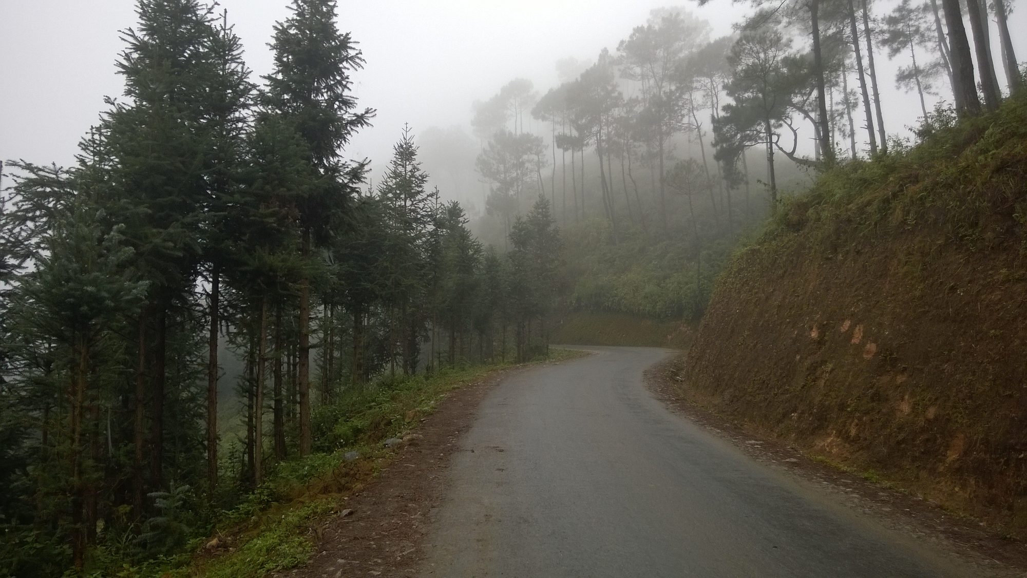
In the early morning and in winter, the Bắc Sum – Heaven's Gate stretch can be thick with fog. Turn your lights on, slow down, sound your horn before blind bends, and never stop in the middle of a bend to take photos.
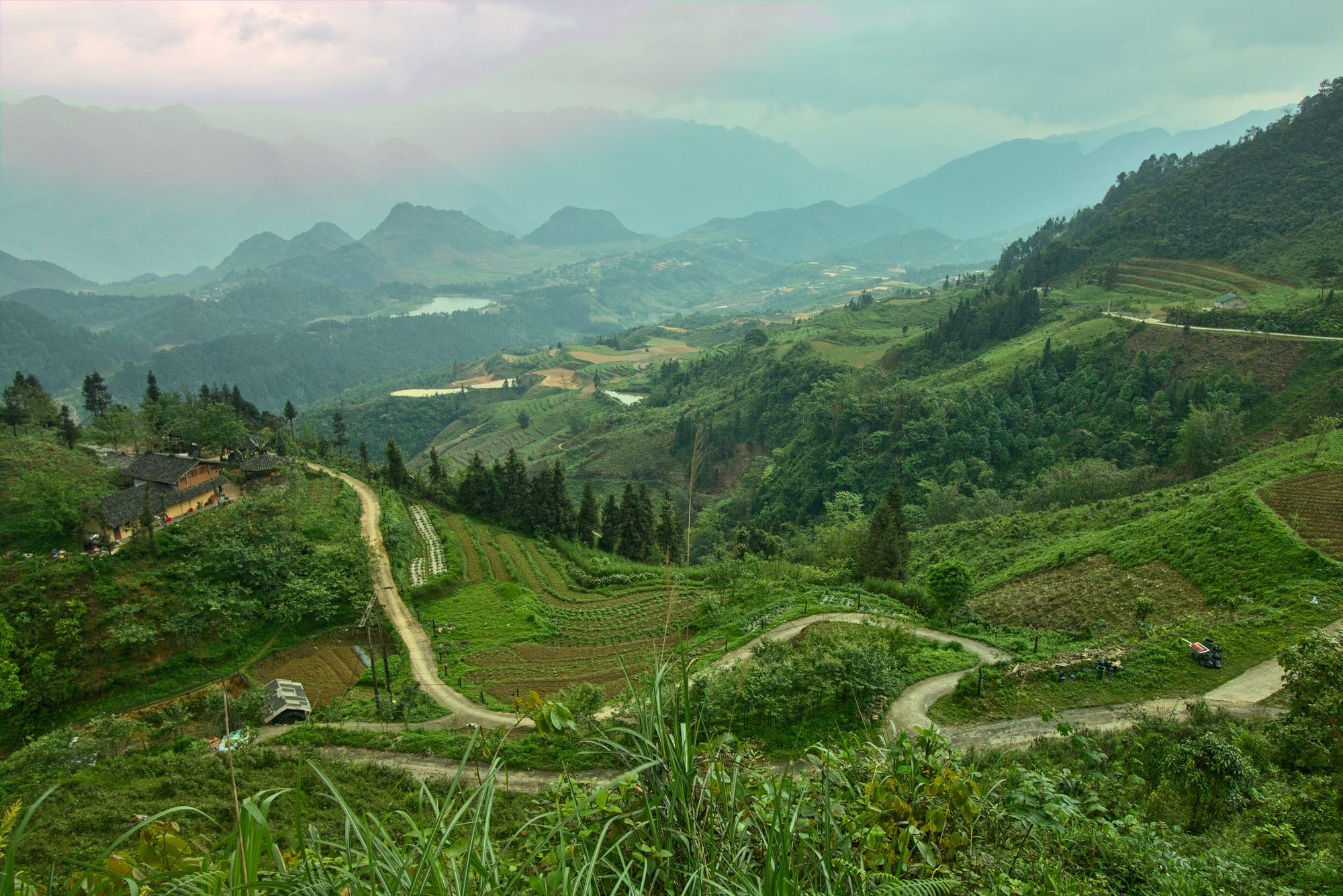
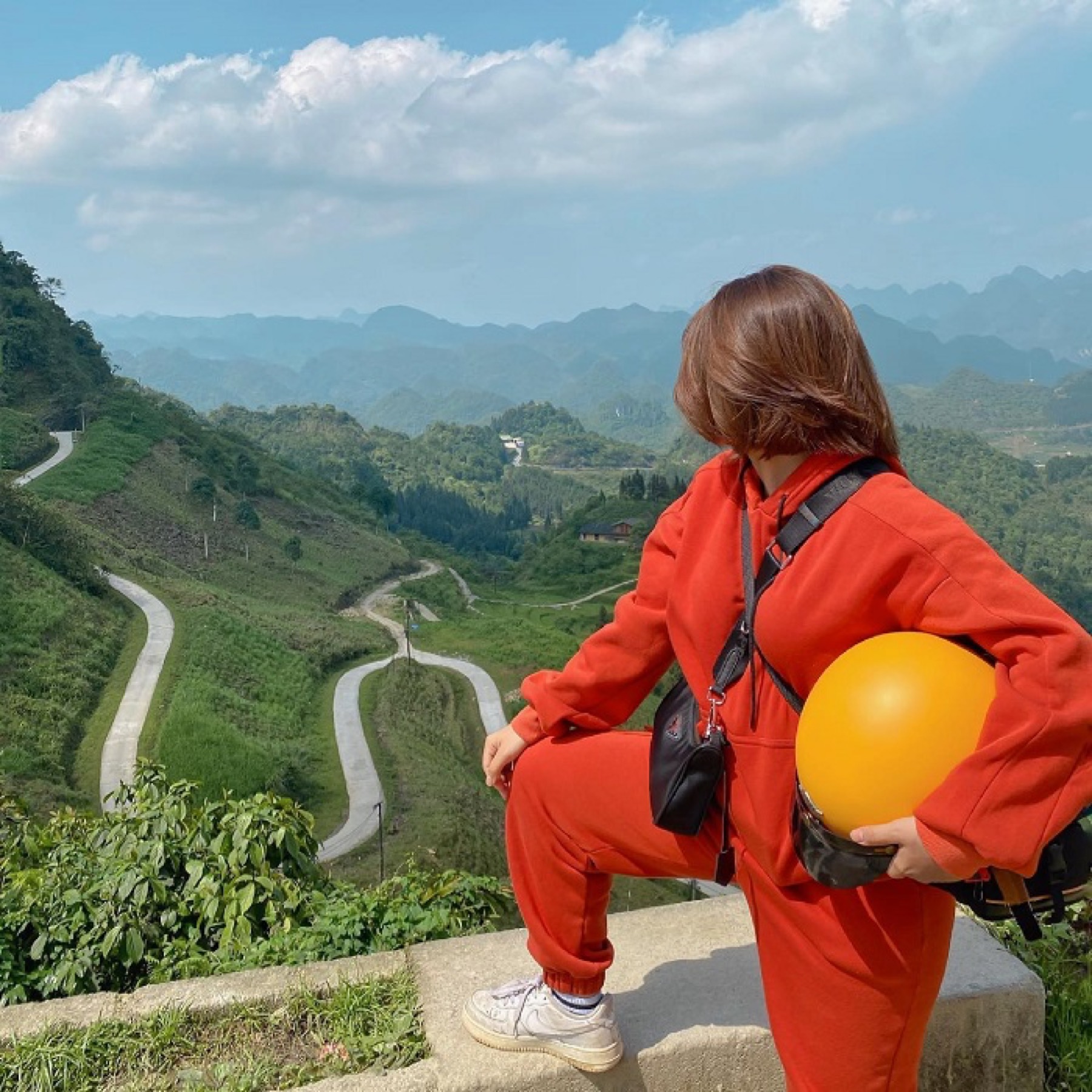
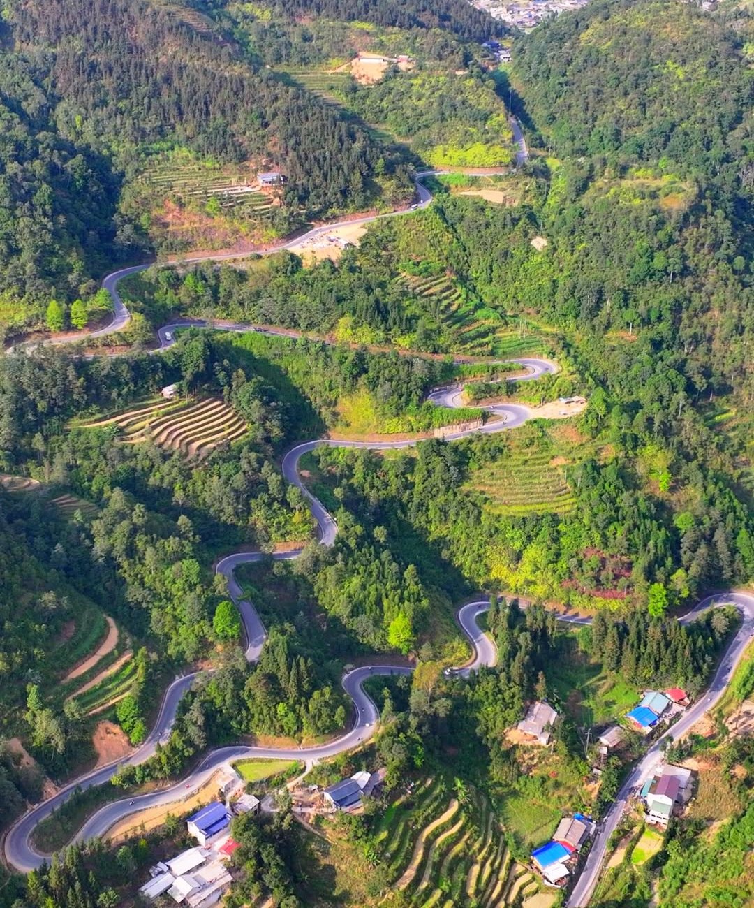
A winding road and terraced slopes in the hills of Quản Bạ — Photo: Benjamin Smith, CC BY-SA 4.0, Wikimedia Commons
It is called "Heaven's Gate" because it is a high point on the pass where clouds often drift across, so looking down feels like standing at the gate of the sky. There is a rest stop with parking, a viewpoint and a few food stalls.
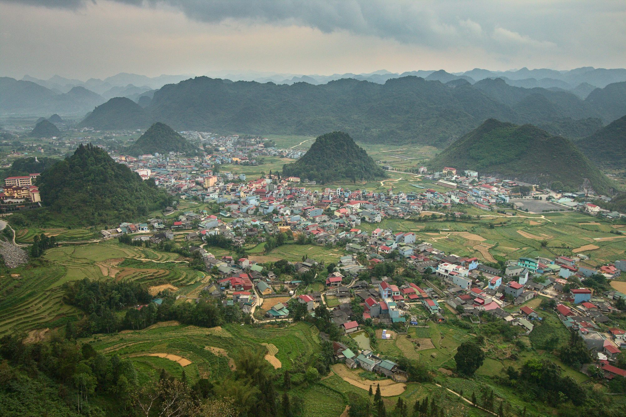
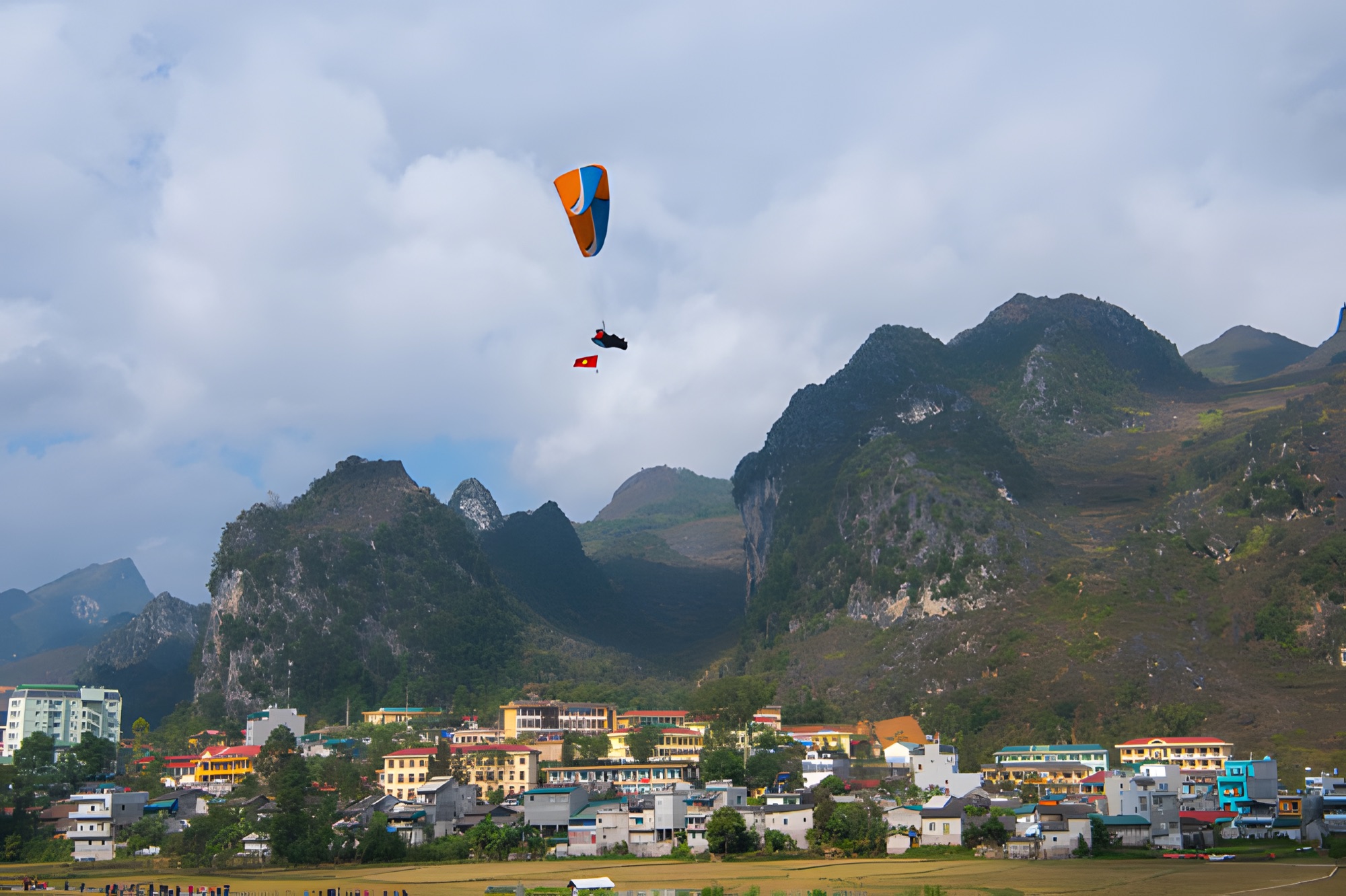
From the viewpoint the whole valley opens up: the roofs of Tam Sơn town, cone-shaped limestone hills rising out of the plain, layered maize and rice fields, and in the middle the two rounded hills of the Cô Tiên twin mountains. Further away stand the jagged limestone ranges of the Rocky Plateau.
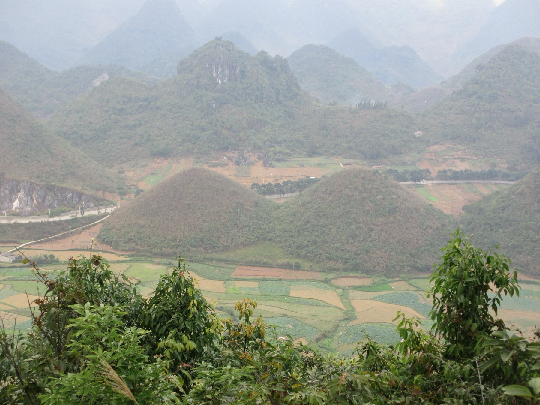
Tam Sơn town and the cone-shaped hills of the Quản Bạ valley, seen from Heaven's Gate — Photo: Benjamin Smith, CC BY-SA 4.0, Wikimedia Commons
Because the Quản Bạ centre is the day-one lunch stop for most tours and easy riders, groups tend to reach Heaven's Gate at the same time, from late morning to early afternoon. For a quieter visit and better light, come early — or spend the night before in Quản Bạ.
The Cô Tiên twin mountains and their legend
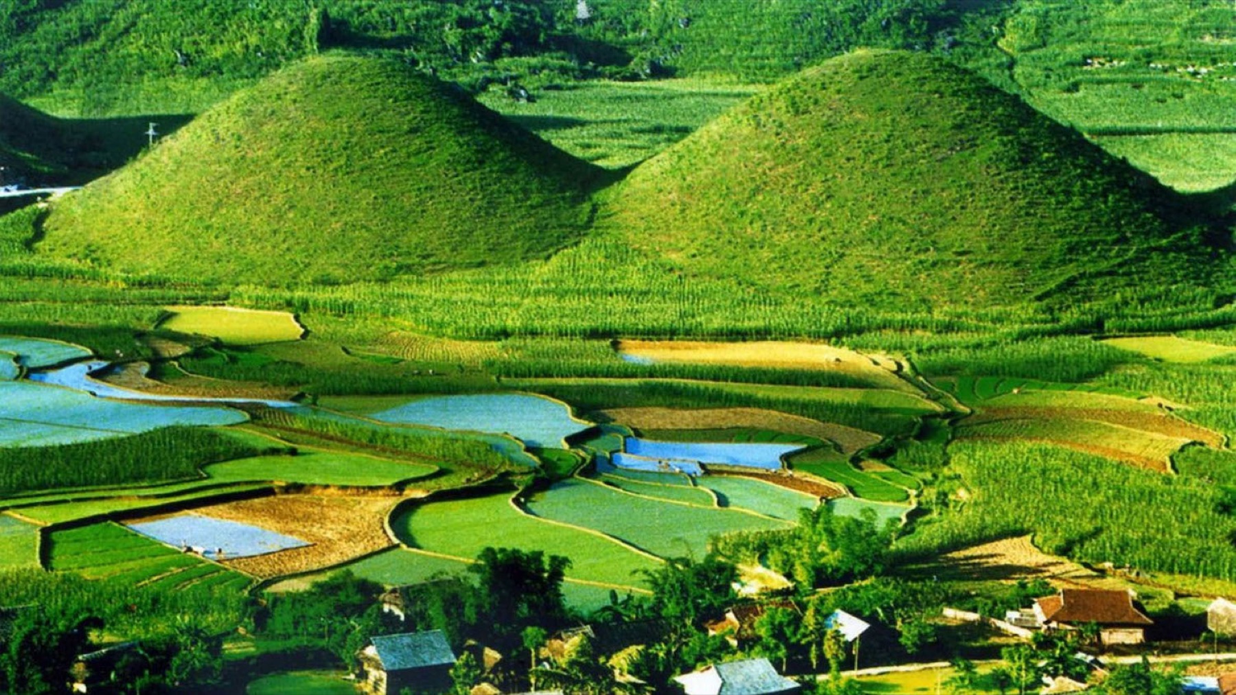
The Cô Tiên twin mountains (sometimes called the "Fairy Bosom") are two round, symmetrical hills sitting side by side in the middle of the Tam Sơn valley. According to local legend, they are the breasts of a fairy who left them on earth out of longing for a young Hmong man. However you hear the story told, anyone driving past recognises the shape at once.
The Cô Tiên twin mountains among the fields of the Tam Sơn valley — Photo: MIA.vn
The land at the foot of the hills is farmland belonging to the valley's families. If you walk down to the fields for photos, stay on the field banks and existing paths, don't trample crops, don't pick flowers, and ask before taking close-up photos of people.
The twin mountains through the seasons
The twin mountains are beautiful all year round, but each season paints them a different colour:
January – March: cold, with some heavily misty mornings; peach and plum blossom in white and pink in the villages.
Summer: the fresh green of maize, rice and grass, plenty of white clouds and passing showers.
September: rice ripens to gold in the fields around the hills. Harvest is usually over by mid-October, so don't come late hoping for golden rice.
October – early December: the dry season, with clear skies and long views; in some years the foot of the hills is covered in the pink-purple of buckwheat flowers, best around late October – November.
December – January: earthy browns, mornings and evenings often only 5–15 °C, and a good chance of a sea of clouds after cold, humid nights; late December – January can bring frost on the high ground.
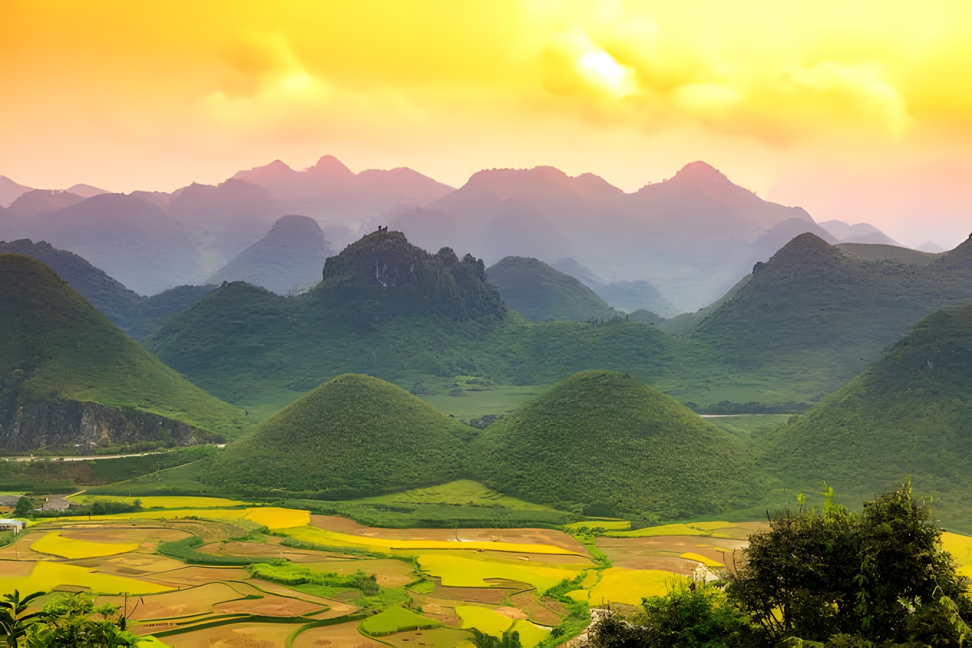
The Cô Tiên twin mountains of Quản Bạ among ripe rice fields in the afternoon sun
The most beautiful; a sea of clouds is common in autumn – winter
9:00–11:00
Morning sun, clear sky
Vivid field colours, good for paragliding
14:00–16:00
Harsh sun, possible backlight
Shoot from the opposite direction
Late afternoon
Low sun, sunset
Great for a sunset flight
In November–December the days are short and the sun sets around 17:15–17:30, so the sunset window comes earlier than in summer. A sea of clouds can't be booked in advance: it is most likely early in the morning after a cold, humid night, and usually burns off once the sun is up. Before you go, check the flying weather forecast to spot clear days with light wind.
Viewpoints over the twin mountains and the valley
Beyond the familiar viewing platform, there are a few other spots around Heaven's Gate for different shots.
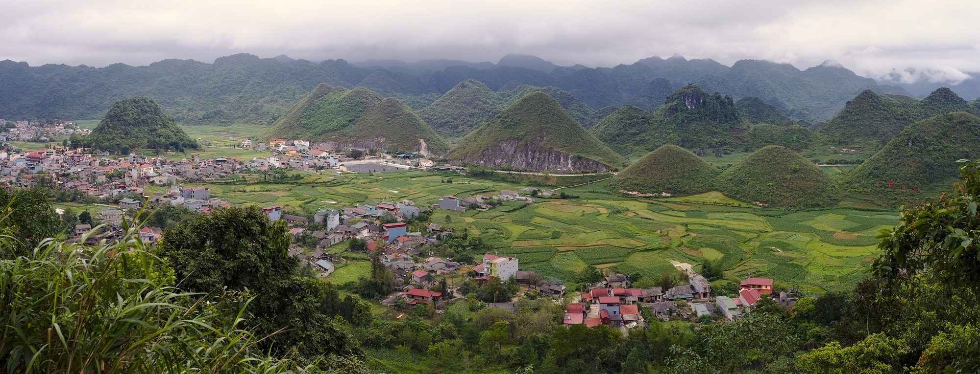
The Fairy Mountains (twin hills) in the Quản Bạ valley — Photo: Sketyl none, CC BY 2.0, Wikimedia Commons
The Heaven's Gate viewpoint: a panorama of the valley, the town and the twin mountains. Arrive early to beat the crowds.
The road down to Tam Sơn: a few bends look straight at the twin mountains, with fewer people. Pull fully off the road, where traffic can see you from both directions.
The fields at the foot of the twin mountains: close-ups of the hills, with rice fields and seasonal flowers.
The paragliding take-off (about 950 m): from the hillside you look down on the winding pass road and the valley. The access road only takes vehicles up to 16 seats, because it is narrow with no room to turn; larger vehicles park at Long Anh restaurant at the turn-off, and the team drives guests the last 1.5 km or so.
The landing field by the Miện river (about 450 m): the wide valley and landing wings as your backdrop. See the location on the landing field page.
In the air: a view you only get when flying — the road up to Heaven's Gate, the twin mountains and the valley all in one frame.
The winding pass road seen from the Quản Bạ take-off
Tam Sơn town: a break and lunch
Tam Sơn is the centre of Quản Bạ, right below Heaven's Gate. It has the most services on this stretch: guesthouses, small hotels, homestays, eateries, a petrol station, grocery shops and usually an ATM. Small restaurants serve simple lunches with highland staples such as thắng cố (horse-meat stew), mèn mén (steamed maize) and smoked sausage. If you are heading on to Yên Minh, fill up and get cash here — the small villages ahead usually take cash only.
The Miện river valley, Nậm Đăm and Lùng Tám
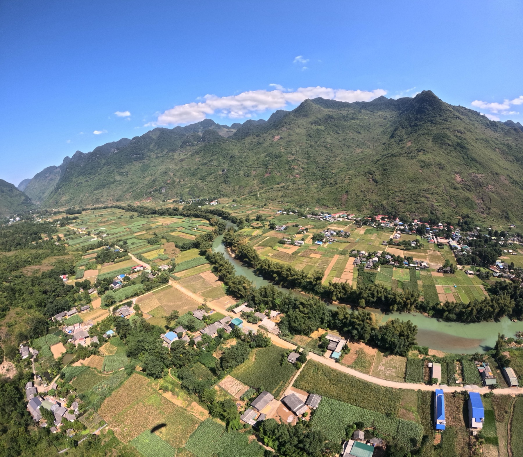
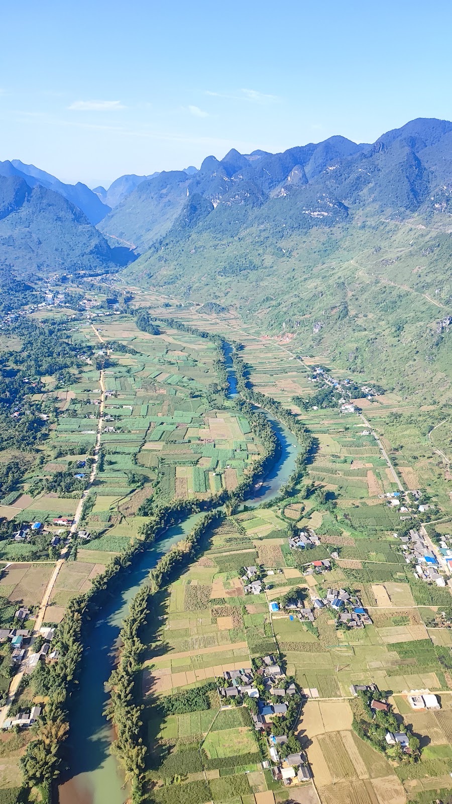
Beyond Tam Sơn the valley widens into a rare stretch of flat land among the limestone peaks, with the Miện river winding through maize fields and villages. This is also the valley you will see below your wing.
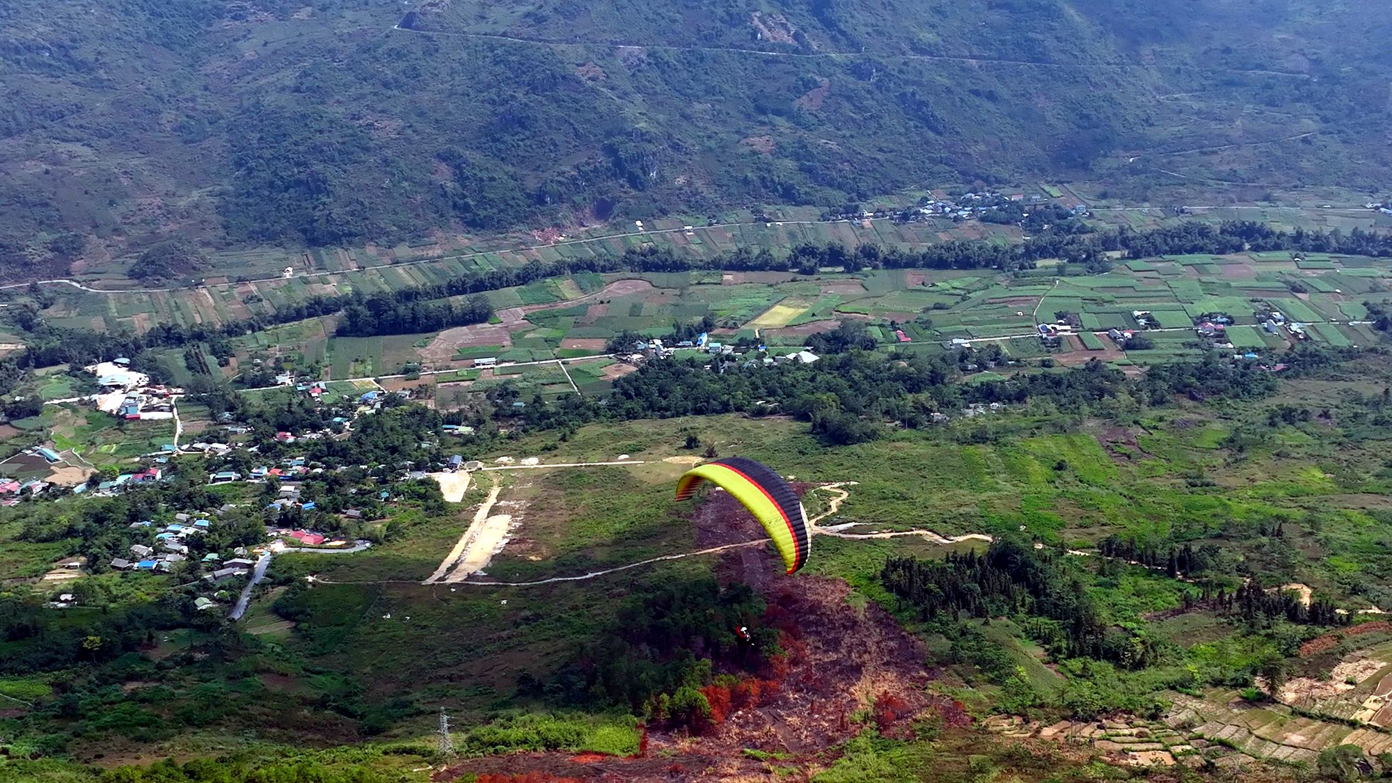
The Quản Bạ valley from above: fields, villages and the Miện river
Nậm Đăm cultural village
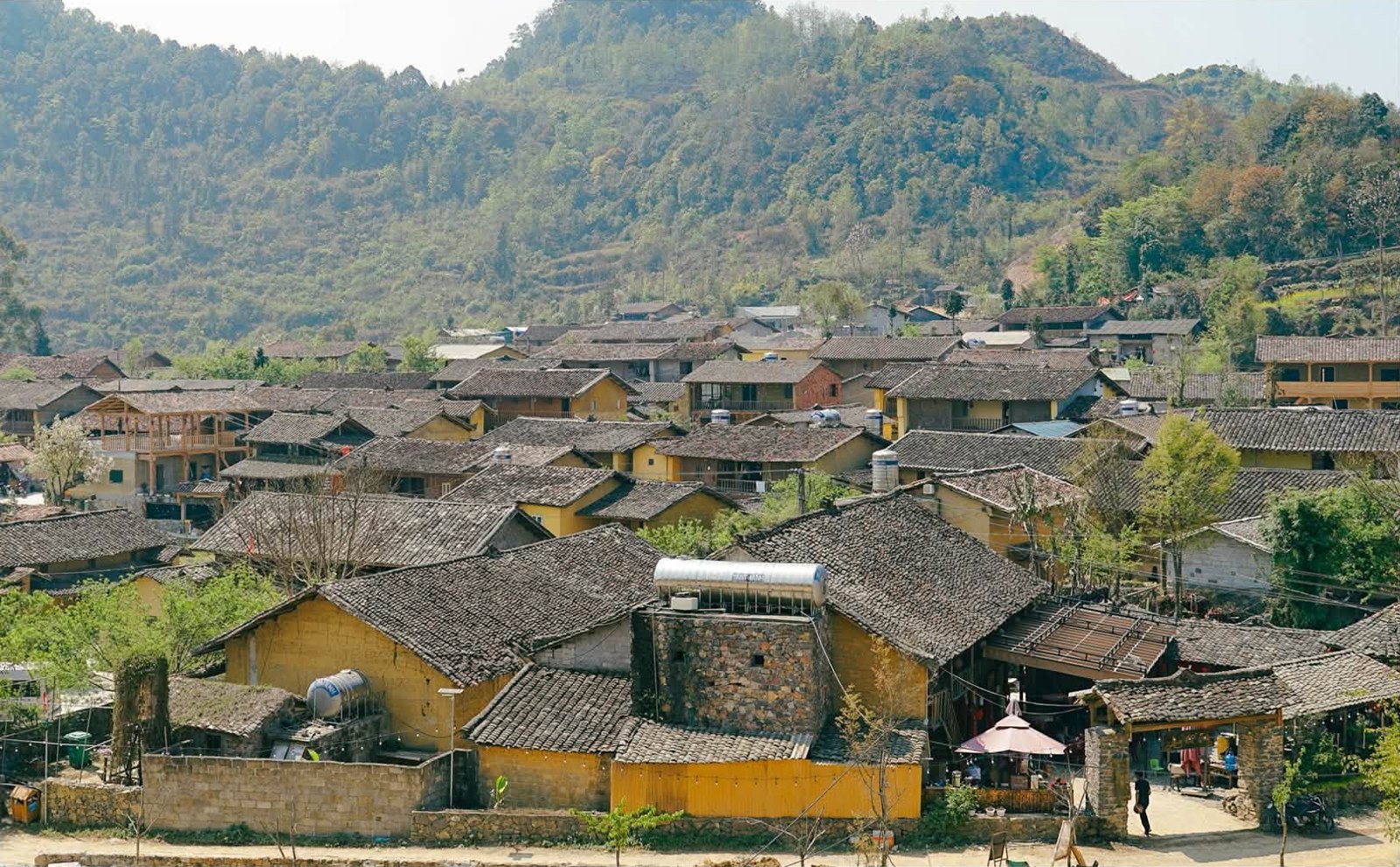
Nậm Đăm is a Dao village a short way from Tam Sơn along a paved side road that motorbikes and cars can drive. Many of its houses are rammed-earth homes with thick walls and yin-yang tiled roofs, set among maize gardens and small terraced fields. The Dao here are known for their colourful hand-embroidered clothing and their herbal medicine and bathing leaves. Many families have adapted their homes for guests while keeping the traditional shape, which makes it a popular first night's stop. Read more in our article on Nậm Đăm cultural village.
Lùng Tám linen-weaving village
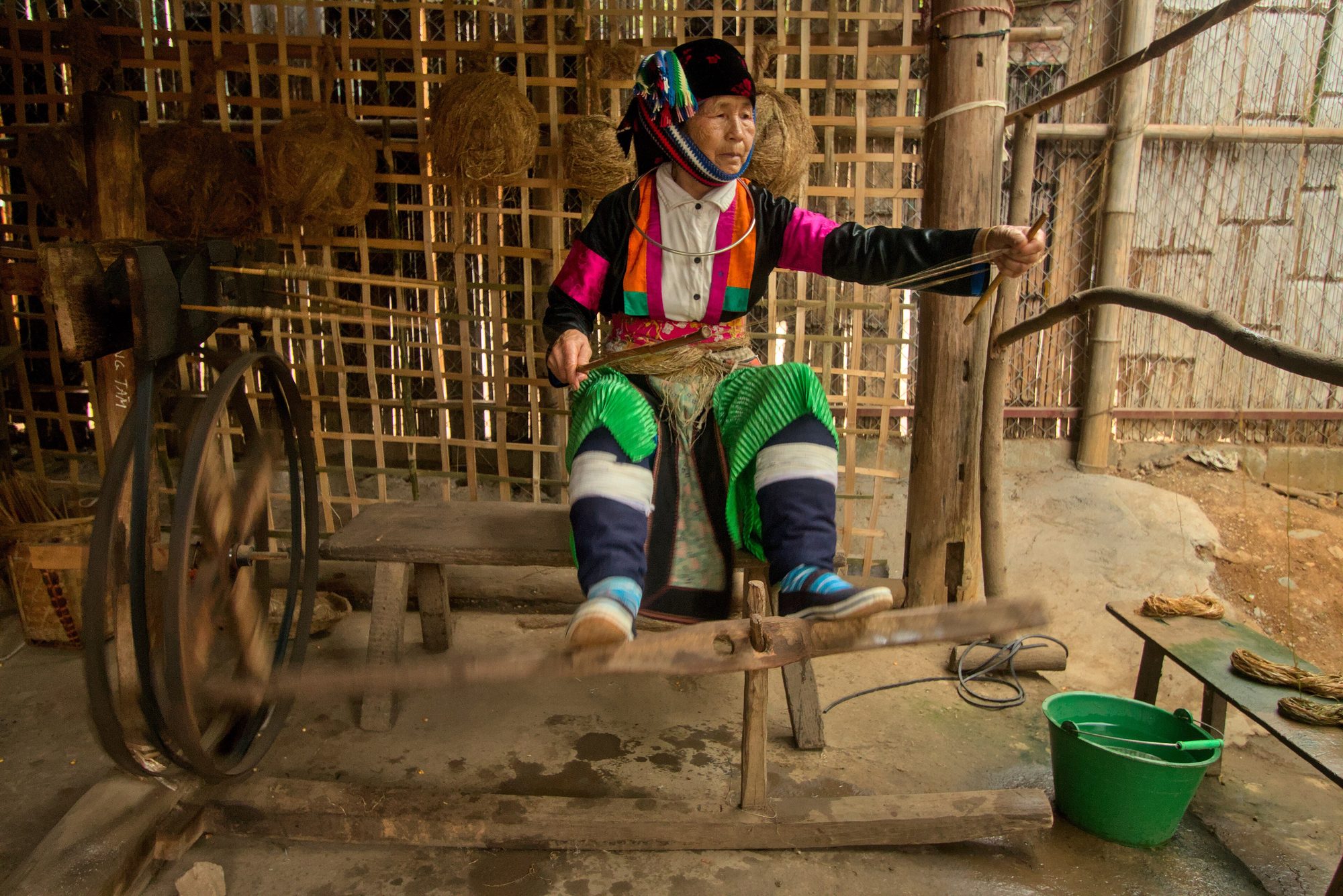
Lùng Tám lies in the Miện river valley, on the road from Quản Bạ towards Du Già. The Lùng Tám linen-weaving cooperative was founded in 2001 and is run by Hmong women from the area. Linen here is still made almost entirely by hand: stripping the hemp stalks for fibre, spinning, weaving on wooden looms, drawing patterns in beeswax and dyeing with indigo.
A woman at her linen-making equipment in Quản Bạ — Photo: Benjamin Smith, CC BY-SA 4.0, Wikimedia Commons
You can watch each step, try joining fibres or dotting a few lines of wax under an artisan's guidance, and buy scarves, wallets and bags right at the workshop. Visit on a weekday morning or early afternoon to see the most people at work. Details in our article on the Lùng Tám linen village.
Seeing the valley again from a wing
The Quản Bạ flying site is right in the valley below Heaven's Gate, run by the Mebayluon Paragliding team; the season opened on 15/10/2026 and the site is open 06:30–18:30 every day. No experience is needed: the pilot controls the whole flight, and you just listen to a short briefing and follow the pilot's calls at take-off and landing.
Paragliding (PG): take off from a hillside at about 950 m, glide for 9–15 minutes depending on the wind over the valley, and land on a flat field at about 450 m beside the Miện river.
Paramotor (PPG): take off straight from the flat field by the river, with no hill to climb. With an engine, the pilot controls height and direction, so flights are longer, with sunrise, cloud-chasing and sunset options when conditions allow.
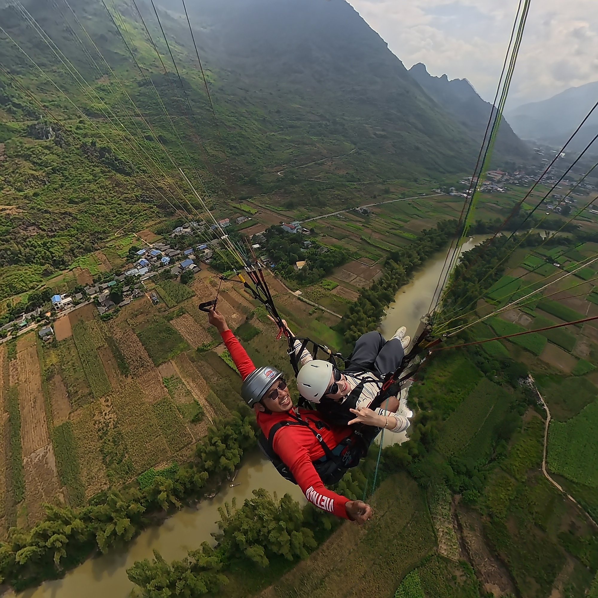
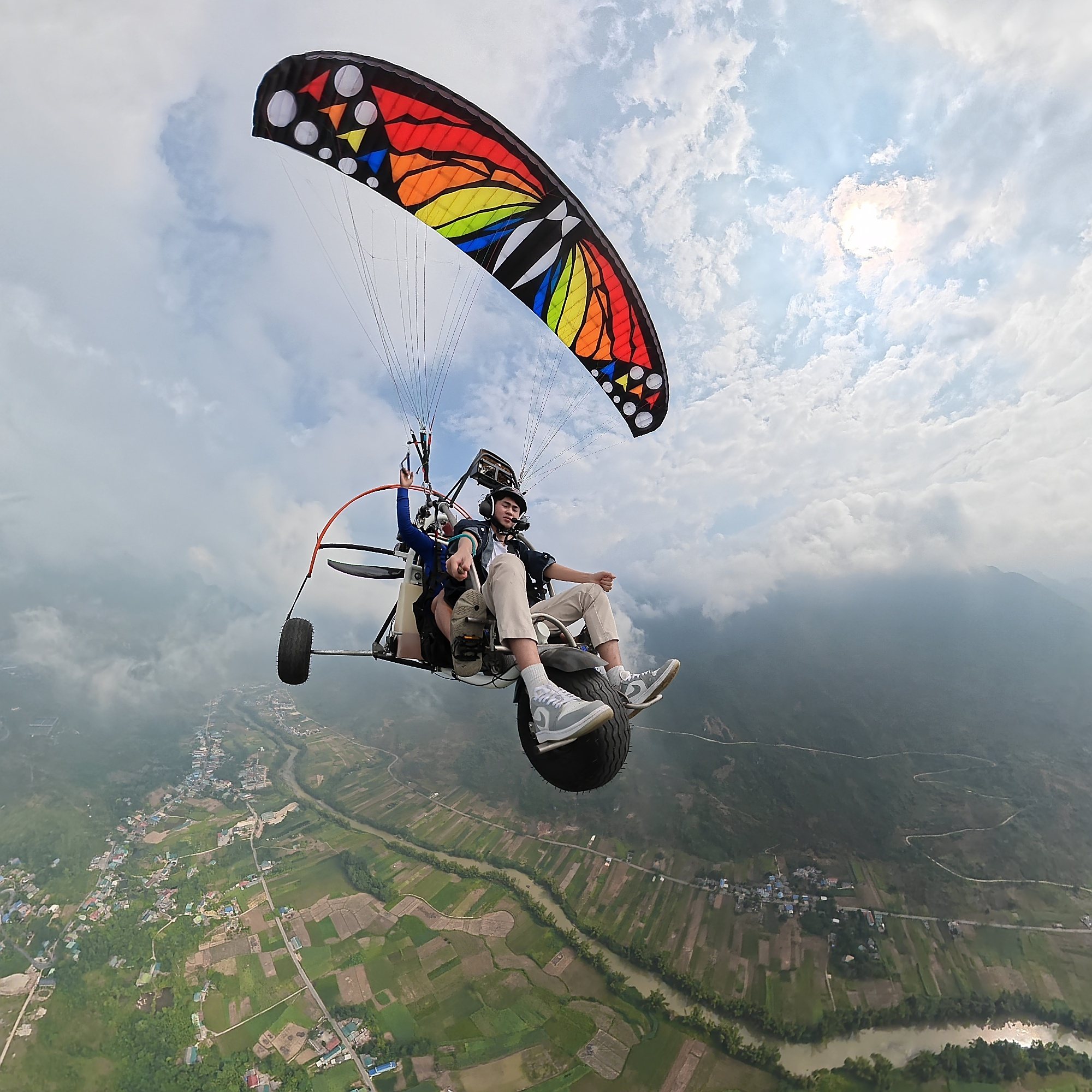
Pilot and guest on a tandem paraglider above the Miện river, Quản Bạ
From up high you see what you just admired from Heaven's Gate in a new way: the twin mountains shrink to two small mounds among the fields, the pass road to Heaven's Gate cuts across the mountainside, and below you spread the jagged limestone, the maize fields and the bends of the Miện river. The paramotor route is described in our article on the Quản Bạ paramotor flight path.
Paragliding has no cloud-chasing package, and sunrise flights are paramotor only. If conditions don't allow a special flight, it becomes a standard PG or PPG flight.
A paramotor among white clouds above the Miện river valley
Prices include a free GoPro video (ask your pilot), insurance, drinking water and free pick-up and drop-off within the Quản Bạ area (for example Tam Sơn, Nậm Đăm, Cán Tỷ, H'Mong Village resort). Extras: drone footage 400,000 VND (≈ US$ 16) per guest, 360° camera 400,000 VND (≈ US$ 16) per guest.
Book online on the booking page: no deposit, nothing to pay when you book. You pay at check-in on the flying day, before your flight: cash, bank transfer, card (+3%) or PayPal (+3%).
Arrive at the site about 30 minutes before your flight.
Who can fly: children from 3 years old; guests over 90 kg, please tell us in advance; also tell us about heart conditions, pregnancy, recent surgery or epilepsy.
Weather: we only fly when wind and visibility are safe; the team checks the forecast and confirms the flight time on the morning of the flight. Bad weather means free rescheduling.
Full details on the take-off, the landing field and how to get there are on the Quản Bạ flying site page.
Suggested plans for a stop in Quản Bạ
If you only have half a day (on a tour or with an easy rider): leave the city in the morning, stop at Heaven's Gate for photos, go down into the valley to paraglide or paramotor, have lunch in Tam Sơn and carry on to Yên Minh. Tell the team when you expect to arrive so they can slot your flight in.
If you stay one night:
The afternoon before: drive up to Quản Bạ, watch the twin mountains in the late light from Heaven's Gate, and check in at Tam Sơn, Nậm Đăm or Cán Tỷ.
6:30 next morning: go back to Heaven's Gate or the bends on the way down to watch the mist and take photos.
Around 7:30: the team picks you up where you are staying (if it's inside the pick-up area) and takes you to the take-off or the riverside field.
8:00–9:30: briefing, flight, landing.
10:00: a light meal in Tam Sơn, a visit to Lùng Tám, or on to Yên Minh.
Staying the night also gives you a backup session if the wind wasn't right the day before. Compare places to stay in our article on spending the night in Quản Bạ, and see more places nearby in our Quản Bạ stage guide.
Frequently asked questions
Is there a fee to visit Quản Bạ Heaven's Gate?
The viewpoint is a roadside rest stop on the national road. Depending on the time, there may be a parking fee or small service charges; it's best to ask on the spot.
How far is it from Heaven's Gate to the flying site?
Very close. The flying site is right in the valley below Heaven's Gate: the paragliding take-off on the hillside, the landing field and the paramotor field beside the Miện river. When you book, the team will send you the exact location.
Can you see the Cô Tiên twin mountains while flying?
Yes. The twin mountains stand in this very valley, so while flying you'll see them, the fields, the Miện river and the pass road winding up to Heaven's Gate.
Which month is best for Quản Bạ Heaven's Gate?
October to December is dry and clear, with a good chance of mist and clouds in the mornings, and buckwheat flowers in some years. September brings ripe rice. Summer is the greenest but showery. These are also good months for flying when the wind is right.
Is it cold in the morning, and what should I wear?
Yes, especially from late autumn into winter, when early mornings are often only 5–15 °C. Bring a windproof jacket, long trousers and trainers with good grip, especially if you are going up to the take-off.
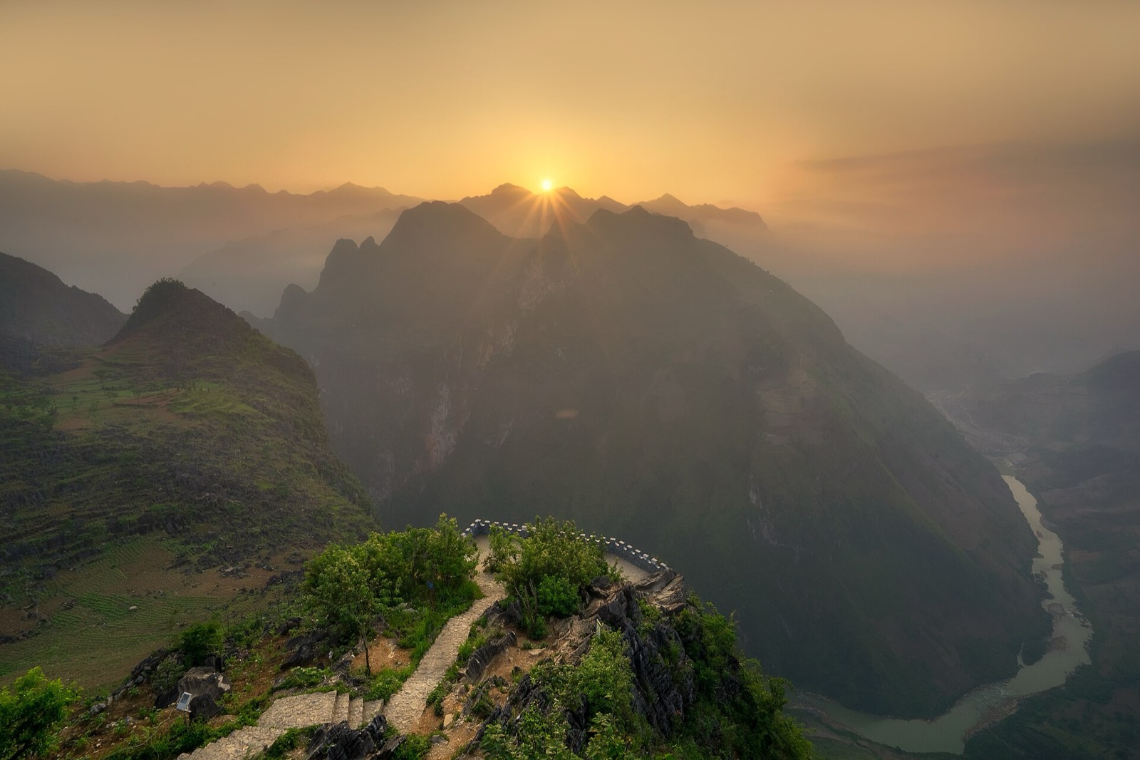
Cover photo: Surreal Nonsense, CC BY 4.0, Wikimedia Commons
Book a flight:book online — no deposit, free cancellation
Bắc Sum Pass or Quản Bạ? A side-by-side look at the two flying sites on the QL4C near Hà Giang city: distance, landing field, valley width, paragliding and paramotor, a flying morning at Quản Bạ, getting there and fitting the flight into the Hà Giang Loop…
Quản Bạ or Đồng Văn? An honest comparison of our two flying sites on the Hà Giang Loop: location, getting there, scenery, paragliding vs paramotor, what a flying session looks like, wind and schedule, price, and how to fly both…
The Chín Khoanh slope is a stack of hairpin bends on QL4C between Phố Cáo and Sủng Là, about 18 km past Yên Minh and 27 km before Đồng Văn: why it's called "nine coils", the best viewpoint, how to stop safely, how it differs from Thẩm Mã and what to see nearby…
A practical guide to the Mã Pí Lèng Sky Path, the cliff-edge walking trail above the Nho Quế River: the trailhead at the Youth Volunteers monument, the route section by section, the death rock closure (October 2026), what to wear, when to go and how to pair it with a Tu Sản canyon boat trip…
A guide to Lô Lô Chải, the Lô Lô village at the foot of the Lũng Cú flag tower: rammed-earth houses, costume and bronze drums, Café Cực Bắc, homestays, the road from Đồng Văn, 2026–2027 traffic rules and village etiquette…
The Yên Minh pine forest lines Highway 4C about 7–8 km before Yên Minh town on the Quản Bạ side: exact location, commune after the 2025 merger, best light, how to stop safely, what's nearby and how to fit it into a 3- or 4-day Loop…