Is the Tuyên Quang – Hà Giang expressway open yet? What we found in November 2026
On the afternoon of 2 November 2026 we test-drove the CT.15 expressway from the QL279 junction (Bắc Quang) to Hàm Yên: about 70% drivable, many temporary barriers, asphalt still being laid, dirt service roads, no lights or signs. A temporary half-road opening is still a few months away; the full route needs at least 6–12 months. Photos, map, project figures and whether to use it.
Ms. Judy · · 14 min read
The Tuyên Quang – Hà Giang expressway (CT.15) is not officially open yet. On the afternoon of 2 November 2026 we test-drove it from the QL279 junction at Bắc Quang south towards Hàm Yên. About 70% of that stretch was drivable on the half of the road that is finished; the other half is still a construction site, with temporary barriers in many places, fresh asphalt being laid and sections where you have to drop onto a dirt service road. You can try it on a dry day in daylight, but don't plan your trip to Hà Giang around it yet. Our estimate: a temporary opening of half the road is still a few months away, and finishing the whole route will take at least 6–12 months.
Our flying team drives between Hà Nội and Hà Giang often, and the question guests have asked most these past weeks is "can we use the expressway yet?". This article records exactly what we saw on that drive, with photos taken on the spot and the project's official figures. The construction site changes every day, so treat this as a snapshot of early November 2026, not an announcement from the road authority.
A note on names: on 1 July 2025 Hà Giang province merged into Tuyên Quang province. The press calls the two parts of the project "the section through (former) Tuyên Quang" and "the section through (former) Hà Giang", and so do we.
Keep reading
Quick summary
Name, route number
Tuyên Quang – Hà Giang expressway, signposted CT.15
Phase 1
About 104.5 km: 77 km through (former) Tuyên Quang and 27.48 km through (former) Hà Giang
Start, end
Junction with the Tuyên Quang – Phú Thọ expressway (former Nhữ Khê commune) → Tân Quang commune (former Bắc Quang district)
Lanes
(Former) Hà Giang section: 2 lanes had a technical opening on 19 December 2025, now being widened to 4. (Former) Tuyên Quang section: first 12.5 km 4 lanes, the rest 2 lanes
Progress
81.9% of the whole project's work completed, by value (site inspection, 28 October 2026)
Opening
No official date. The target is to finish phase 1 in 2026; the Vietnam Road Administration says progress is behind; our estimate: a few more months for a temporary half-road opening, at least 6–12 months to finish the whole route
What we saw on 2 Nov 2026
Barrier and a "No unauthorised entry" sign at the entrance; no street lights, signs or road markings on many sections
Which section did we drive?
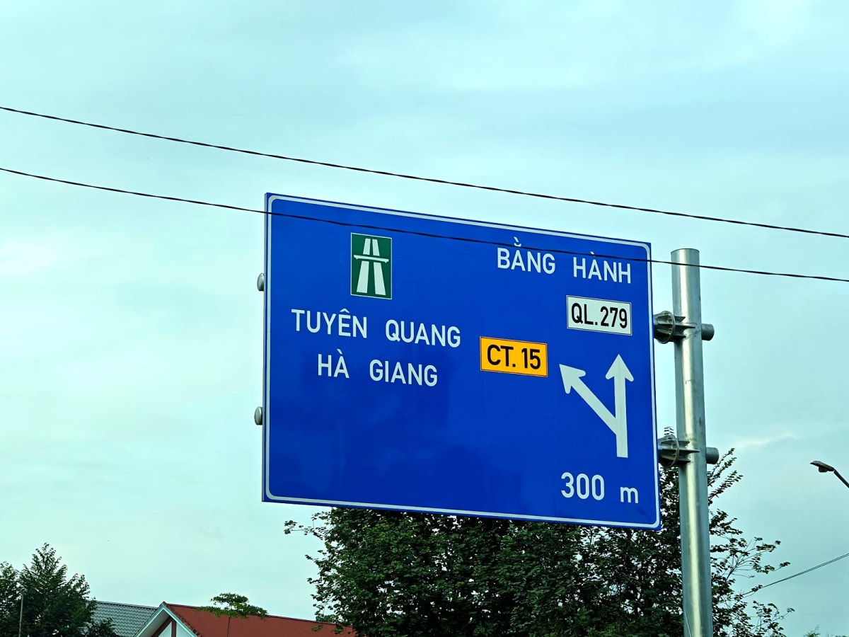
We left the centre of Bắc Quang at 16:30, followed QL2 for a short way and turned off at the expressway signs. About 300 m before the junction with QL279 a blue sign reads "Tuyên Quang – Hà Giang, CT.15"; straight on is Bằng Hành and QL279.
The sign to the expressway near the QL279 junction, Bắc Quang. Photo: 2 November 2026.
Right at the foot of the slip road there is a barrier, a warning sign saying "Construction area – No unauthorised entry" and another saying "Construction site – No entry". In other words, the road is not open to private vehicles. Motorbikes and cars do still go in, but once you do you are driving through a construction site at your own risk.
The entrance still has a barrier and no-entry signs. The number plate in the photo has been blurred.
From there we drove south for about an hour, including photo stops, and rejoined QL2 at 17:28 south of Hàm Yên town, near Thái Sơn commune. Our exit was the junction between the expressway and QL2; the junction itself is still under construction. We covered about 50 km on the expressway, measured along the route on the map. After that we took QL2 to Tuyên Quang city as usual.
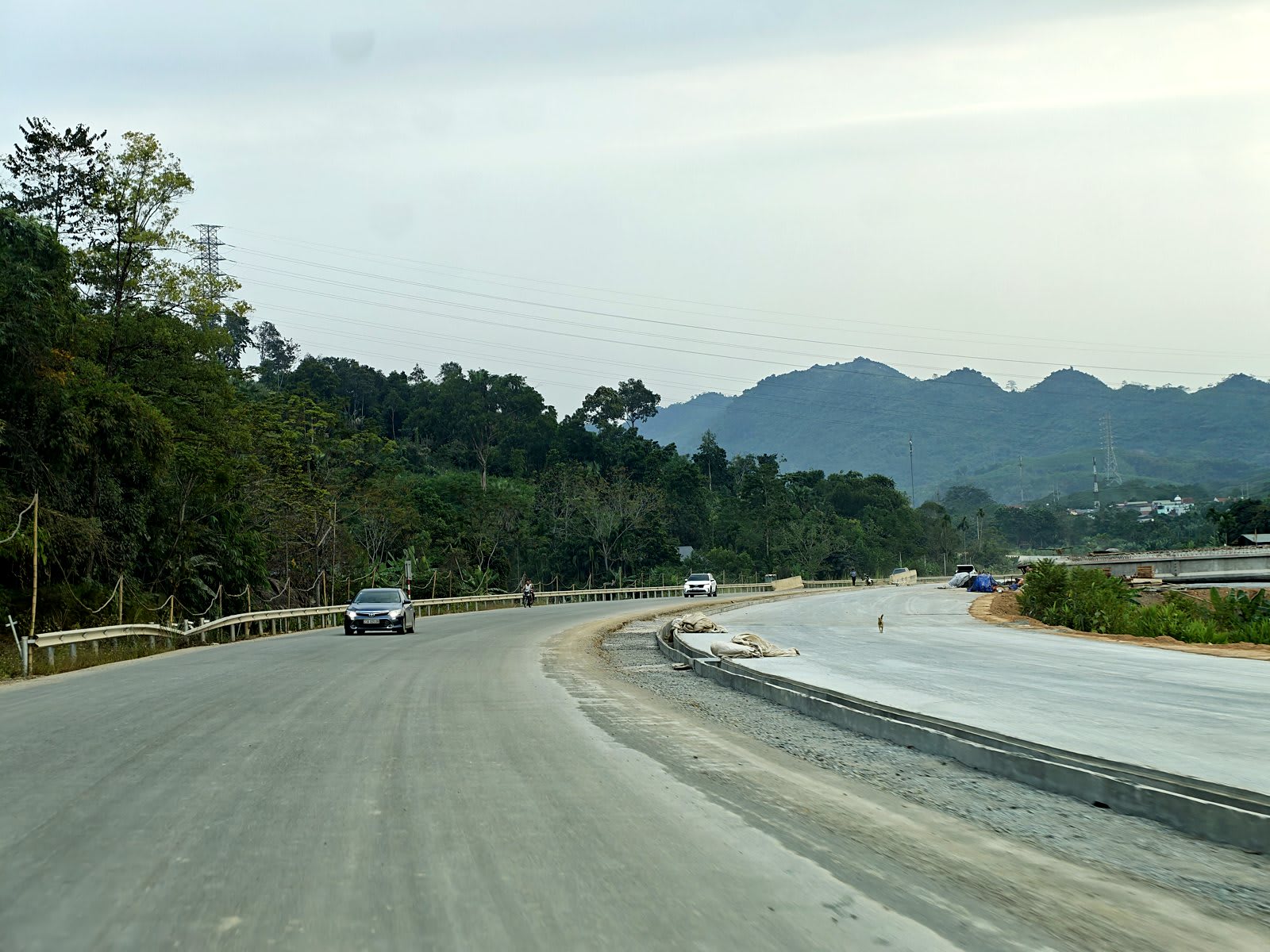
The asphalt-surfaced sections are a real pleasure to drive. The road is very wide; around Bắc Quang the roadbed is being built for 4 lanes, so each direction looks like more than 2 lanes. The route is fairly straight with few steep climbs, crash barriers and walls are already in place, and there was almost no traffic when we drove.
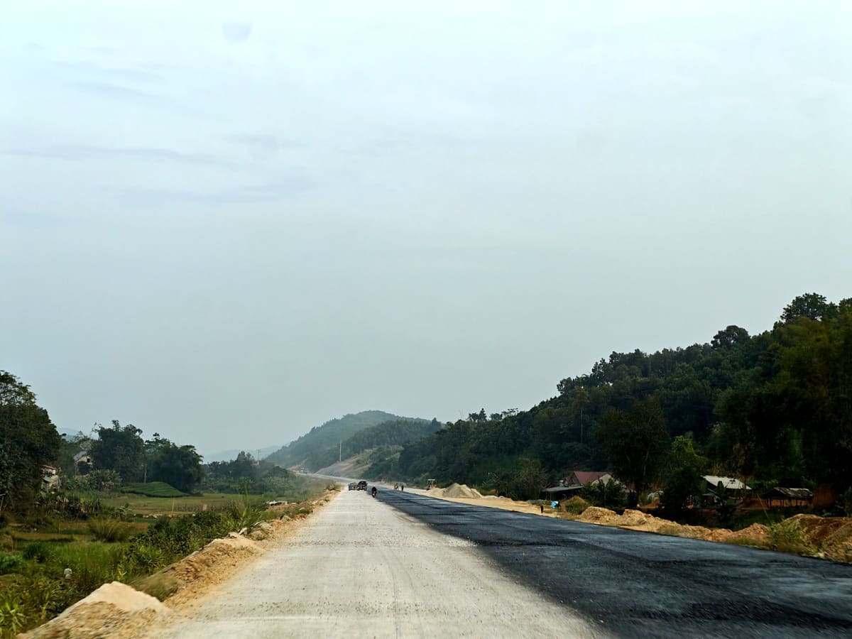
A section with a finished surface, crash barriers and a wall.
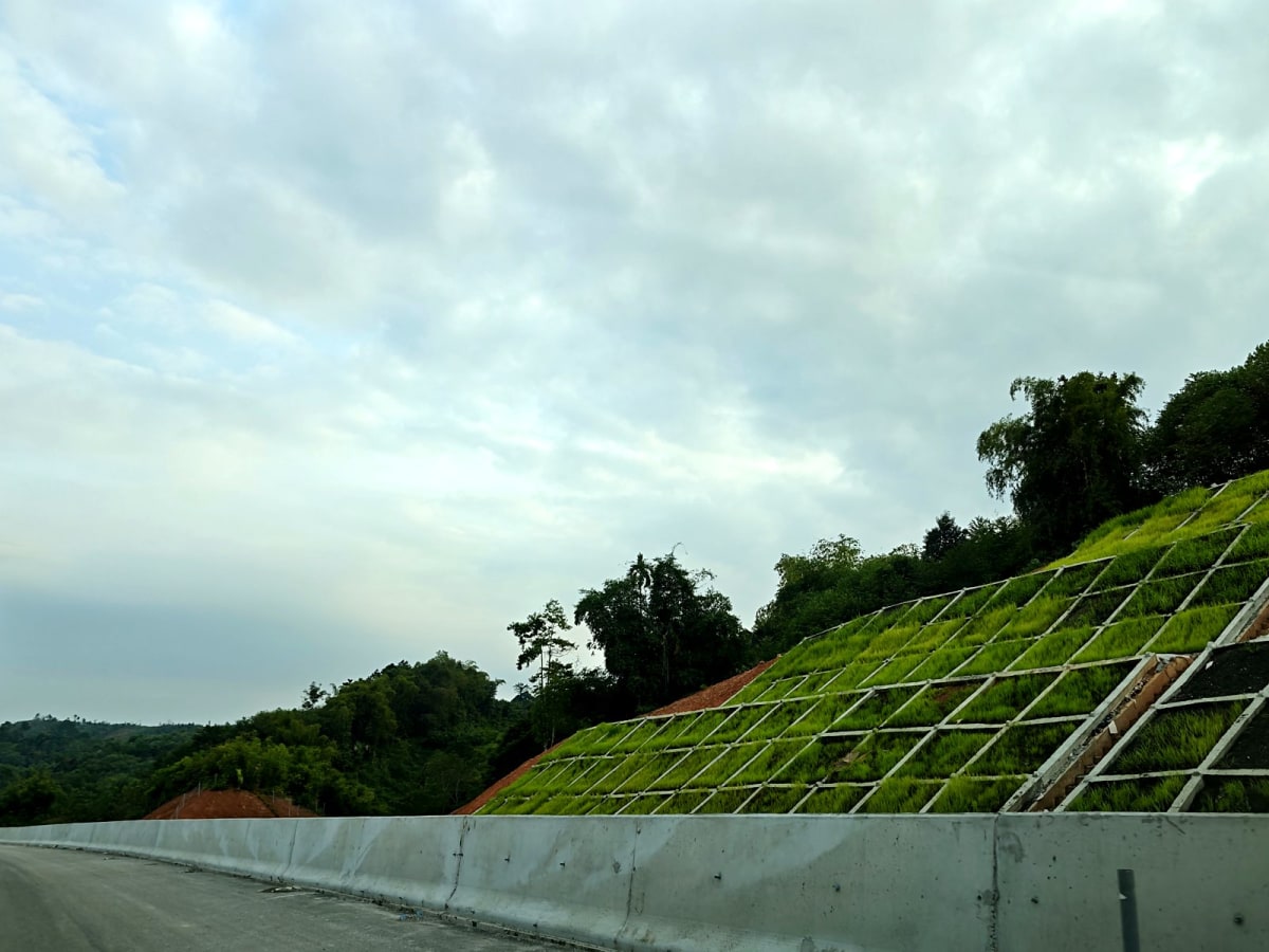
In many places the cut slopes are already reinforced with concrete grids planted with grass. These sections show how different the road will be from QL2: that same morning Google Maps gave about 2 hours on QL2 from Bắc Quang to Tuyên Quang city, through many bends and towns. A wide, straight road running alongside will cut the Hà Nội – Hà Giang journey considerably.
A reinforced, grassed slope on a finished section.
The unfinished sections: what you will meet
Temporary barriers and sudden lane changes
In many places metal sheets or concrete blocks close half or all of the road for works. There are no advance warning signs, so you only see them when you are close. Sometimes you switch to the other carriageway, sometimes you have to turn back.
Temporary sheets across the road.
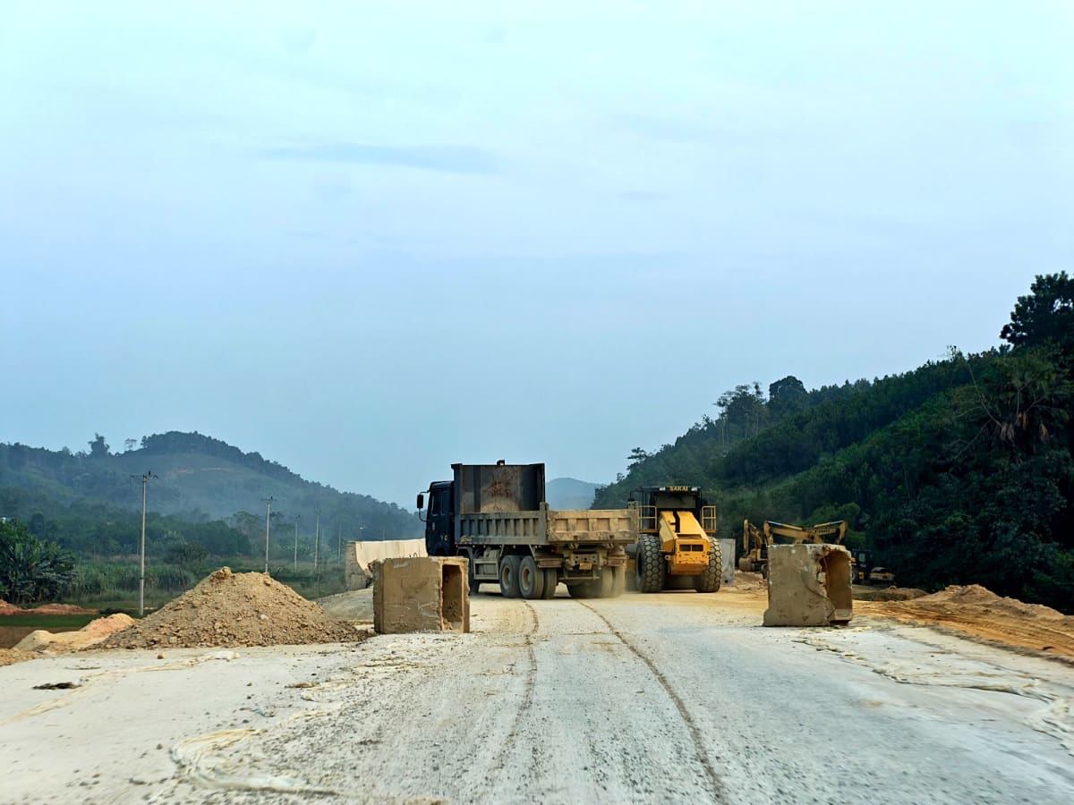
Dump trucks and rollers working on the carriageway, concrete blocks closing one side.
Crushed-stone base and asphalt being laid
When we drove, about 3 km were still being surfaced. That stretch already had its crushed-stone base, and the plan was to finish the asphalt within about a week. On the crushed stone it is dusty and bumpy, and stones fly. The inspection report of 28 October 2026 also notes about 4 km of the (former) Tuyên Quang section still without asphalt concrete.
Crushed-stone base: a cloud of dust every time a vehicle passes.
Fresh asphalt on one side, crushed stone on the other.
Dropping onto a dirt service road
Where asphalt is being laid, vehicles are not allowed on the main carriageway and have to use the service road alongside. The service road is dirt: dusty when it's dry, slippery and muddy when it rains.
The dirt service road along the route.
Freshly cut hillsides
On many sections hillsides are being cut back and slopes reinforced. The earth and rock are freshly exposed, not yet stabilised, right by the edge of the road. This is why we advise against driving in the rain.
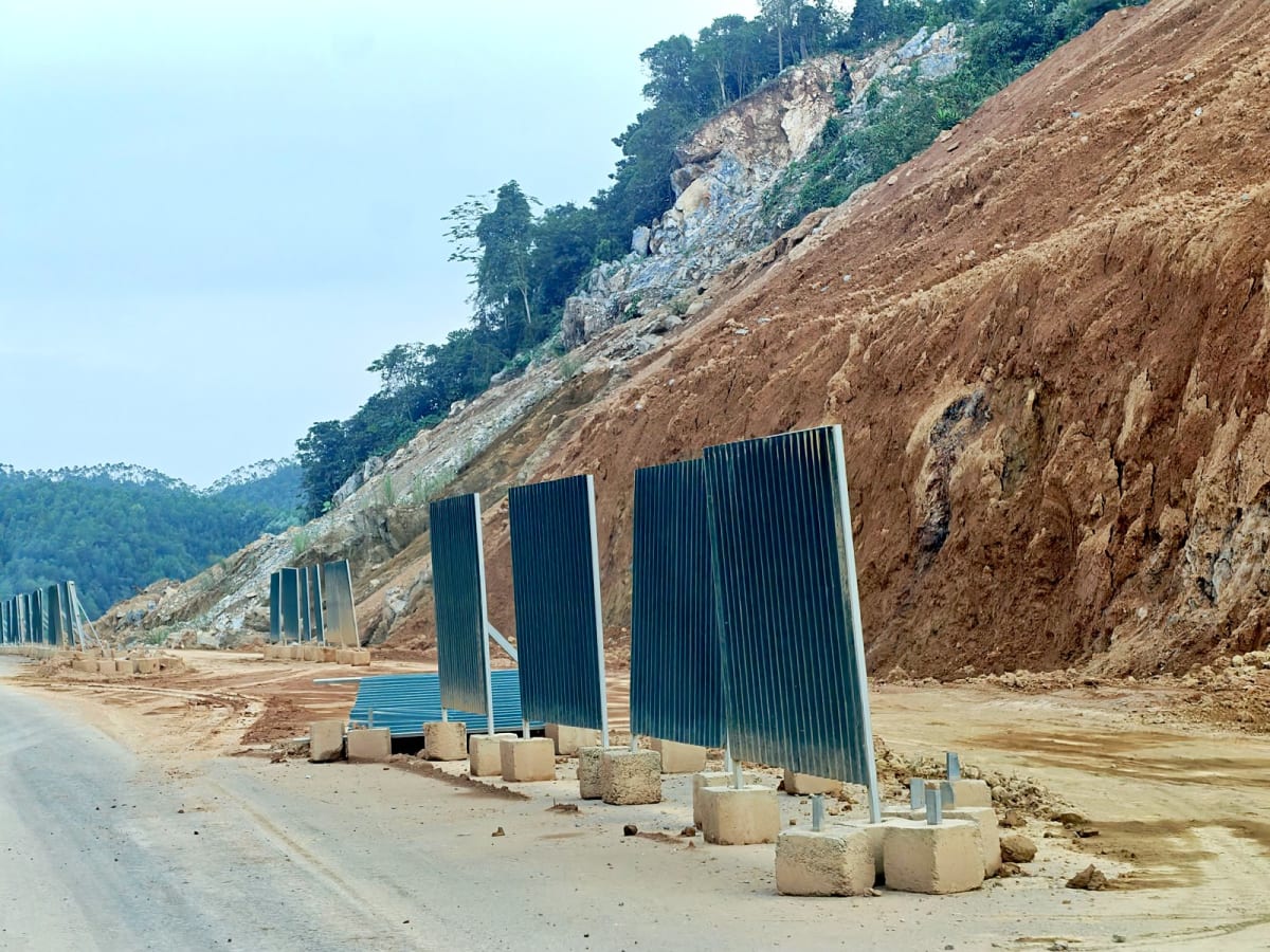
A freshly cut slope, temporary screens beside the road.
No street lights, signs or road markings yet
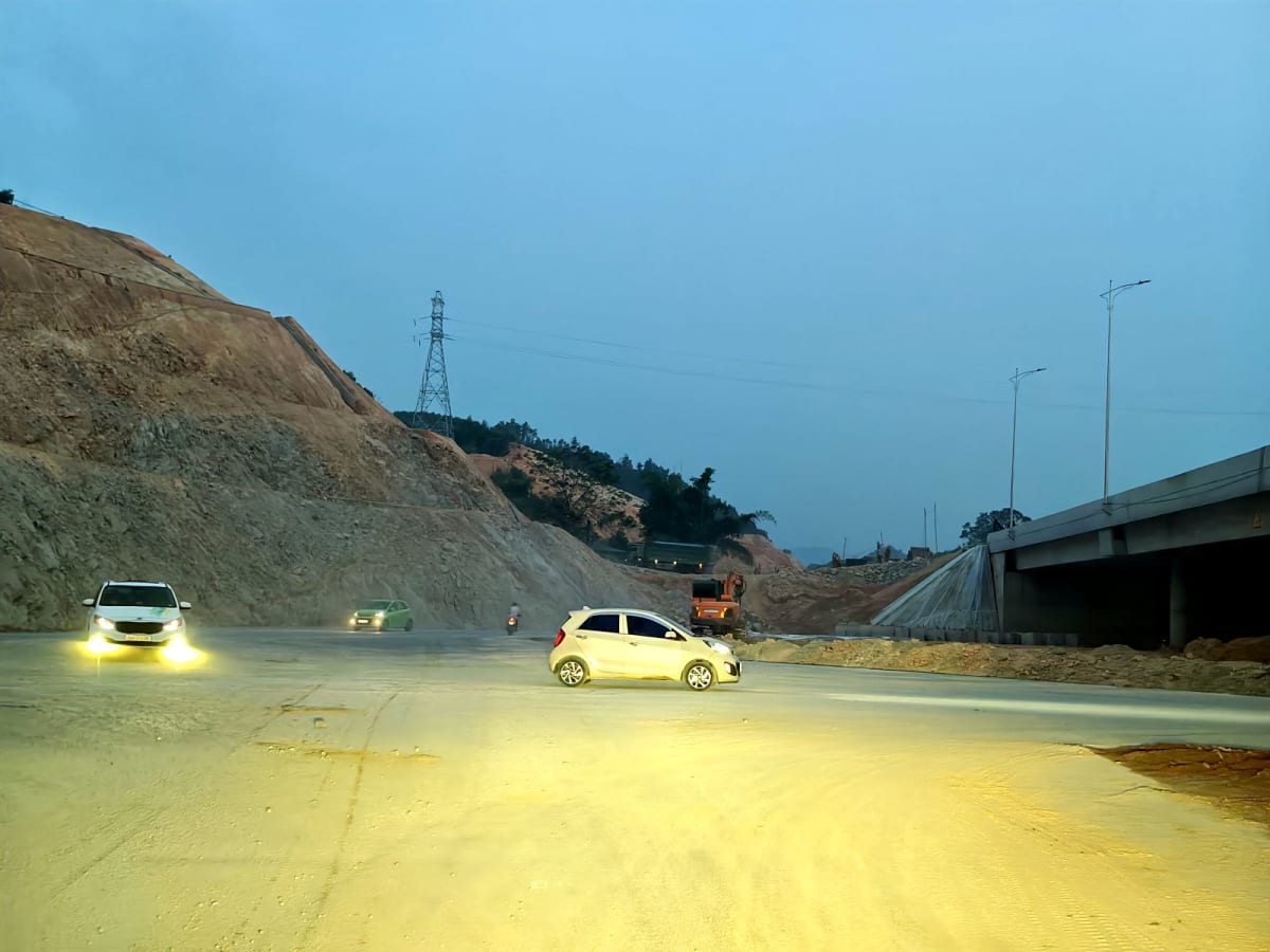
Most of what we drove has no street lights, signs or road markings. Darkness falls early in November: at 17:29 we already needed headlights. In the dark it is very hard to spot barriers, concrete blocks or lane switches. According to the late-October report, the toll stations, the intelligent transport system and the control centre have not been started either.
17:29, near the exit to QL2 at Hàm Yên: dusk already, and no street lights.
Should you use it?
In our view, you can give it a try, but it's hit and miss: a section you can drive today may be closed tomorrow without warning. If you want to try:
Daylight only. Plan to be off the expressway by about 17:00 at this time of year.
Not in the rain or just after it: the crushed stone, the dirt service road and the fresh cuttings are all dangerous when wet.
Drive slowly and look far ahead, and give way to dump trucks, rollers and workers. If you meet a barrier or a no-entry sign, go back to QL2; don't drive around it.
Know your way out. QL2 runs almost parallel, so there is always an exit, though you may need to take a dirt road for a while.
Don't use the expressway yet if you ride a motorbike, are an inexperienced driver, travel with small children or elderly passengers, or need to be in Hà Giang at a fixed time.
When will the Tuyên Quang – Hà Giang expressway open?
As of early November 2026 there is no official opening date. The published milestones:
(Former) Hà Giang section, 27.48 km: the 2-lane road had its technical opening on 19 December 2025 and its road safety equipment is being completed. Widening to 4 lanes is over 52% done; the contract requires completion by 31 December 2026.
(Former) Tuyên Quang section, 77 km: the QL37 and Chân Sơn junctions are finished and the QL2 junction is under construction (Báo Tuyên Quang, August 2026). At the end of October about 4 km still had no asphalt, and an extra 8.1 km section still had a lot of cut-and-fill and rock blasting to do. The project's completion deadline is 31 December 2027.
Overall target: the Prime Minister has directed that phase 1 be finished in 2026. After the inspection on 28 October 2026, the Vietnam Road Administration said progress was behind and recommended a traffic management plan so the 2-lane road can open as soon as phase 1 is complete.
Later phases: the province has proposed widening 64.5 km of the (former) Tuyên Quang section to 4 lanes in 2026–2030; the 57.87 km extension from Tân Quang to the Thanh Thủy border gate is at the investment-preparation stage.
Our estimate from what we see on the ground: opening half the road to temporary traffic may take a few more months. At the current state of the works, finishing the whole route will take at least 6–12 months, because many work items are still outstanding and a number of construction packages are applying for deadline extensions. This is our team's assessment from driving the route regularly, not an announcement from the project owner. If you are coming to Hà Giang in winter 2026–2027, plan on QL2.
We will update this article when the road officially opens.
Frequently asked questions
Is the Tuyên Quang – Hà Giang expressway open yet?
No. The (former) Hà Giang section had a technical opening as a 2-lane road at the end of 2025, but the route as a whole is not open to private vehicles. The entrance still has a barrier and a construction-site no-entry sign. We estimate a temporary half-road opening is still a few months away, and finishing the whole route will take at least 6–12 months.
How long is the expressway and how many junctions does it have?
Phase 1 is about 104.5 km long. The (former) Tuyên Quang section alone has 24 bridges and 8 junctions, according to Báo Tuyên Quang (21 August 2026). The slip road we used is at the junction with QL279, Bắc Quang.
Is there a toll?
Not yet, because the road is not in operation. According to the late-October 2026 report, the electronic toll stations have not been built.
Can I ride a motorbike on the expressway?
Once it opens, motorbikes will be banned, as on every Vietnamese expressway. For now it is still a construction site, so we recommend motorbikes stay on QL2.
How do I get to Quản Bạ for paragliding?
Take QL2 to Hà Giang city, then QL4C for about 46 km to the Quản Bạ Heaven Gate. Directions to the take-off and landing fields, with a map, are on our getting there page.
A round-up of buses to Hà Giang in November 2026: from Hà Nội (21 operators; sleeper, cabin, limousine and shared car; direct buses to Đồng Văn; pick-ups at IC3–IC9) and from Sa Pa (6 operators, return trips included), plus a few routes from other provinces. Timetables and fares, and where to get off for paragliding at Quản Bạ (Tráng Kìm)…
How far from Quản Bạ centre, and where to turn, to reach the 950 m paragliding take-off and the 450 m landing field by the Miện River, which is also the paramotor take-off. With a 3D map, coordinates and the distance of each leg…
Hà Giang paragliding and paramotor prices for 2026 in Quản Bạ: standard package from 2.290.000đ, cloud-chasing and sunset packages, drone, 360 camera, transfers, group discounts and how paying at check-in before your flight works…
Paragliding is engine-free flight under a soft fabric wing, powered by wind and rising warm air. A simple explanation of how the wing flies, what a tandem flight is, and the experience in Hà Giang…
The Quản Bạ flying site is about 45 km from Hà Giang city along QL4C. We compare motorbike, bus and the flight team's 4-seat car, plus the meeting point and when to arrive…
What to wear, what to bring, and how to prepare physically and mentally for your first paragliding flight over Hà Giang's Rocky Plateau, with a season-by-season checklist…